

REVISED: 10/28/08
Civil Airports of California
This is a sole survivor from our Civil Airports of the USA, still active only because (1) it was the most complete of the lot and (2) it's Aerofiles' home state. Like a majority of the stuff on our pages, it's a relic, but one that might still serve a purpose for some viewers. Files for the other 49 states were handed over to Paul Freeman to blend into his Abandoned Airports site, which does a more comprehensive job on that subject, and info on current airports can be found on many web sites so dedicated.
CODES: (C) commercial; (D) ag duster; (G) gliders; (L) limited fuel/services, usually unattended; (L aux) auxiliary with no fuel/services, emergency use; (M) municipal; (P) private, sometimes commercial or residential airpark, often available; (R) restricted, was reported available but cautionary or with prior approval (most exclusively restricted private fields are not listed); (S) seaplane anchorage/moorage. Runways: cd = compacted dirt; d = dirt; g = gravel; od = oiled/treated; p = paved; s = sod; t = turf; wwy = waterway/sealane. Coordinates [in brackets] are classic spherical degrees, minutes, and seconds (dd-mm-ss), as found and verified with GoogleEarth (GE) and maps; hemispheric locations are all West longitude and North latitude—coords shown without dashes have been verified. Elevations (elev:) in feet ASL. Runway headings are shown clockwise in the W through ENE hemisphere—as example, it can be assumed that a NW rwy will usually also be a SE rwy.
Entries are generally regarded as Airports unless otherwise named. Parenthetical years "(1946-19??)" show lifespans as known—therein a symbol "-->" shows the airport was active at the time of its inclusion on this list. Non-parenthetical dates are years of the transcribed data that follow an equal sign (=). The word "town" is used generically in reference to a city center or associated post office. @ reports notable field activity, pertinent data. Red text is a memo to ourselves (or any knowledgeable viewer). Purple text indicates namesakes or honoraria. Satellite and GoogleEarth™ aerial views from 2004-2008 are indicated by an asterisk (*) after a click icon.
As for GoogleEarth™, the coordinate numbers work well in locating fields, but the hyphens don't. Hyphens need to be replaced by spaces, and an N-comma and W added, as is done with the verified entries—eg: 34 10 00N, 118 10 00W. We are editing them as time permits ... a tedious job! (This also applies to the USAF and USN Airfields pages on the Military home page.)
It seems silly but, in this age of frivolous lawsuits, we caution that none of the information presented here should be used for actual flight operations. So there.
Ace Field Los Angeles [34 00 33N, 118 10 04W] (19??-19??) Was Sprott Field. c.1931 = (C) 6100 Telegraph Rd, W of Atlantic Ave, S of Telegraph. (As Sprott: (C) 5 mi SE of city hall along UPRR; elev: 200; triangular 3950'x3320'x1525' all-way sod field;) another source shows 3450'x3077'x1600'. One of the many names that were Telegraph-Atlantic at one time or another. Needs sorting out.
Adams Fresno [36 42 15N, 119 44 19W] (19??-19??) = INFO NEEDED about this reported field located on SW corner at E Jensen and S Chestnut Aves.
Adamson Field Olancha [36 16 42N, 118 00 01W] 2006 = (L or R) 0.24 mi SE of town, S of hwy 190 at the bend; N dirt strip.
 Adams Port aka Adams N Hollywood [34 12 00 N, 118 22 26 W] (1931-c.1941) Was Lloyd's. 1931 = (C) 11036 Sherman Way, acquired and renamed by J J Adams as 640'x1750' rectangular field with oiled sod surface, W of Vineland, between Sherman Way and SPRR, next to Wilson. c.1941 = Closed, became Lockheed Air Terminal property as part of the clearway for rwy 25.
Adelanto [34 32 15 N, 117 27 46 W] (19??-->) 1995 = (L) 4.3 mi SW of town; elev: 2980; WNW 2500' p. 2006 = W 5100' d.
Adelanto see El Mirage, Hansen, Krey Field, Sun Hill Ranch.
Adin [41 11 10N, 120 57 14W] (19??-->) 1968 = W 2200' p. 1992 = (L) 1 mi SW of town, NW of hwy 299. elev: 4228; WNW 2850' p.
Aero Corp of California Los Angeles [33 57 13N, 118 18 48W] (1926-1930) 2/3/26 = (C) Leased 310-acre field between W 91 and W 92 Sts and S Van Ness Ave and S Western Ave, N of Burdette-Dycer #2. 1927 = @ Fokker distributor; Standard Flying School; established Standard Air Lines. 1928 = Relocated to NW of W Century Blvd & S Western Ave [33 56 46 N, 118 18 38 W] with access taxiway to Dycer #2. 1930 = Sold interests to Western Air Express (WAE).
Agua Caliente Agua Caliente Springs [32 57 20N, 116 17 40W] (19??-->) 1968 = (L) 1 mi NE of town; elev: 1220; WNW 2500' p. 1988 = ditto.
Agua Dulce Airpark [34 30 09N, 118 18 51W] (1983-->) = (C) elev: 2680; NE 4200' p. 1992 = 2 mi E of town, NE San Fernando Valley; elev: = 2660; NE 4600' p.
Aha-quin [33 51 57N, 114 31 37W] (19??-->) 2006 = (L) 18 mi NNE of Blythe, E of Hwy 95; elev: c.300; N 2280' p.
Akin Coloma [38 45 10 N, 120 54 07 W] OR [38 45 13 N, 120 53 56 W] (19??-->) 2006 = (L, possibly P) 3.2 mi S of town; elev: 1595.
Alameda [37 47 42N, 122 19 27W] (1929-1936) 1929 = (C) S shore of Oakland Estuary, all-way sod field with one W rwy, 3 hangars, yacht basin. Dedication 3/2/29; "30,000 attending." 100 of 345 acres developed; 2 large and 7 individual hangars. Landfill extended by owner Curtiss Co 2000' into SF Bay; "existing hangars to be dismantled and relocated along sides of field." 1930 = Identified as Curtiss-Wright Airport in 1931 (ACYB). USAC colocation. 1933 = (C) 3.5 NW of town, 3 mi SW Oakland; elev: 10. T-shape all-way field with oiled and sand surface; W 2500'x900' od, 2000'x200' od. 1935 = @ Pan American Airways base. 1936 = (C, S) ditto, plus "filled land on SF Bay at W end of estuary"; W 2500', N 2000' sod. Landing area floodlights, beacon and boundary lights. PanAm seaplane moorage. 6/1/36 = 100-acre property deeded to Army, who in turn transferred it to USN in September, but no construction took place because of lack of funding. 11/1/40 = Became Alameda NAS; 2,720 acres included 5 rwys and seaplane lagoon, 2 aircraft carrier piers. 9/30/97 = Decommissioned for economic reasons. 1999 = Land ceded to city, renamed Alameda Point for industrial development.
Alameda see Curtiss-Wright, San Francisco Bay Airdrome, Sunset Field.
Alamo, Jolon Strip [35 58 05N, 121 11 01W] (19??-19??) 2006 = NW dirt strip and parking area 1.5 mi WSW of town, S of Mission Rd; elev: 960. Utility strip for Hunter-Liggett; doubtful any civil use.
Alexander Valley Healdsburg [38 38 N, 122 48 W] ? (19??-19??) 1960 = (L) 4 mi WNW of town; elev: 180; 1900' t. 19??: Closed.
Alhambra [34 04 31 N, 118 06 45 W] (1929-1946) 1929 = (C) Renamed from Western Air Express. c.1935 = (C) E of town, 7 mi E of LA; elev: 380; square sod field with one "surfaced" NE 2870' (>2600') and three dirt rwys: W 2125', NW 2500', N 2200'. 1939 = Bordered by Valley Blvd, New Ave, E Ramona (Ross)=, S Almansor; NE 2800' dg. @ Western Air College, Harlow Aircraft Co. 1944 = Purchased by city. 1945 = Purchased by Harlow Aircraft Co. 1946 = Sold to real estaters.
Allen Maricopa [est: 35 03 07N, 119 01 13W] (1946-19??) WW2 = Gardner Field's satellite. 1950 = (P) 21.4 mi E of town, 22 mi S of Bakersfield, S of hwy 166; elev: 500; 3200' p. 19?? = Closed, reverted to agriculture. No trace remains.
Allen Field Terminal Island [33 44 51N, 118 15 14W] (1928-1935) 7/x/28 = (C) 410-acre civil airport built on a portion of the expanded section of Terminal Island, but a USN reserve training facility was colocated there, as well, and had frequent use of its landing areas and beaching properties by seaplanes from naval ships anchored nearby. 1936 = Rededicated as Reeves Field NAB.
Alessandro Flying Field Riverside [33-54 117-15] (19??-1918) was it ever civil airport?. 3/15/1918 = Became March AFB.
Alpine Co Markleeville [38 44 03N, 119 46 00W] (19??-->) 1968 = (C) elev: 5880; N 4400' g. 1975 = (L) 3 mi N of town, 1 mi SE of reservoir; elev: 5880; N 4400' p. 1992 = elev: 5867.
Alta Dinuba [36 32 22N, 119 18 58W] (c.1947-1994) 1951 = (C) elev: 360; 2300' d. 1968 = (L) N 3300' p. 1992 = 3.5 mi E of town along Road 116 between El Monte Way and RR; elev: 364; N 3365' p. 1994 = closed.
Alta Sierra Grass Valley [39 06 43N, 121 03 17W] (19??-->) 1968 = (C) elev: 2274; N 3016' p. 1992 = (P) 7 mi S of town, 1.2 mi E of hwy 49; elev: 2310; NNE 3000' p.
Alturas [41-x-x 120-x-x] ? (c.1925-19??) 1927 = (L) Listed as "Temporary"; 0.5 mi N of town, half-mile square field was inside rodeo grounds and golf course; W dirt rwy.
Alturas #2 [41 31 14N, 120 39 50W] (1944-1968) 1948 = (L aux) 7 mi WNW of town, c.1 mi NW of Airport Rd and Crowder Flat Rd; elev: 5034; NW 6250' p. Developed by CAA and USFS. 1960 = used by CDF borate combers and tankers. 1963 = seen on later charts as Devil's Garden; elev: 5022; closed to civil use during fire seasons. 1968 = closed, became Conservation Camp (c.1985); rwy extant but unused and deteriorating.
Alturas Muni [41 28 57N, 120 33 55W] (19??-->) 1968 = (M) NNE 3450', NW 2650' p, W 2550' t. 1988 = 1 mi W of town, S of W 4th St, W of N Warner St. elev: 4375; NW 4300', NNE 3460' p. 1992 = ditto. 2003 = NW 4301' p, NNE 2935' p.
Alturas see American Legion-Laird Field, Bates Field, California Pines.
Alum Rock [-?-] San Jose (19??-19??) 1936 = 4 mi E of town; 0.25 E of race track; elev: 75; NW 1800' s.
Amador Co Jackson [38 22 36 N, 120 47 38W] (19??-19??) 1960 = elev: 1711; 2050' od. 19??: Renamed Westover Field.
Amargo see Trenary.
Amargosa Death Valley Junction [36 17 44 N, 116 25 33 W] (19??-19??) 19?? = (L Aux) 1 mi W of town; elev: 2037; N 1300' g. Emergency only. INFO NEEDED on this old mystery site. Maybe was CAA Intermediate?
Amargosa Death Valley Junction [36 18 04 N, 116 25 02 W] (1936-->) 1936 = (L aux) Renamed from Death Valley Junction, 0.2 mi W of town on T&TRR (now abandoned); elev: 2037; 2000'x200' sandy loam field. 1951 = NNE 2350' d.
Amboy, Amboy Muni [34 33 39N, 115 44 57W] (19??-->) 1927 = (L) 0.4 mi N of town, N of hwy at Amboy Rd; 1750'x200' dirt field, NW strip. 1930 = (C) (ACYB). 1933 = (L) adjoins town on N; elev: 601; 1300'x300' gravel field. 1936 = N of hwy 66 and RR; NW 1400' g. 1941-1944: Amboy AAF Aux, satellite for Patton AAF. 19?? = became Amboy Muni. Purported to be one of the first airports in California, this "Muni" serves the town's population of about 12. Visit downtown Amboy.
American Los Angeles [-?-] (19??-19??) 1931 = (C) 6 mi SW of town; elev: 112. 3500'x3100' all-way sod field with three oiled rwys: two W 1000' and one N 3000'. Is American Aircraft or vice-versa?
American Aircraft Los Angeles [-?-] (c.1928-19??) 19?? = (C) 3809 Angeles Mesa Dr. @ American Aircraft Corp; American Air School. Between Sperl and Rogers.
American Legion, Laird Field Alturas [-?-] (19??-19??) 1933 = (L) adjoins town on NE, SE of corral; elev: 4300; 2640' square dirt field with three strips: W 2340'x750', NW 3500'x200', NE 3500'x300'.
American Legion Tracy [37 41 19N, 121 26 22W] (19??-19??) 1936 = (C) elev: 190. Became Tracy.
Anderson see Pinnegar.
Andy McBeth Klamath Glen [41 30 43N, 123 59 44W] (19??-->) 2005 = (L) 1 mi S of town, W of river; elev: 42; WNW 2400' p.
Angels Camp [est: 38 02 58 N, 120 31 40 W] (19??-1960) 1960 = Renamed Frog Town.
Angwin see Parrett.
Antelope Valley Lancaster [34-39 118-08] (19??-19??) 1950 = (C) S of town; elev: 2530; 2700' d.
Antioch [37 57 58N, 121 48 02W] (1947-1993) 1948 = (C) elev: 195; W 2100' d. 1968 = elev: 180; W 2500' p. 1988 = W 2480' p. 1992 = (P) 3 mi S of town, S of Mt Hamilton Dr between Golf Course Rd and Dallas Ranch Rd; elev: 185. 1993 = Closed, turned into housing.
Antioch see Skyvale.
Apple Valley [34 31 35N, 117 12 55W] (19??-19??) 1950 = 6.3 mi ENE of Victorville; elev: 2930; W 4200' d. @ Fdrs: Roy Rogers & Dale Evans. 1983 = 2.4 mi NW of town, NE of Hwy 18 S (Happy Trails Hwy), S of of Thunderbird Rd; elev: 2928; W 4125' p. 19?? = Closed for real estate development, some remnants visible in aerials (2006).
Apple Valley Co [34 34 44N, 117 11 09W] (19??-->) 1968 = (C) N 6500', N 1038' d. 1977 = N 6498' p. 1998 = 5.5 mi N of town, 6.6 mi NE of Victorville; elev: 3059; N 6500' p. 2002 = E 4100' N 6500'.�
Aptos see Rio Del Mar.
Arcadia Air Field [-?-] (1926-19??) = (L) Arcadia (US Air Service mapping ops).
Arcata-Eureka McKinleyville [40-58-45 124-06-28] (c.1947-->) WW2 = Arcata NAS. 1968 = (M) NW 5998' p, N 4499' p. @ Humboldt Bay CGAS (6/?/77-->). 1998 = 7 mi N of Arcata; elev: 218; NW 5998' p, N 4499' p.
Archie Dean Field see Paso Robles.
Ardis Downey [33-54-02 118-08-02] (19??-19??) 1936 = (C) 2.5 mi SE of town on Cerritos Rd, 12.5 mi SE of L A; halfway between Maplewood St & Compton Blvd (now Somerset Blvd) and between Cerritos & Ardis Aves; elev: 200. Irregular sandy and clay field with two rwys: NW 1600' and NE 1800'. @ Mamie Haygood Ardis, co-owner. 1939 = elev: 85; NW 1500' d.
Arlington Riverside [33-57 117-26] (19??-19??) c.1922 = (C) @ Clarence O Prest Aircraft Co. 1928 = "Prest closing out his (war-surplus) stock ... has done some talking of going into the manufacturing end..." (WnFly 2/28). 1950 = elev: 765; 3200' s.
Artesia see Cranford.
Art Scholl Field see Rialto.
Arvin [35-12 118-55] (19??-19??) 1950 = (P) 4.5 mi W of town; elev: 373; 2800' d. Not in Jepp68 or 48 secl
Ash Mountain Three Rivers [36-29-44 118-50-03] (c.1947-->) 2006 = (P Natl Park Svc) 4 mi NE of town; elev: 1820.
Ascot Park Commerce [34-00-33 118-09-39] (19??-19??) c.1911 = (L) Atlantic Blvd & Telegraph Rd. 1912 = Race track advertised Aviation Meet 11/24-12/11. (Roots of Ace Field? or Telegraph-Atlantic?)
Atwater [37-19-22 120-36-00 (est)] (19??-19??) 1936 = (C) 2 mi S of town; elev: 156; 1320'x2640' sod field. DoC Site #26 on Los Angeles-San Francisco Airway.
Atwater [37-20-04 120-36-17] (1964-1994) Was Buller. 1964 = (M) 0.5 mi S of town; elev: 142; 2200' od. 1988 = W 1800' od. 1992 = 1 mi S of town, S of RR; elev: 145; NW 2670' p. 1994 = Closed, as former Castle AFB became Atwater Muni.
Atwater see Castle.
Atwood Fullerton [33-52- 117-50-] (19??-19??) 1950 = (P) elev: 235; 1500'.
Auburn [38-56-27 121-03-18] (19??-->) 1936 = (M) 3.3 mi NNE of town; elev: 1354; N 3100' t, NW 2400' d. DoC Site #10 on San Francisco-Salt Lake City Airway. 195? = The field was moved NNW a bit to higher ground 3.8 mi N of town [38-57-15 121-04-56]. 1960 = elev: 1523; ENE 3100' p. 1992 = elev: 1520. 2006 = elev: 1536; ENE 3100' p.
Auburn see Skyridge.
Avalon SPB Santa Catalina Island [33 21 12 N, 118 19 46 W] (19??-19??) 1990= (S). Docking facility with ramp, located at Hamilton Beach, 0.65 mi N of town.
Avalon Bay aka Catalina Santa Catalina Island [33 24 18 N, 118 24 57 W] (1941-->) 1941 = (C) 6 mi NW of town. Built by Wilmington-Catalina Airline to accommodate its two Lockheed Lodestars on a NE 3400' rwy. 1950 = elev: 1560; NE 3250' p. 1998 = elev: 1602; NE 3240' p.
Avalon see Catalina Moorage-Sugar Loaf, Pebbly Beach SPB.
Avenal [36-00-05 120-08-25] (19??-19??) 1936 = (C) elev: 500; WNW 2400', W 2200', N 1600' od. 1950 = 3200' d. 1988 = (P) W of town at hwy intersection; elev: 790; WNW 2880' d, NNW 2000' d.
Azavedo Santa Rita Park [37-03-00 120-33-57] (19??->) 1964 = (P) elev: 113; 2880' d. 1968 = 2 mi E of town; N 2000' d.
Bacchi Valley Coloma [38-49-02 120-55-20] (19??-->) 2006 = (L.P) 2.2 mi NW of town, N of hwy 49; elev: 760. WNW dirt strip.
Bagdad [-?-] (19??-19??) 1936 = (C) 1 mi S of town; elev: 700; 155 acre sod and dirt field with N, W & NW 4000' landing areas. DoC Site #16 on Los Angeles-Amarillo Airway. (not in Jepp 68).
Baker [-?-] (19??-19??) 1928 = (Standard Oil ad, WnFly 1/28). 1936 = (C) 1 mi N of town; elev: 1000; 2625'x2625' sandy field. DoC Site #16 on Los Angeles-Salt Lake City Airway.
Baker [35 17 13N, 116 04 55W] (19??-->) 1968 = (C) elev: 920; NNW 3200' p. 1992 = 2 mi NW of town; elev: 922; NNW 3157' p. 2000 = (L).
*
Baker Culver City [33 59 18N, 118 24 04W] (1927-1928) = (C) NE corner of Centinela & Jefferson Blvds; elev: 100. @ Frank Baker, Baker Aircraft Co. 1928 = Became Kreutzer and Culver City.
Baker & Hall Tucker Mtn [36 43 01N, 119 08 18W] (19??-->) 2006 = (L) elev: 2150; W dirt strip.
Bakersfield Airpark, Bakersfield Muni [35 19 27N, 118 59 47W] (19??-->) 1950 = (M) 3000' p. 1977 = NNW 3200' p. 1992 = (M) 3 mi SSE of town; elev: 376; NNW 4000' p.
Bakersfield-Kern Co #1 [35 25 43 N, 119 03 01 W] (1927-1968) 1927 = (L) 2600' all-way square dirt field, hwy and RR parallel W side. 1936 = 6.5 mi NW of town; elev: 495; NW 3600' od, NE 3000' od, W 2350' od, N 2000' od. WW2 = USAAF satellite for Hammer Field. 1960 = (C) elev: 515; 5900' p. 1968 = Became Meadows Field.
Balboa Bay Newport Beach [-?-] (19??-19??) 1950 = (C) N edge of town; elev: 100; 2600' t.
Balfe Ranch Clovis [-?-] (19??-19??) 1936 = (P) 6.5 mi NE of town; NW 1200' d.
Bandini [-?-] (19??-19??) 19?? = (P) 5.6 mi from LA, no direction noted.
Banning [33 55 21 N, 116 51 22 W] (19??-->) 1930 = (ACYB.) 1936 = (M) elev: 2240; W 2640' g. 1950 = ditto. 1968 = ditto. 1998 = 1 mi E of town, E of S Hathaway St, S of RR and hwy; elev: 2219; W 5200' p.
*
Barnes Rancho Lancaster [34 51 50N, 117 57 55W] (1935-1953] 19?? = (P) 15 mi NE of town, S of Willow Springs Rd, 2.7 mi W of Lancaster Blvd (aka Barnes Rd); elev: 2368. NE 3600' d, later expnded in number and lengths (c.1940-50). Florence "Pancho" Barnes, developer as adjunct to her Rancho Oro Verde Fly-Inn Dude Ranch, less formally the "Happy Bottom Riding Club." Legendary recreation spot frequented by legendary pilots and other notables was not, as some reports hinted, a brothel but a bona fide resort, as well as a working ranch and farm, staffed mainly by lovely ladies who remained ladies under Barnes' strict code of conduct. Its demise came after legal battles with EAFB brass about her land being needed for a rwy extension, which never was made after she threw in the towel and moved out in 1953. 2005 = Long abandoned, faint outlines of N, W, and NE strips are still visible in the sand, and an annual memorial barbecue is still held there by her fans and friends. The last vestige is the U-shaped former clubhouse with its fountain in the shape of a USAF insigne [34 51 49 N, 117 57 22 W].
Barstow, Barstow 30-20 [est: 34 54 48N, 117 01 17W] (19??-19??) 1930 = (ACYB). 1936 = 1.5 mi N of town; elev: 2150; W 1300' hard sand..
Barstow see Ludlow.
Barstow-Daggett [34 51 11N, 116 47 24W] (1933-->) 1933 = Was Daggett. 1936 = (C) 5 mi E of Barstow; elev: 2006; NE 4000', W 3800', N 3250' sandy g. DoC Site #10B on Los Angeles-Amarillo Airway. WW2 = USAAF combat crew training base. 1968 = W 6400', NE 5494' p. 1992 = 4 mi E of Barstow; elev: 1927; W 6400', NE 5150' p. 2000: W 6400' p, NE 5119' p.
Bass Lake Wishon [-?-] (19??-19??) 1951 = (C,L) elev: 2280; 2200'.
Bates Field Alturas [41 25 15 N, 120 34 06 W] 2006 = (P) 5 mi S of town, W of County Rd 60; elev: 4400. NW 2200' t.
Baumann Field see Rio Vista.
Bay Cities Lawndale [33-52-28 118-20-52] (19??-19??) 19?? = (C) S of town, bordered by Hawthorne Blvd, Redondo Beach Blvd, 174 St (Artesia Blvd), Prairie Ave, SW of Alondra (now Hogan) Park.
Bay Meadows San Mateo [37-33-00 122-18-13] (19??-1954) 1948 = (C) 1.5 mi SE of town, N side of Bay Meadows racetrack; elev: 6; NW 2700' t.
Beaumont [33-56-01 116-59-00] 1936 = (C) 1.5 mi E of town, 1 mi W of Richfield beacon on hwy; elev: 2560; W 1500' g. 1950 = (P) elev: 2570; NW 2500'. 1965 = Field shown on secl as closed.
Beckwourth [39-49-05 120-21-23] (19??-1962) Was Portola-Plumas Co. 1998 = (L) 1 mi E of town; elev: 4895; W 3520' p. 1962 = Became Nervino or .
Bear Creek aka Thompson Airstrip Murrieta [33-33-55 117-14-24] (19??-1998) 19?? = (P) 2 mi NW of town; elev: 1120; NW 2682' p. 1998 = Closed.
Beiber see Southard Field.
Bell [-?-] (19??-19??) 19?? = (C) 210 S Atlantic Blvd; 2000'x2000' field.
Bellflower [33-53-25 118-06-42] (1948-c.1952) 1948 = (C) N of Center St (now Alondra Blvd), E of Woodruff Ave; NE 2100' s. E edge of present site of Bellflower HS, encompassing McNab Ave. c.1952 = Closed.
Belmont [37-31-33 122-16-20] (19??-19??) 1948 = (C) 0.5 mi NE of town; elev: 5; 3000'. SEE NOTE *1.
Belmont Fresno [36 45 08 N, 119 53 15 W] (19??-19??) 1947 = N of W Belmont Ave between N Hayes and N Cornelia Aves; elev: 265. NW 2600' d. 2006 = A faint image of the rwy still visible in aerials.
Benbow Garberville [-?-] (19??-19??) 1936 = 3 mi S of town, 1.5 mi W of hwy 101; elev: 460; N 2050'. This location puts it in some steep mountainous terrain and is suspect. There is a flat area, now a golf course, 2.2 mi S of town, just E of hwy 101, which could have served as a flying field, as well as three streets with the name Benbow in them. We guess [40-04-04 123-47-09], as well as 1.9 mi SE over the hill from Garberville Airport.
Benecia [38-03-56 122-10-52] (19??-19??) 1948 = (C) 2 mi NW of town, 2 mi SE of Vallejo, SW side of hwy; elev: 10; 2200' d.
Benton Airpark Redding [40-34-28 122-24-28] (1929-1960) 1930 = (M) Also as Benton Field (ACYB.) 1936 = (M) 7 mi S of town; W 3000', N 2800' clay and g. Lt John W Benton, USAAC. WW2 = Redding AAF. 1960 = Became Redding.
Benton Field Alameda [est 37 47 13N, 122 19 04W] (1927-1936) (C) W of San Francisco Bay Airdrome; elev: 6. Also used by Army as an aux field. Land became part of Alameda NAS in 1940. First PanAm Clipper terminal and seadrome. About a half-dozen four-pipe destroyers were sunk to form a breakwater. Later they floated all but one; it stayed in place, covered by sand, asphalt, and concrete in the infield between the runways of Alameda NAS, near where the main gate was. When the Navy agreed to build the base, they took over the Army site and PanAm gave up their terminal to move to Treasure Island. (— E R Kallus)
Benton Landing Field [37 49 19N, 118 28 34W] (19??-19??) 2006 = (L) NNW 2000' dirt strip adjacent to town, N of hwys 6 and 120, 32 mi NNW of Bishop; elev: 5428. Possible WW2 military satellite or aux.
Beresford (19??-19??) 1928 = is San Mateo?
Berkeley [37 52 41N, 122 18 26W] (19??-19??) 1926 = (C) !.5 mi W of town on filled land on bay shore at the foot of Gilman St; elev: 5; two 1600' d rwys. 1929 = "Neilsen plant under construction"; 3 runways 1000', 2000', 2500'. 1930 = (M) Approval as DoC emergency field. Identified as Nielsen [sic] Field in ACYB. 193? = Closed. Berkeley also had a much earlier field, reported to be at Kittridge and George Sts about 1900, for balloon flights.
Bermuda Dunes [33-44-54 116-16-29] (19??-->) 1968 = (L) 0.8 mi NE of town, SW of RR; WNW 3500' p. 1988 = (P) 4 mi NW of town; elev: 69; WNW 4030' p.
Berryessa (island) Lake Berryessa [38-34-18 122-13-30] (19??-19??) 19?? = (R) Rough dirt strip on island. See also Lake Berryessa SPB.
Best Woodland [38-46 121-46] (19??-19??) 1936 = (C) 2.5 mi N of town, S of road. N 2500' d. 1960 = (P) 1750' asphalt.
Bidwell, Bidwell Field Red Bluff [40-09-03 122-15-07] (19??-1968) 1930 = (M) (ACYB). 1936 = (C) 1.5 mi SW of town; elev: 350; 2640'x1320' gravel field. 1968 = Became Red Bluff.
Bieber [41-08-21 121-07-27] (19??-19??) 1968 = (L) 1.5 mi NE of town. NE 2950' p. 19?? = Became Southard.
Big Bear City [34 15 49N, 116 51 26W] (1925-->) 1925 = 115th CA Natl Guard encampment. 1928 = (L) elev: c.7000; c.5000' d. 1968 = W 3700' p. 1992 = (C) W of town; elev: 6750; W 5850' p.
Biggs see Jones.
Big Pine [approx: 37-08-42 118-16-55] (19??-19??) 1936 = (C) 1 mi S of town, W of Hwy 395; elev: 4000; NW 3000', NE 2000' hard sand. 2006 = [37-08-46 118-14-21] Very faint traces remain of a NW dirt rwy and some support roads 3 mi SE of town, E of abandoned RR; probable AAF Aux use during WW2. Needs verification.
Bishop [37 22 19N, 118 21 49W] (19??-->) 1936 = (C) 2 mi NE of town; elev: 4000; NW 2750' d, NE 2500' d . WW2 = Bishop AAF. 1968 = (C) NW 7500', N 5600', W 5560' p. 1988 = ditto. 1992 = 2 mi E of town; elev: 4120; NW 7498', N 5600', WSW 5566'.
Bishop see Coyote Flats.
Blackwells Blackwells Corners [-?-] (19??-19??) 1950 = 52 mi WNW of Bakersfield; elev: 650. Likely is West Hills Co-op [35 38 54N, 119 53 08W].
Blair Hanford [36-16-26 119-38-16] (19??-->) 1975 = (L) 4 mi S of town; elev: 231; W 2200' d. 2006 = (P) Corporate ops only.
Bland Kerman [36-42-38 120-01-50] (19??-->) 1968 = (L,R) 2 mi SE of town, N of RR; elev: 222; WNW 1800' od/turf .
Blue Canyon aka Nyack Emigrant Gap [39-16-29 120-42-35] (1936-->) 19?? = 1.5 mi SW of town, S of hwy, 4.5 mi SW of Clyde Peak; elev: 5276; N 3375' d, NE 2250' d. DoC Site #13 on San Francisco-Salt Lake City airway. 1968 = (L) N 3300' p. 1998 = (L) 1 mi SW of town; elev: 5273; NW 3300' p.
Blythe [33-36-26 114-34-21] (19??-19??) 1936 = (L aux) E edge of town, between E Hobson Way and E 14 Ave, W of S Intake Blvd; elev: 265; N 2700' p. 19?? = Became Heron.
Blythe [33-36-59 114-43-00] (19??-->) WW2 = Satellite for March AFB; triangular field with W, NW, N and NE rwys. 1950 = 6915' p. 1968 = W 6543' p, NE 6479' p, N 5865' p. 1992 = (C) 7 mi W of town; elev: 397; N 5820' p, W 6562' p; NW and NE rwys closed.
Blythe Airfield [est: 33-34-25 114-37-21] (19??-19??) 1936 = (C) 3 mi SW of town; elev: 265. Irregular sod field with NE 3637' and N 2525' strips. Reported flashing beacon suggests a civil airway site. However, coordinates center in a developed agricultural area with no visible traces of an airport.
Blythe see Gary Field, Heron, Midland, Skyway Airpark, W R Byron.
Bob's [38-49-47 121-43-05] (19??-->) (P) 2 mi N of town, elev: 40; N 2340' p .
Bob Hope see Burbank.
Bodega Bay [approx: 38-19 123-02] (19??-19??) 1960 = (L) elev: 2; 1800'.
Bohunks Airpark Lancaster [34 41 37 N, 118 16 45 W] (19??-->) 2005 = (L) 8.4 mi W of town; elev: c.2390; ENE 2400' d, NE 1600' d.
Bolam Lake Havasu [34 29 07 N, 114 24 31 W] (19??-19??) 1954 = (L) NNE 1500' g (LA secl 1954/1958 via Chris Kennedy). @ Mgr R P Bolam. 2006 = Closely NW of the Havasu Marina on the Colorado R. Tell-tale "Bolam Airport Rd" leads to the remnants of what might have been the apron, now decorated with parked RVs.
Bonanza Hills Snelling [37 31 24 N, 120 23 51 W] (19??-->) 1975 = (L) 2.3 mi ENE of town; elev: 295; ENE 4100' d.
Bonny Doon Village Santa Cruz [37 04 14 N, 122 07 40 W] (1930-1973) 1930 = Began ops. Nov 1973 = Closed, property sold to Mt Hermon Assn.
Boonville [39 00 50 N, 123 22 55 W] (19??-->) 1968 = NW 3000' p. 1975 = (L) 1 mi NW of town; elev: 371; NW 3000'. 1992 = (P) NW 3240' p.
Borax Boron [35 01 48 N, 117 42 28 W] (19??-->) 19?? = (R) NW of town; elev: 2400'; WSW 3300' p. Commercial plant ops.
Borderland San Ysidro [32 34 x N, 117 04 x W] (19??-19??) 1950 = (C) 1.75 NW of town, between hwy and RR; elev: 80; 1850'. 19?? = Closed?
Borges Clarksburg [38 26 34 N, 121 30 27 W] (19??-1998) 19?? = (L) 1.9 mi NE of town; elev: 12; W 2335' t. 1998 = Closed.
Boron [-?-] (19??-19??) 1950 = NNW of town; elev: 2550; 2500' d.
Boron [35 00 06 N, 117 36 34 W] (19??-->) 1968 = elev: 2450; ENE 2500' d, WNW 2500' d, N 2500' d. 1988 = (P) 2.2 mi E of town; elev: 2499; ENE 2200' d, WNW 1900' d.
Borrego Air Ranch Borrego Springs [33 11 30 N, 116 16 50 W] (19??-->) 1950 = (R) 5 mi SE of town; elev: 575; two 2400' rwys. 2006 = (R) Private housing development with one W 2400' p rwy. Possible utility use NE 3100' d rwy off to E.
Borrego Valley [33 15 30 N, 116 19 22 W] (19??-->) WW2 = Borrego NAAF. 1950 = (C) ENE 3500' p. 1968 = ENE 3482' p. 1992 = 3 mi E of town; elev: 520; ENE 5000' p.
Borrego Valley Springs [maybe 33 15 41 N, 116 24 02 W] (19??-19??) 1950 = (P) elev: 700; NNE 2000' d. 2007 = No substantial location found on Google search, but what could pass for a faded NNE c.1800' dirt rwy is a guess.
Boulder Creek [37 09 N, 122 10 W] (19??-19??) 1948 = 2 mi NW of town; elev: 810; 2900'. 1963 = 2850' od. 2006 = 4.5 mi ENE of town ??. Nothing found at either claimed site.
Bowles Live Oak [39-17-10 121-41-37] (19??-->) 1968 = (P) N 1650' p. 1992 = 2 mi WNW of town; elev: 75; NNW 2600'.
Bowlus Ranch [-?-] (c.1938-19??) = (P) E San Fernando Valley. Property of Hawley Bowlus, noted designer and manufacturer of sport sailplanes and WW2 troop-carrying gliders, its exact location is uncertain but was generally in the foothills behind what is now Hansen Dam.
Brackett La Verne [34-05-30 117-46-54] (19??-->) 1950 = (C) 1 mi SW of town; elev: 1000; W 2400' s. 1963 = W 3500' p. 1970 = W 4004'. 2006 = W 4839' p.
Brand Field Glendale [34-08 118-15] (1919-c.1930) 4/12/1923 = (C) head of Brand Blvd; elev: 650; 1200'x600' rolled dirt field. Millionaire Leslie C Brand, original owner of a nearby stately residence, El Miradero, dubbed "Brand Castle," established this well-manicured grassy field that featured hangars at one end and a putting green on the other. Only three aircraft are known to have been actually based there, but Brand apparently bought many war surplus Jennies, some to tinker with and fly as a sport, although most languished in storage buildings. Apparently the field was in use as late as around 1930. The area is now totally residential (and Brand's home a library).
Branstetter Sacramento [38-38-17 121-30-54] (1945-c.1958) 1945 = (C) 4 mi NNW of town; elev: 20. N 3000' od. c.1958 = Became Natomas.
Brawley [32-59-34 115-31-00] (19??-->) 1930 = (ACYB). 1936 = 1 mi E of RR, 1.5 mi SE of river; elev: -120; 2640'x2640' sod field. 1950 = 3100'. 1968 = NW 2800', W 2447' p. 1992 = 1 mi NE of town; elev: -129; W 4447' p.
Brawley see O'Connell.
Brea [-?-] (19??-19??) 1927 = 1.5 mi E of town, S of hwy, W of PERR; 2000'x1800' all-way field with W rwy. 1928 = (Standard Oil ad, WnFly 1/28).
Brian Ranch [34-30-53 117-45-45] (19??-->)
Bridge Bay SPB Redding [40-45-28 122-19-22] (19??-->) 2005 = (S,L) 11 mi N of town, S shore of Shasta Lake, W of bridge; elev: 1065; 10000'x4000' wwy.
Bridgeport see Bryant.
Brown Field Chula Vista [32-34-20 116-58-48] (1943-->) 6/11/43 = Brown NAAS / Otay Mesa NAAS; Cdr Melville S Brown, USN. 19?? = Deeded to city of San Diego (C). 1968 = 13 mi ESE of town; elev: 524; parallel rwys W 8000' p and 2498' p. 1997 = parallel rwys W 7999' p and 3032' p.
Brownsville Aero Pines [39-27-17 121-17-27] (19??-->) 1968 = 2600' od. 1992 = (C) 2 mi SW of town; elev: 2120; ENE 2550' p.
Bryant Field Bridgeport [38-15-47 119-13-18] (19??-->) 1968 = NNW 4380' p. 1992 = (L) N edge of town, S shore of lake; elev: 6468; NNW 4400' p.
Buchanan Concord [37-59-22 122-03-25] (1947-->) WW2 = Concord Aux AAF. c.1946 = aka Contra Costa Co as civil field. 1950 = Air show. 1968 = (C) NW 4600' p, NW 2800' p, NE 5000' p, NE 2768' p. 1992 = 1 mi W of town; elev: 23; NW 4400' p, NW 2768' p, NE 6601' p, NE 2800' p.
Bud Coffee Field Modesto [-?-] (1920-19??) = (C) Dedication June 1920; 2100'x500' sod field; mgr F J Rossi (1927). 1930 = (ACYB). 1931 = (M) 1 mi S of town, N and W of river; elev: 88. Iregular 65-acre sandy field with two rwys: W 1650', N 2600'.
Buffalo Springs, Catalina Island [33 24 18 N, 118 24 57 W]. A Regional Planning Commission proposal of 1939 specified that this airport, which would "prove highly beneficial to the further development of this unique recreational center," would have this as its name. However, estimated costs were $1,000 for the land and $503,550 for the material that would become Catalina Airport.
Buller see Atwater.
Burbank see Hollywood-Burbank.
Burbank-Glendale-Pasadena [34-11-51 118-21-23] (1978-c.1990) Was Lockheed Air Terminal. 1968 = (M) W 6088' p. N 6955' p. Managed by City of Burbank. 1988 = (M) NNW 6902' p, ENE 6074' p. c.1990 = Renamed Hollywood-Burbank. 19?? = Renamed Bob Hope.
*
Burdette Field also as Air Port Los Angeles [33-57-04 118-18-48] (1924-1927) 1925 = (C) 133-ac sod field between S Van Ness and S Western Aves, W 92 and W 96 Sts. @ Established by Burdette Fuller with Jack Frye and Bon MacDougall ("13 Black Cats") as a base for Burdette Flying School and Airlines, apparently selling this operation to Master Aircraft Co (Jeff Warren, Bon MacDougall et al) in 1928. Home base for the legendary motion picture aerial stunt group, "13 Black Cats." 1927 = Became Dycer #2. 1930 = 9441 S Western. @ Burdette School of Avn. Dycer #1 @ 10401 S Western?
Burnley Pomona [34-01-37 117-44-45] (1928-c.1932) 1929 = (C) 2400 S Garey Ave; elev: 775; 1500'x700' sod field. @ Fdr: John Burnley. 1930 = (ACYB.) c.1932 = Renamed Pomona.
Burum Richgrove [-?-] (19??-19??) 1950 = elev: 470; 1500' d.
Butte Valley Dorris [41-53-15 121-58-31] (19??-->) 1968 = (L) 5 mi SW of town, W of hwy 97; elev: 4239; N 4300' p. 1992 = ditto.
Buttonwillow-Kern Co #15 [35-21 119-29] (19??-1992) 1950 = elev: 268; NW 3200' d. 1968 = NW 3250' p. 1992 = Became Elk Hills, apparently moved a bit.
Byron [37-49-48 121-37-37] (1994-->) 1988 = NE 2100' p, NW 2800' p. 1992 = (C) 2.7 mi S of town; elev: 65; NW 2800'.
Byron see W R Byron.
Byron Airpark (c.1955-1994 1973 = (C) 2.2 mi S of town, S of Armstrong and W of Falcon Rd; elev: 63. NW 2100' d. 1981 = NW 2800', NE 2100' p. 1986 = Purchased by Contra Costa county. 1994 = Closed, replaced by adjacent Muni.
CAA Emergency Field 3A Newhall-Saugus [approx: 34-23-50 118-32-46] (19??-19??) 1939 = (L) 600'x2470' sod field; NW 3700' d. 1948 = Newhall Ave, N of 16th St, SW of RRtracks not on 2/50 secl.
CAA Field 5 Palmdale [-?-] (19??-19??) same as following?
CAA Field 5B Antelope Valley (19??-19??) 1929.
Cable-Claremont Upland [34-06-41 117-41-14] (19??-->) 1950 = (C) 2 mi NW of town; elev: 1400; 2150 p. 1963 = 3530' p. 1968 = W 1450' p, ENE 3000' p, NE 1550' p. 1985 = elev: 1450; NW 3800' p, NNW 3600' p. 2006 = elev: 1439; W 3864' p.
Caddo Field Reseda [34-13-10 118-31-12] (c.1926-1930) = (P) SW of Roscoe Blvd & White Oak Ave, WNW of Metropolitan (Van Nuys). Established by Howard Hughes as base of operations for filming "Hells Angels" and named after his father's oil fields in Texas.
Calabasas [-?-] = (C).
Cal-Aero Field Chino [33 58 30 N, 117 38 12 W] (19??-19??) 19?? = (P). 1950 = (C) 7 mi SSW of town; elev: 625; 4700' p. 19?? = Became Chino.
Cal-Aero Port Imperial [approx: 32-50-56 115-33-33] (19??-19??) 1950 = 0.5 mi SE of town, E of SPRR; elev: -69; three 2500' d.
Cal-Aero Schools at Grand Central Air Terminal, Lancaster, Ontario, Oxnard.
Calaveras Co-Rasmussen San Andreas [30 08 43 N, 120 38 50 W] (1968-->) 1992 = 3.8 mi SE of town, W of Hwy 49 at Carol Kennedy Rd; elev: 1319; NW 3600' p. Maury Rasmussen.
Calaveras Co-San Andreas [38 11 08 N, 120 40 06 W] (c.1955-1982) 1968 = 1 mi SE of town, E of Hwy 49 at Airport Rd; elev: 1156; W 2150' p. 1982: Closed in favor of new muni airport (qv: previous).
Calexico [approx: 32-42-23 115-20-26] (19??-19??) 1936 = 2 mi N of town, E of RR; elev: 0; 2650' s, 2495' s.
Calexico Intl [32-40-10 115-30-47] (19??-->) 1950 = two 3600' p. 1968 = W 4490' p. 1988 = ditto. 1992 = (C,L )1 mi W of town; elev: 0; W 4330' p. 2006 = elev: 4; W 4629' p.
Calico Ranch Yermo [34-55 116-49] (19??-19??) 1950 = (C) elev: 1925; 3000'. @ Guest ranch. N 2000' dirt strip at [34-55-36 116-45-58] ? No sign of a ranch as such.
California City [35 09 04 N, 118 01 00 W] (19??-->) 1968 = 2 mi NW of town; elev: 2445; NW 4290' p.
California City [-?-] (19??-19??) 1992 = (M,G) 10 mi NE of town; elev: 2437'; NE 6025' p.
California Pines Alturas [41-24-44 120-41-03] (19??-->) 1988 = (L) 8 mi SW of town, NE of reservoir; elev: 4398'; NE 4250' p/g. 1992 = ditto.
California Valley [35 18 57 N, 120-00-08] (19??-->) 1968 = (L) 36 mi E of San Luis Obispo; elev: 1969; NW 3900' od.
Calipatria, Cliff Hatfield Memorial [33-07-53 115-31-17] (19??-->) 1930 = (M) (ACYB). 1936 = 4 blocks NW of town; elev: -182; N 1400' p, W 1500' s. 1950 = (M) three 4000'. 1968 = W 3330' p, NW 2475' p. 1992 = 1 mi NW of town; elev: -180; W 3440'. 19?? = Renamed Cliff Hatfield Memorial.
Calimesa Beaumont [approx: 33-58-02 117-04-06] (19??-19??) 1950 = (P) 6 mi WNW of town, NE of San Timoteo Cyn Rd; elev: 2250; 1700' od. 19?? = Closed.
Calistoga Airpark [38-34-46 122-34-30] (c.1946-1998) 1960 = (C) NE edge of town, NE of Lincoln Ave & Washington St intersection; elev: 350; WNW 2790' p. @ fdr: David Compton. 1968 = elev: 365; W 2600' p. 1989 = (G) private commercial operation, closed to airplanes. 1998 = field closed.
Callies Monterey Park [-?-] (19??-19??) 19?? = (C) SE of Monterey Pass Rd; N 1600'x600'. Arthur W Callies. 19?? = Renamed Callies Flyers.
Callies Flyers aka Monterey Park [-?-] (19??-19??) Was Callies. 19?? = (C) Garvey Ave at Rio Hondo, 3 mi E Monterey Park (mail = 322 S Garfield, Monterey Park). what was (Art) Callies Flyers (Flight School at El Monte?), S El Monte (WnFly 2/28).
Calpine [39 39 42 N, 120 25 03 W] (19??-19??) 1945= (L) 1 mi E of town, S of Calpine Rd, W of Westside Rd; elev: 5000; NW dirt rwy.
Cal Poly San Luis Obispo [35-18-26 120-39-38] (19??-c.1985) 1963 = elev: 342. 1968 = (R) 2 mi N of town on campus; elev: 360; NW 2700' turf. Adjunct to the school's Aero Engr department. c.1985 = Closed.
Camanche Skypark Ione [38-15-47 120-55-22] (19??-->) 1968 = (L) 6 mi SSE of town; elev: 520; WNW 2250' od.
Camarillo-Ventura (1942-1951) & Camarillo [34-12-49 119-05-27] (1976-->) WW2 = Sub-base for Van Nuys AAFB. 1942 = Built as an auxiliary field by CA Dept of Highways; W 5000' d. 1951 = Became Oxnard AFB; elev: 84; W 8000' p. 1969 = Deactivated by DoD. 1976 = Acquired by County of Ventura as Camarillo civil airport. 3 mi W of town, E of Oxnard, S of hwy 101; elev: 75; W 6010' p. 1977 = (C) elev: 79; W 6020' p.
Cambria [est: 35 33 46 N, 121 06 01 W] (19??-19??) 1933 = S edge of town. "Officially became scheduled stop on Pacific Seaboard Air Lines LA-SF route." 1936 = .25 mi SE of town; elev: 300; 2150' t, 1600' t. 1948 = elev: 350; 1900' t (secl). 19?? = Closed.
Cameron Airpark Cameron Park [38-40-59 120-59-13] (19??-->) 1968 = NW 4000' p. 1988 = (P). 1992 = (C) NW edge of town, 3 mi NW of Shingle Springs; elev: 1286; NW 4060' p.
Camino Airstrip Needles [34-50-06 114-57-24] (19??-19??) 2006 = 19.5 mi W of town, 0.9 mi S of I-40; elev: 2080. NNW 2840' d. No info found.
Camp Ibis [34 58 34 N, 114 50 22 W] (1942-1946) WW2 utility strip in desert warfare training area; 16 mi nw of Needles, 1 mi WNW of Camp Ibis HQ; elev: 1842; N 3900' d. No known civil use. 2006 = Only traces remain.
Cannon Fresno [36 46 58 N, 119 47 17 W] (19??-19??) 1947 = c.3.3 mi N of town, 4 mi W of Hammer Field; elev: 321. 1900' d (Jan 1947 secl).
Canoga Park see Conejo Valley.
Capistrano San Juan Capistrano [33 29 01 N, 117 40 17 W] (19??-19??) 1968 = 2 mi SSW of town; elev: 59; WNW 2000' p. Not on CA 85 secl or AOPA 88.
Capitola [36-58-49 121-56-31] (c.1925-1964) c.1925 = 2000'x1500' sod field just WNW of Capitola with NW 1300' strip. 1931 = elev: 100; NE 2000' p added. Operation under lease to Santa Cruz Chamber of Commerce. Nov 1954 = Abandoned; avn ops moved to Santa Cruz Skypark.
Capitola see Santa Cruz-Capitola.
Capitol Sky Park W Sacramento [38-35-01 120-31-22] (1946-1960) 1046 = (C) Alongside RR, N of W Capitol Ave; elev: 25. WNW 2400' p. @ Jack Rich & Robert Watts, fdrs. 1950 = Closed, became a mobilehome park.
Carbondale see Eagles Nest.
Carlsbad [33-10 117-19] (19??-19??) 1950 = (C) 1 mi NE of town; elev: 260; 1700' d.
Carlsbad see McClellan, Palomar.
Carmel Valley Airpark [36-28-54 121-43-44] (1941-2002) 1941 = elev: 450; Byington & Tirey Ford, developers envisioning an airstrip bordered by pilots' homes. 1963 = elev: 450; 1800' od. 1968 = W 2500' g. 1992 = NE edge of town; elev: 450; NW 2475' p, NW 1800'. Promoted as "Carmel Valley Vintage Airfield." 2002 = Closed, doomed as rural sprawl.
Carpinteria [-?-] (19??-19??) 1930 = "Undergoing improvements; add 600'x180' rwy to existing W 2400'x600'." not Parsons, but maybe Santa Barbara
Carpinteria see Parsons Sky Ranch, Santa Barbara.
Cashen Delano [35-41-37 119-29-20] (19??-->) 2006 = (R,L) 14.5 mi SW of town, E of Bell Rd; NNW od rwy; ENE rwy appears not in use.
Casitas Ojai [est: 35-25-44 119-17-23] (19??-19??) 1948 = 4 mi SW of town, W of hwy; elev: 500; NE 1100' t. 19?? = Closed, became a mobilehome park.
Castle Atwater [37 22 09 N, 120 33 48 W] (1994-->) Was Castle AFB. 1994 = Remanded to city. (M) 3 mi NE of town; elev: 188; NW 11802' p.
Catalina Moorage Santa Catalina Island [33 20 53 N, 118 19 28 W] / Wilmington [33 44 57 N, 118 16 29 W] (1931-19??;). Was Sugar Loaf Terminal, (S) 47 mi from mainland. 1923-1931 = (S). Many attempts at island service came and went during the early years. In 1920, Pacific Marine Airways, which was Foster Curry and his two ex-USN Curtiss HS-2Ls, operated from Dead Man's Island near San Pedro, but threw in the towel by 1923 DATE?. Reorganized as Marine Airways in 1925, which was absorbed by Western Air Express in 1928, flying a Sikorski S-38, a Boeing 204, and two Loening amphibians. When their contract expired in 1931, Philip Wrigley founded Wilmington-Catalina Airlines, constructed a concrete ramp on the island at Hamilton Beach (Avalon SPB), from which to operate Douglas Dolphins. Renamed Catalina Air Transport in 1941, but service was suspended at the outbreak of WW2. @ Many airlines have provided services after the war's end: United Air Lines, Pacific Marine Transport, Holiday Air Lines (Pomona), Pacific Air Lines, Catalina Channel Airlines, and Avalon Air Transport, all operating out of the harbor and Long Beach Airport.
Catalina see Avalon Bay.
Catalina Island see Avalon Bay SPB, Catalina Moorage.
Cathedral City see Palm Desert Air Park.
Cedarville [41-33-09 120-10-00] (19??-->) 1968 = NE 3570' p. 1992 = (C) 2 mi N of town; elev: 4623; NNE 4415' p.
Centerville [-?-] (19??-19??) 1948 = 2 mi SE of town, 1 mi W of Irvington; elev: 62; W 2600'.
Central Compton [33-54-26 118-15-02] (19??-19??) 1939 = (C) All-ways field with W 2000' s, N 1800' s. 1947 = Central Ave & c.136 St, NW of Cressey (now Gonzales) Park; 3250' od. "Housed 160 planes." 1950 = elev: 86; 3000' p.compare Compton
Chamber of Commerce Coalinga [-?-] (19??-19??) 1931 = ACYB.
Chandler Field aka Chandler Downtown Fresno [36-43-51 119-49-14] (1928->) 1928 = Property deeded to city by owner, state senator W F Chandler. (1936-1968) 1936 = (M) 1.3 mi W of town; elev: 281; 3000'x500' oiled sod. @ Terminal built for UAL, Schneider Aero Service. 1968 = (C) 1.5 mi W of town; elev: 278; NW 3475' p, NW 3441' p.
Chaplin Field Los Angeles [34-03-44 118-21-45] (1919-c.1923 1919 = (C) SW of corner Wilshire Blvd & Fairfax Ave. Syd Chaplin. 1919-20; Emory Rogers 1920-22. 1938 = "Bigelow's Air Circus, Oct 15, 1938." (pennant, could be movie prop?). 1923? = Closed, subdivided for real estate.
Château Thierry Flying Field Long Beach [approx: 33-49-36 118-11-21] (1919-19??) 1919 = (C) American Ave (now Long Beach Blvd) & Bixby Rd. @ Earl Daugherty Flying School, "moved operations to American Ave & Willow St in 1920" [33-48-15 118-11-21]. 1920 = Long Beach Air Tournament 9/25-27/20.
Chatfield San Francisco [37-44 122-23] (19??-19??) 1963 = (S) Hunter's Point; elev: 0; 25000' wwy.
Cheim Marysville [est: 39-09-32 121-34-02] or maybe site of school [39-09-29 121-26-10] (19??-19??) 1931 = (ACYB.) 1936 = (C) 1 mi E of town; elev: 67; N 3000' od, NW 2800' od. 1945 = (C) NE of town, W of Levee Rd and E 22 St maybe. 19?? = Closed for housing.
Chemehuevi Valley [34-31-44 114-25-55] (19??-->) 1992 = (L) 3.4 mi NW of town; elev: 619; NNW 5000' p.
Chester [40 17 15 N, 121 14 31 W] (19??-->). 1968 = (C) NE 6000 g, NW 5230' p. 1998 = 1 mi SW of town, SE of hwy 36, NW edge of Lake Almanor; elev: 416; NNW 5380' p, NE 5320' g (closed). 2005 = NNW 2566' p. USFS borate bomber facility.
Chico [39-42 121-48] (19??-19??) 1936 = 2.5 mi SE of town, SW of hwy 99; N 2300'. 19?? = renamed Peterson-Chico Airfield, later Patrick Airstrip.
Chico Muni [39 47 46 N, 121 51 31 W] (1935-->) 1935 = Dedication on 4/12/35. Original 40-acre plot was appended with 160 acres, located at the NW part of the present airport. 1941 = adjacent 228 acres purchased by city for expansion. WW2 = Chico AAF. 1968 = (M) NW 6722' p. 1992 = (M) 4 mi NW of town; elev: 238; NW 6724' p, NW 3005' p. 2005 = (M) 5 mi NW of town.
Chico see Patricks Field Airstrip (Peterson-Chico Airfield), Ranchaero.
Chino [33 58 30 N, 117 38 12 W] (19??-->) Was Cal-Aero Field. 1963 = NE 6090'. 1968 = elev: 652; NE 6200' p, W 2600' p. 1992 = (C) 4 mi SE of town; elev: 650; NE 6221' p, W 4856' p. 2002 = NNE 6032', W 4856', W 7000'.
Chiriaco Summit [33 39 49 N, 115 43 00 W] (19??-->) WW2 = Patton AAF, desert training for mechanized troops. 1992 = (L) 1 mi NE of town, N of Hwy 10 and RR; elev: 1713; NE 4600' p. same as or was Shavers Summit?
Chowchilla [37-04-13 120-16-31] (19??-->) 1930 = (M) (ACYB). 1963 = elev: 238; 2000' p. 1968 = NW 3450' p. 1992 = (M) 1 mi SE of town; elev: 242; NW 3250' p.
Christofferson San Francisco Bay [-?-] (1913-1916) 1913 = (C, S) First situated at the foot of Sloat Blvd. Christofferson brothers. Was SF's first airport, as such, with a runway comprised of flat boards laid out on the Great Beach, reportedly later relocated eastward to the Bay shoreline. Sightseeing flights at Panama-Pacific Exposition from the Marina. 1914 = SF-Oakland aerial ferry was the second commercial airline in the US.
Christofferson San Carlos or Redwood City [-?-] (19??-19??) c.1915 =
Christofferson Ocean Beach, San Francisco [-?-] (19??-19??) c.1912 = Exhibition and sightseeing flights from the hard sand part of the beach. Reportedly moved operations to the Marina late 1912 or early 1913.
Chula Vista [-?-] (19??-19??) 1930 = (M) (ACYB). 1928 = (Standard Oil ad, WnFly 1/28). 1936 = 1 mi W of town; elev: 10; 1600'x1900'x2000' turf field.
City of Friendship New Cuyama [34-56-31 119-41-27] (19??-->) 2006 = Was New Cuyama. (C) 0.4 mi S of hwy 166, E of Perkins Rd. W paved rwy.\
Clark Field San Luis Obispo [35 15 17 N, 120 39 25 W] (c.1926-c.1939) 1928 = (Standard Oil ad, WnFly 1/28). 1930 = (Not listed in ACYB). 1936 = 1.5 mi S of town, end of Prado Rd, W of SPRR; elev: 173; 2000'x1430' s. c.1939 = Activities replaced by San Luis Obispo.
Clarks Dry Lake Borrego [33 19 56 N, 116 16 53 W] (19??-19??) 2006 = USN aux field, described as "all-way" but showing remnants of several strips.
Clarksburg see Borges.
Clear Lake [39-07 122-66] (19??-19??) 1960 = (S) elev: 1326; all-way unlimited.
Clear Lake see Pearce Field.
Clear Lake Oaks [est 39 01 17 N, 122 39 37 W] (1938-1942) 1939 = (C) E edge of town; elev: 1330. 1942 = closed with advent of WW2, never reopened and was erased by housing developments.
Clear Lake Highlands [38 56 15 N, 122 37 53 W] (19??-19??) 1927 = S edge of town between lake and hwy, 20 mi N of Middletown; 350'x2000' sod field. 1928 = (Standard Oil ad, WnFly 1/28). 19?? = Abandoned in favor of neighboring Pearce.
Cliff Hatfield Memorial see Calipatria.
Clover Field Santa Monica [34 01 06 N, 118 27 10 W] (1921-c.1942) 1921 = (C); elev: 200. Used as a flying field prior to 1920, was originally an all-way sod field. Dedication as city airport 4/15/21. @ Robert Lloyd Air Service, Ambassador Airlines (Ben Frank, mgr of Ambassador Hotel, "with new Stearman biplane from Rogers Airport"), Stearman Aircraft Co (1926-27), Douglas Co (1928->). 1936 = 63 asphalted acres available; elev: 150. Beacon and landing area floodlights. 1939 = E 3000' p, NE 3000' p. c.1942 = Renamed Douglas Airfield and Santa Monica.
Cloverdale Airfield, Cloverdale Muni [38-46-25 122-59-32] (19??-->) 1968 = (M) NW 3166' p. 1992 = 2.5 mi SSE of town, SW of river; elev: 272; NW 3155' p.
Clovis see Balfe Ranch.
Coalinga [approx: 36 08 55 N, 120 21 23 W] (c.1924-19??) 1927 = (L) 0.5 mi N of town on N edge, S of dry wash, N of baseball park. 1928 = (Standard Oil ad, WnFly 1/28). 19?? = Closed. SW of Cambridge Ave and Hwy 198 intersection; site of West Hills College.
Coalinga [36 09 27 N, 120 21 35 W] (19??-c.1995) 1936 = 1 mi N of town; elev: 674; NW 4200', N 2500'. 1930 = (M) As "Chamber of Commerce Airport," no data (ACYB). 1939 = (M) elev: 671; 220-ac all-way sandy loam field with two strips: NW 3900' od and N 2650' od. WW2 (1942-46) = Emergency Field for Lemoore AFB. 1948 = elev: 664; 5600'. 1963 = elev: 697; 5200' p. 1968 = (M) NW 5280' p, N 4120' p. 1992 = 1 mi N of town; elev: 714; NW 4600' p, N 4140' p. c.1995 = Closed.
Coalinga, New Coalinga) [36 09 47 N, 120 17 37 W] (19??-->) 2005 = (M) 4 mi ENE of town; elev: 622; NW 5000' p, N 2500' p/g.
Coalinga see Chamber of Commerce.
Coddingtown Santa Rosa [approx: 38 28 25 N, 122 44 17 W] (19??-19??) 19?? = Known briefly as Santa Rosa Metro. 19?? = (C) W of Hwy 101, single narrow paved N rwy. Became a shopping center.
Colburn Lindsay [36 12 04 N, 119 11 21 W] (19??-19??) 1947 = (L) 5 mi E of town, S of Ave 232; elev: 125. 2800' d. (Jan 1947 secl).
Colley San Mateo [-?-] (19??-19??) 1948 = (S) W end of San Mateo bridge; elev: 0. (NOT Cooley, 3 mi S)
Colton Airpark [approx: 34-04 117-15] (Jan 1928-19??) = (C) 3 mi E of town; 2669'x1366' sod field.
Columbia [38 01 40 N, 120 24 48 W] (1946-->) 1948 = elev: 2150; 2700'. 1968 = @ Pfeifer Aircraft. 1992 = 1 mi SW of town; elev: 2121; N 4677' p, NW 2600' t. 1968 = elev: 2112; N 3660' p, NW 2300' t.
Colusa Co [39 10 52 N, 121 59 40 W] (1930-->) 1930 = Dedication and air circus, 30 May-1 June. 1992 = 3 mi S of town, W of hwy 20; elev: 47; NNW 3000' p.
Colusa see Davis Dusters.
Commodore SPB Lake Tahoe [39 04 25 N, 120 08 23 W] (19??-19??) 1960 = (S) elev: 6229; 25,000' wwy.
Commodore Center SPB Tiburon [37 52 43 N, 122 30 44 W] (1948-->) 1955 = (S) @ Charter service featuring Republic Seabees, Widgeon; flight school (pic & article, Flying 11/55). 1992 = (S) edge of Bay, E of hwy 101; elev: 0. Fdr: Robert & Alice Law.
Compton [33 53 23 N, 118 14 37 W] (c.1920-->) 19?? = (C) NW of Olive & Wilmington Aves; 1 mi SW of town. @ Blue Bird Airlines (John Montijo et al). 1936 = E 2000', N 1800'. 1939 = All-ways 3600'x4500' sod field with E 1500'. 1947 = N of Alondra Blvd. "Based 180 planes." 1963 = 2600' cd, 2200' cd. 1985 = W 3700' p, W 2800' p. 1992 = elev: 97; W 3670' p. compare Central
Concord [37 58 09 N, 121 59 41 W] (c.1927-19??) 1927 = (L aux) 2 mi SE of town, 6 mi NW of Mt Diablo; 2600'x2200' all-way sod field. Air mail hangars at NE corner (probably was Diablo Air Mail Field, West & Denver Sts). 1928 = (Standard Oil ad, WnFly 1/28), no data. 1929 = local map description as "80-acre 2200' square intermediate emergency field." 1933 = DoC Site 2A, San Francisco-Salt Lake City Airway; black loam field with hangars. 1937 = no longer listed in directories, but remembered as being in civil use in the "late '30s." Reported boundaries were West St, Wilson Ln, Denkinger Rd, Clayton Rd. 1942 = property sealed for WW2 security reasons, became post-war Concord Village housing development.
Concord [37 59 23 N, 122 01 05 W] (1942-19??) WW2 = Concord OLF/Concord Naval Weapons Station, with 2 paved rwys N and ENE; used as an auxiliary tng field by Alameda NAS. 1948 = (L) 1 mi NE of town; elev: 104; 4000' p. 19?? = Closed; some real estate encroachment on its W side, but development reportedly stopped because of soil contaminations.
Concord see Buchanan.
Conejo Valley Thousand Oaks [34-10 118-52] (1948-c.1960) 1948 = (C) S side of Hwy 101; elev: 750; WNW 2600' t. 1958 = 3150' s. c.1960 = Closed.
Cones Field Twenty-Nine Palms [34 09 46 N, 116 02 51 W] (19??-->) 2005 = (L) 1 mi N of town, S of Amboy Rd; elev: c.1800. Three dirt rwys: NW 1450', NNE 1380', and NE 1200' seen in aerial photo. No signs of activity, could be abandoned.
Conover Air Lodge [34 45 40 N, 119 03 32 W] 2006 = 5.3 mi SW of Lake of the Woods; elev: 5160; N 2700' d.
Continental Santa Monica/Los Angeles [-?-] (19??-19??) c.1931 = S of RR, E of Clover Field.
Contra Costa Co see Buchanan.
Cooks San Bernardino [-?-] (19??-19??) 1936 = (C) 2.5 mi NW of town; elev: 1212; 70-acre sod field.
Cooley San Carlos [37-31-27 122-14-57] (19??-19??) 1948 = 1 mi NNE of town, 1 mi N of San Carlos Airport; elev: 6; 1900'.
Corcoran [36-06-02 119-35-35] (19??-->) 1951 = (C) elev: 197; 3700'. 1968 = elev: 195; NW 3770' p. 1992 = 2 mi W of town; elev: 197; NW 3800' p.
Corcoran see Salyer Farms.
Cornell Porterville [36 01 50 N, 119 01 17 W] (19??-19??) 1945 = Dirt strip wedged in between Porterville Airport and S Main St. Perhaps a duster operation. 1947 = 2600' d (Jan 1947 secl).
Corning [39 56 31 N, 122 10 16 W] (19??-->) 1927 = 1 mi NE of town; 254-ac field with "gravel surface N rwy for wet weather landings." 1936 = (C) Marguerite & Neva Aves; elev: 300; 2800'x800' sod field. WW2 = AAF Aux. 1968 = (M) elev: 293; NW 2700' p. 1992 = 1 mi NE of town; elev: 294; N 2700' p.
Corona, Corona Muni [33-53-51 117-36-08] (19??-->) 1927 = (L) 1 mi NE of town; 900'x300' pasture, adjoins okd Park Ridge Country Club stables. 1928 = (Standard Oil ad, WnFly 1/28). 1963 = elev: 530; E 3153' p. 1992 = (M) 3 mi NW of town, N of Butterfield Dr; elev: 533; ENE 3200' p.
Corona see Norco.
Costerisan Farm Pumpkin Center [35-15-48 119-02-45] 1977 = (R) Was Pumpkin Center Airpark. 1988 = (P) 0.8 mi SW of town, S of Taft Hwy; elev: 346; NWN 2200' t.
Cotati [38-21-05 122-43-27] (1942-19??) WW2 = 217 acres acquired by USN as a satellite for Alameda NAS; elev: 94. W 4000' p, NW 4000' p. Deeded post-war to private hands; used only briefly as a civil airfield by a few planes c.1950, and more as a drag strip. Didn't make it to sectional charts as a civil airport.
Cotati see Rohnert.
Covelo [39-47-25 123-15-58] (19??-19??) 1936 = 0.5 mi SW of town; elev: 1385; W 2640' d, N 1980' d. 1968 = Became Round Valley.
Coyote Flats Bishop [37 12 15 N, 118 28 34 W] (19??-19??) 19?? = 11.8 mi S of town, 10.6 mi W of Big Pine, 70.5 NE of Fresno; elev: 9988; NW 3000' p/d (rough). 640-acre high-altitude helicopter test facility for Edwards FTC, it once was the highest airport, actually just a landing strip, in the USA. 19?? = Closed, but still gets occasional use by some USFS, civil, and govt planes (2003). 2008 = Google Earth elev: 10030',
Crafton Hills Yucaipa [34-02-05 117-04-25] or [34-02-04 117-04-47] (19??-19??) = 1950 = (C) About 2 mi E of town, N of Yucaipa Blvd; elev: 2350 (>2270); no data found, became a golf course.
Cranford Artesia [33 51 N, 118 03 W] (19??-19??) 1948 = (C) Artesia Blvd near Bloomfield Ave, 6 mi NE of Long Beach; 2400' s. 1950 = elev: 55; two 2200' p.
Crawford Santa Ynez [34-35-16 120-00-48] (19??-->) 2006 = (P) 4.15 mi SE of town, N of road; elev: c.575. WNW dirt rwy.
Crawford Air Field (1927-c.1932), Crawford Airport (c.1932-19??) Seal Beach [-?-] 1928 = (C) 2225 American Ave. @ Crawford Airplane Manufactory (also aircraft supply at 350 Washington, Venice). "Government officials reviewing as emergency landing field." 1928 = Ad in WnFly 2/28: "Crawford Airplane Co, 350 Washington Blvd, Venice." 1929 = Crawford Aeronautical School at Venice, flying at Clover Field.
Crescent City see McNamara Field.
Crissy Field San Francisco Presidio [37 48 14 N, 122 27 48 W] (c,.1910-1974) c.1910 = Was Army's pre-aviation Cavalry Flats. 1928 = (Standard Oil ad, WnFly 1/28). 1931 = W 2610' p. 1936 = (R, L) edge of bay 1 mi E of Golden Gate. elev: 5; 3040'x400' sandy loam field with 2000' landing mat. Military, with civil use by prior arrangement. 1974 = closed.
Crosswinds Twenty-Nine Palms [34-09-39 115-59-44] (19??-->) 2006 = Found on an aerial view, a small desolate dirt field, likely private, 3.75 mi NE of town and 3.5 mi NW of 29 Palms Airport, with W 2500' and NNE 1750' rwys delineated. Located SE of Bullion Mtn and Amboy Rds. No data found.
Crystal Llano [34 29 05 N, 117 49 35 W] (19??-19??) 1963 = S of town; elev: 3420; 5000' d.
Cuddeback Lake Atolia [-?-] (19??-19??) 1936 = 8 mi E of town; elev: 2600; 1,929 acres c.5000' d landing area.
*
Culver City [33 59 18 N, 118 24 04 W] (1930-c.1950) Was Baker, Kreutzer. 1928 (?) = (Standard Oil ad, WnFly 1/28). 1930 = (ACYB). 19?? = (C) 11741 Jefferson Blvd, between Sepulveda and Mesmer, 3 mi S of town, 1 mi SE of Baldwin Hills; elev: 100; NW 2400' s, NE 2000' s. @ "Bought by Margaret Perry, Beverly Hills, from W G McAdoo, and plans to make it an airport for women." 1936 = 3 mi S of town, 1 mi E of Baldwin Hills; elev: 1000 (doubtful); NW 2400' s, NE 2000' s. 1939 = NE 1500' d. WW2 = USAAF base for FMPU flight ops. 1950 = elev: 25; 2150' p. 19?? = Closed. Now a freeways 90 and 405 interchange.
Cummings see Gills.
Curtiss-Wright [37 47 42 N, 122 19 27 W] (c.1929-19??) c.1929 = Renamed from Alameda. Also listing in ACYB for Curtiss-Wright San Mateo Airport (qv).
Cuyama Ventucopa [34-58 119-48] (19??-19??) 1950 = (P) E side of Ventura hwy; elev: 2749; 2700' d. @ Richfield Oil Co.
Cypress Airpark [33 50 N, 118 01 W] (19??-19??) 1950 = 2000' d. 19?? = (C) 3.25 mi S of Fullerton, W of hwy; elev: 60; 2200' (above Horse Farm NAF).
Cyr Aviation Blythe [33 35 31 N, 114 36 18 W] (19??-->) 2000 = (D) 1 mi SW of town; elev: 263; NNW 2400' p.
Daggett see Barstow-Daggett.
Dalton Williams [39 09 45 N, 122 07 53 W] (19??-19??) 1948 = (P) 1 mi NE of town, S of Hwy 20 and Husted Rd intersection; elev: 65; N 2600' d. 19?? = (L) Renamed Williams.
Darwin [36 15 57 N, 117 35 53 W] (19??-->) 1936 = AP 36 lists Stove Pipe Wells under both Darwin and Death Valley (which was also shown as Furnace Creek Inn.) 1951 = (M) elev: 4790; 1750'. 1968 = 1 mi W of town; elev: 4730; N 2150' d. 1975 = ditto but N 2100' d. Possibly closed or abandoned.
Daugherty Field Long Beach [33-47 118-11] (1920-1923) 1921 = (C) American Ave (Long Beach Blvd) & Willow St; elev: 50; 3000'x270' sand and sod field. Earl S Daugherty, first mgr. 1923 = Renamed Long Beach. See also Château Thierry Flying Field.
*
Davis, State Forestry [38-33-14 121-40-50] (c.1927-c.1965) CA State Nursery established W 2300' od rwy for aircraft used to transport seeds and plants, later added similar N and NE od rwys. 1950 = 3.3 mi ENE of town, S of Hwy 80, W of County Rd 105; elev: 28. c.1965 = Abandoned.
Davis Ridgecrest [35 35 36 N, 117 40 17 W] ? (19??-19??) 1950 = 1 mi S of town; elev: 2300; 4000' d. 19?? = Closed.
Davis Dusters Colusa [39-12-03 122-02-54] (19??-19??) 1960 = (D,R) 2 mi E of town. elev: 45; N 1980' g. 1968 = ditto. 1992 = ditto.
Death Valley Furnace Creek [36 27 47 N, 116 52 50 W] (19??-->) 1936 = (C) 1 mi W of Furnace Creek Inn, 30 mi W of Death Valley Jct; elev: -178; 2640'x200' gravel field. Identically listed in 1936 as Furnace Creek Inn, somehow adding N 4500' & W 2600' to that small area! See also Darwin. 1951 = (C) NW of golf course; elev: -198; N 3700'. 2005 = (C) elev: -210; NNW 3065' p.
Death Valley Junction see Amargosa.
Delano [-?-] (19??-19??) 1968 = (M) elev: 314; NNW 6000' p. 1992 = 2 mi SE of town; elev: 313; NW 5650' p, 3500' p.
Delano-Kern Co #3 [35 44 42 N, 119 14 11 W] (19??-->) 1934 = (M) 1 mi S of town, E of SPRR; elev: 312. 1936 = (C) 1 mi SE of SPRR; elev: 314; 2640'x1320' all-way sod field with NW 3000' od rwy. WW2 = USAAF base.
Delano see Dunlap.
Del Mar [32-58 117-15] (19??-19??) 1950 = (M) elev: 11; 2500' p.
Delpert Air Field Norwalk [33-54-25 118-06-01] (19??-19??) 1948 = (C) W of Studebaker Blvd at Leffingwell Rd; ENE 2100' s.
Delta [-?-] (19??-19??) 1936 = (L) 0.25 mi SW of town; elev: 1320; 2150'x330' dirt field. DoC site #22 on San Francisco-Seattle Airway.
Delta Air Park Oakley [37-59-14 121-39-55] (19??-->) 2006 = (L) 2.8 mi E of town, E of Knightsen Ave, S of E Cypress Rd; elev: 7; ENE sod rwy.
DeMille Field #1 aka Mercury Aviation Field Los Angeles [34-05-00 118-21-42] (1917-1918) 1917 = (C) Established on SW corner Melrose Ave & Crescent Ave (now Fairfax Ave). Film director Cecil B DeMille learned to fly during WW1 at a pasture airport that would later become Clover Field, and was awaiting induction into the Air Service when the Armistice came. His interest in aviation led him to establish this airport in 1917, on what is now the Miracle Mile, as well as others and to found his Mercury Aviation Co. Flight training, passenger service to SF. 1918 = DeMille holdings moved to DeMille #2.
DeMille Field #2 Los Angeles [34-03-49 118-21-44] (1918-1921) 1918 = (C) NW of corner Wilshire Blvd & Crescent Ave (now Fairfax Ave); elev: 250; 1800'x500' dirt field. 1921 = Property and holdings sold, renamed Rogers #1.
DeMille Field #3 Altadena [-?-] (1919-1921) Present site of Altadena Country Club. Used by DeMille as base for fire patrol of local mountains, as well as a seldom-utilized station for his Mercury Air Lines. Mention found of DeMille planning "his third field" in Glendale, W of Central Ave at W Mountain St ([34-10-00 118-15-26]), but no info about anything so developed.
Depeu Barstow [34-51-24 117-08-12] (19??-->) 2006 = (P) 7 mi SW of town; elev: 11.
Desert Air Sky Ranch Salton Sea [32-28-56 115-52-34] (19??-->) 2006 = NE shore of upper Salton Sea. Aerial view shows NNW cd rwy in desolate area. Appears to be a real estate projection.
Desert Center, Mecca [33 42 58N, 115 23 29W] (c.1929-1950) 1929 = (P) emergency only. 0.5 mi E of town, N side of hwy; elev: 894; W 4000' s, N 2600' s. c.1936 = Renamed Mecca. 1938 = (P,L aux) L-shaped dirt field with W 3000' and N 2600' landing strips and beacon. DoC Site #17 on Los Angeles-Phoenix Airway. 1945 = (P,L aux) elev: 894. W 3740' g, N 2960' g. 1950 = 3700' g. 1964 = Abandoned.
*
Desert Center [33 45 11N, 115 19 51W] (1942-->) WW2= Desert Center AAF. 1946 = (L aux) elev: 555; two 5000' p. 1968 = elev: 550; NE 5000' p. 1992 = (L) 5 mi NE of of intersection of hwys 10 and 177; elev: 559; NE 4200' p. 2005 = as previous. This was also known as CAA Intermediate Site 17, conflicting somewhat with Mecca.
Devils Den [35 44 46N, 119 58 02W] (19??-19??) 2008 = What purpose this relic served out in the middle of nowhere is unknown, and only a faint trace of a N landing area is visible in GoogleEarth.
Devil's Garden see Alturas #2.
Diablo Air Mail Field Concord [-?-] (1925-19??) 1925 = Dedication 2/7/25. c.1927 = Located along West St. Likely original site for Concord.
Dinsmore [40-29-34 123-35-58] (19??-->) 1968 = W 2531' p. 1992 = (L) 1 mi E of town; elev: 2375; W 2510' p.
Dinuba see Alta, Sequoia.
Dixon see Maine Prairie.
Dixon Field Cuyama [34-55-19 119-31-33] (19??-->) 2006 = (P) elev: 11.
Dominguez Hills Los Angeles [-?-] 1910-1912 = (L) W of Wilmington Blvd & Del Amo Blvd. Site of First US air meet.
Dorman Santa Maria [35-01 120-27] (19??-19??) 1948 = (L) 4 mi N of town; elev: 380; 2300' d.
Dorris see Butte Valley.
Dos Palos [est: 36 59 05N, 120 39 58W] (19??-19??) 1992 = (P) 1 mi E of town; elev: 118; 2200'.
Dos Palos (19??-19??) 1936 = (L aux) 1 mi W of town on hwy; elev: 120; square sandy field with NW 1500' d rwy.
Dos Palos [36 57 51N, 120 37 45W] (19??-->) 1968 = 2 mi S of town. E of hwy 33; elev: 118; NW 3000' t not on 4/92 secl.
Dos Palos see Eagle Field, Red Top.
Double Creek Ranch see Mustang.
Douglas Airfield Santa Monica [34 01 06N, 118 27 10W] (19??-19??) 19?? = Was Clover Field, became Santa Monica.
Dow Livermore [est: 37 41 59 N, 121 50 35 W] (19??-19??) 1948 = 2.5 mi ENE of town, S of hwy; elev: 350; 2700'.
Downey Los Angeles [-?-] (19??-19??) 19?? = (C) Crawford Ave, S of Downey.
Downey see Ardis.
Dublin - Gelderman NOLF, Dublin [37-75 121-95] (1943-45). Satellite for Livermore NAS; single 2200' sod runway.. Possible post-WW2 brief civil use?
Duck Field San Leandro [approx: 37 42 20 N, 122 07 38 W] (19??-19??) = 150 Ave & E 14 St. INFO NEEDED.. Existence somewhere in 1920-27. Possible first home for Duck Flying Service, an early FBO at Oakland Airport.
Dunlap Delano (Richgrove) [-?-] (19??-19??) WW2 = Satellite for Minter Field. 1950 = 7 mi ESE of town; elev: 525; 2600' p. Used briefly for ag operations.
Dunsmuir (1936-19??) and Dunsmuir-Mott [41-15-47 122-16-19] (19??->) 1936 = (C) 4 mi NNE of town; NW 2950'x300' dirt field. DoC Site #25B on San Francisco-Seattle Airway. 19?? = Renamed Dunsmuir Muni 1968 = (M) 4 mi NNE of town; elev: 3258; NNW 2700' p. 1992 = ditto. For confliction see Shasta Springs.
Durant Field East Oakland [approx: 37 44 50 N, 122 11 51 W] (1916-19??) 1916 = 82 Ave at East 14 St ("foot of 82nd Ave"). @ Rex Clifford Durant, developer, aviation aficionado and son of founder of General Motors Corp. Estimated to be just SE of what is now the Raiders' stadium parking lot. 1919 = @ Durant Aircraft Corp, rebuilt and modified war surplus Standard J-1s. 19?? = Renamed Oakland Airport (unrelated to Oakland Intl). 19?? = Closed.
*
Dycer #1 Moneta (Los Angeles) [33 54 25 N, 118 18 40 W] (19??-1927) 1936 = (C) 6 mi SW of "business district"; elev: 250; L-shape all-way oiled sand field with two marked rwys: W 2648' and N 2638'. 136 St between Van Ness & Western Aves (likely down to 139 St, and that "L-shape" maybe to 141 St). @ Fdr: Charles Dycer. Dycer #1 @ 10401 S Western? 1927 = Relocated at Burdette Field.
Dycer #2 Inglewood [33 57 04 N, 118 18 48 W] (1927-c.1934) Was Burdette Field. 1927 = Between S Van Ness and S Western Aves, W 92 and W 96 Sts; "... taken over after Aero Corp and Standard Airlines moved." 1928 = 9401 S Western (ad: WnFly 2/28). 1930 = 9441 S Western; elev: 192. @ Burdette School of Avn. SEE Aero Corp of California. 1934? = Property (Dycer #! or #2?) became Gardena Valley (#2?).
Eagle Los Angeles [33 57 08 N, 118 18 33 W] (pre-1927-19??) (C) 9201 S Western Ave OR Redondo Blvd & Arlington Rd? Does not match Western Ave address! Was N of Burdette/Pacific Aero Corp? 19?? = @ Eagle Airplane Co, Redondo & Riverside. c.1935 = just below Pacific. ??
Eagle Studio City [34 08 39 N, 118 23 25 W] (1928-1930) = (L) Irregular sod field bordered by Los Angeles River, Ventura Blvd, Colfax Ave (ex-Lanke--rshim), Laurel Canyon Blvd. Operated by Eagle Aircraft Co, perhaps as its first base, the field apparently lasted only two years before company's move to South Gardena in 1930.
Eagle Field, War Eagle Dos Palos [36 53 55N, 120 40 18W] (1942-19??) 3/12/42 = USAAF contract primary flight training as Eagle Field, operation allied with Mesa del Rey at King City. 8/x/44 = Closed, deeded to county for civil use, which was principally duster ops. 1953 = (C) 6 mi S of town; elev: 158; NW 3000' t. 1968 = NW 2300' p. 1968 = elev: 156; NW 2300' p. 1992 = (P) elev: 153. 19??= (D) Closed to private aircraft. 1980 = Property bought by Joe Davis to revive the airport to its nostalgic wartime look as Central Calif Historical Military Museum.
Eagle Lake SEE Spaulding.
Eagle's Nest Carbondale [38 25 58N, 121 00 58W] (19??-->) 2005 = (P) 7.2 mi NW of town, W of Lambert Rd; elev: 520. NNW paved rwy.
Eagleville [41 18 50N, 120 02 57W] ? (19??-2002) 1968 = (L) 4 mi E of town; elev: 4497; N 3400' d. 1975 = ditto. 2002 = Closed.
East Los Angeles [33 59 28N, 118 08 11W] (19??-19??) 1939 = Telegraph Rd, along Yates Ave by Vail Field; N 1400' d. (5150 or 7118 Telegraph Rd) 1950 = [33-59-24 118-08-08] (C) elev: 165; NNE 3383' p (secl). 19?? = Became Montebello.
Eastside aka Monarch Aero Corp Whittier/Montebello [-?-] (pre-1931-19??) = (C) S of Whittier Blvd, W of San Gabriel Blvd. c.1935 = elev: 150. @ Schmuck Brothers Aviation. 19?? = Closed.
Easton San Mateo [-?-] (19??-19??) INFO NEEDED on this pre-WW1 field.
Eaton Altadena [-?-] (19??-19??) c.1915 = Was Hyde Park Flying Field.
Eckert Field Strathmore [36 09 43N, 119 03 01W] (19??-->) 2947 = Was Traugher (Jan 1947 secl). 1968 = 1 mi NE of town, between Rds 232 and 236, N of Ave 204; elev: 426; NW 2020' p. Wendell Eckert, owner. 1992 = ditto.
Eddie Martin's Landing Field Santa Ana-Tuttin [approx: 33 41 31N, 117 52 04W] [Google Earth: 33 41 03N, 117 51 55W] (19??-19??) 1923-1939 = (C) SW of Tustin-Newport Beach Hwy. Eddie Martin and his two brothers selected a site in 1921 at South Main St and Newport Ave for their venture before moving slightly southwest [approx: 33-40-40 117-52-12] a few years later to about the present location of John Wayne. There they operated a successful flight school which, in its recent form as Martin Aviation, is still in operation. Became Orange Co.
Edom see Land & Air.
Elk Grove see Sunset Sky Ranch.
Elk Hills Buttonwillow [35 21 11N, 119 28 47W] (1992-->) 1992 = Was Buttonwillow-Kern Co #15; (L) 3 mi S of town; elev: 326; NW 3260' p. 1998 = ditto.
Ells Field Willits [39 27 04N, 123 22 20W] (19??-->) 1968 = N 3000' p. 1988 = (M) 3 mi NW of town; elev: 2054; NNW 3000' p.
El Macero Davis [38 32 40N, 121 40 35W] Short-lived airstrip in the 1960s, used in conjunction with a planned country club but abandoned in favor of housing, its N 3000' p rwy replaced by an aptly named El Macero Dr. (P) 3.4 mi E of town; elev: 30.
El Mirage Adelanto [34 37 24N, 117 35 54W] (19??-c.1990) WW2 = Satellite for Victorville AAFB (as Mirage Aux #3). 1963 = (G,R) 11 mi W of town; elev: 2865; NW 3700', NE 3700', W 3200', N 3200'. 1966 = 1 mi S of El Mirage Dry Lake. c.1990 = (P) Closed to general avn.
El Monte aka San Gabriel Valley [34 05 07N, 118 02 05W] (1927-19??) 1928 = (Standard Oil ad, WnFly 1/28). 1930 = (ACYB). 19?? = (C) N 2600'x660' sod. Arthur W Callies, mgr. 1948 = elev: 300; 2000' p. 1963 = W of Lambert & Tyler in dry wash. 2 mi NW El Monte(?); elev: 291; 2480' p. 1992 = 1 mi N of town; elev: 296; N 3995' p.
El Monte see Rosemead.
El Rico Corcoran CA [36 02 30N, 119 38 45W] (19??-->). (L) 6.2 mi SW of town, W of 10th Ave and Tule Rd; elev: 187. N 4500' p.
Elsinore [33-39 117-19] (19??-19??) 1928 = (Standard Oil ad, WnFly 1/28). 1950 = (G,L) elev: 1256; 3190' p.
El Toro Santa Ana [33 40 18N, 117 43 45W] (3/17/43-7/3/99) = El Toro MCAF/MCAS. 1999 = 8 mi SE of city. Decommissioned, 4,700 acres ceded to city and was in a heated contest about its ultimate use (2004).
Emeryville [37 20 09N, 122 17 15W] (c.1911-1914). While not an airport, as such, the Emeryville Race Track served a few airplanes as a base for local flights, also for public exhibitions featuring notable flyers, as witness this excerpt (author unkown): There was the "outlaw" meet of Feb 17-25, 1912 at the Emeryville race track. The [Oakland] Aero Club cautioned contestants with the threat of "license" revocation but the show went on. Participants were Blanche Scott (Martin-Curtiss type; Hall-Scott 60), P. O. Parmalee (Wright; Hall-Scott 60), Lincoln Beachey (Curtiss; Curtiss 80), Hillery Beachey (Beachey; Hall-Scott 40), Glenn L. Martin (Martin-Curtiss type; Curtiss 80), Horace Kearney (Curtiss type), Weldon B. Cooke, (Wiseman II; Hall-Scott 60), William Hoff (Curtiss; Curtiss 60), Farnum Fish (Wright; Wright 30). The mail-carrying, radio, marriage and aerial homeymoon projects do not appear to have been carried out, but thrills there were. Parmalee's Wright had a muffler for each bank of exhaust ports and the only noise was the whir of the propellers and chain. "Sure-shot" Kearney flew an extra stunt from the field to San Francisco, landing and taking off on Van Ness Avenue. Two days later, Aero (3/9/12) reported, Cooke "made a bad landing on a fence at the track and destroyed the entire center-section of his Curtiss-type biplane."
Emigrant Gap see Blue Canyon.
Emsco Downey [33 55 16N, 118 08 00W] (1929-c.1936) 1929 = Imperial & Lakewood. @ Emsco Aircraft Corp, moved from Long Beach. 1930 = 75 acres, 3000' d. 1936 = 890 Cerritos Blvd (Lakewood Blvd), 1.5 mi SE of Downey, 11 mi SE of LA; elev: 200; 72-ac all-way 2500'x1256' hard-dirt field with NE 2500' od, W 1400' od rwys. 193? = Rectangular all-way dirt field with two oiled rwys: W 1439' and NE 2952'. 19?? = Became Vultee Field.
Encinitas [-?-] (19??-19??) 1928 = (Standard Oil ad, WnFly 1/28).
Engle see Escondido.
Enterprise Sky Park Redding [40 34 26N, 122 19 12W] (c.1965-1995) 1968 = 3.75 mi ESE of town, just E of Shasta View Dr-Hwy 44 interchange; elev: 580; N 2950' p. 1995 = Closed; metal hangars and street names Tarmac Rd and Airstrip Dr preserve its memory.
Escalon aka Thornton [37 50 38N, 120 57 44W] (19??-->) 1968 = (L) 4 mi NE of town, E of Steinegul Rd, N of Edwards Rd; elev: 128; NW 2500' d. 1975 = do. 2005 = do.
Escondido aka Engel [33 07 N, 117 06 W] (19??-19??) 1950 = (M) elev: 630; 1900' d.
Escondido see Howell, Lake Wohlford.
Estrella Paso Robles [35 40 15 N, 120 37 36 W] (1942-19??) 9/2/42-10/15/44 = Estrella AFB, coastal defense. 1947 = (C) elev: 806; 6000' p. 11/27/194? = Became Paso Robles.
Eureka City, Muni [40-46-51 124-12-40] (19??-->) 1992 = (C) 2 mi W of town on strand NW of channel; elev: 20; N 2700' p. 1968 = (M) ditto.
Eureka see Murray.
Exeter, Exeter-Lindsay [36 14 34 N, 119 08 59 W] (19??-19??) 19?? = (C) 3.7 mi S of Exeter, 4.4 NW of Lindsay, E of Belmont Rd, 0.7 mi S of Ave 256; elev: 341. NW 2500' p. 19?? = Renamed Pruner.
Fairfield see Travis.
Fairfield-Suisun [38-15-26 121-58-52] (19??-19??) 1936 = 5 mi E of town; elev: 20; NE 3000' s, N 2970' s, W 2640' s. DoC Site #4 on San Francisco-Seattle Airway. c.1941 = Became USAAF base.
Fair Oaks [38-36-19 121-16-20] (c.1946-c.1958) 1949 = (C) S of town, NW of Folsom Blvd and RR; elev: 70. c.1958 = Closed, became a drive-in movie, then. as a freeway interchange developed, a shopping center.
Fair Oaks see Phoenix.
Fall River Mills [41-01-06 121-25-59] (19??-19??) 1927 = (L) 0.3 mi N of town, 2 mi E of Pit River power plant' 10-ac square all-way dirt field. Might have been an earlier location. 1928 = (Standard Oil ad, WnFly 1/28). 1936 = 0.5 NE of town, N side of hwy; elev: 3317; 2640'x660' sod field. 1968 = 1 mi N of town; elev: 3323'; N 3600' p. 1992 = ditto.
Fallbrook Airpark [33-21-15 117-15-02] (19??-->) 1968 = N 2000' p. 1992 = 1.5 mi SSE of town; elev: 708; N 2160' p.
Famoso [35 38 22N, 119 12 39W] (19??-19??) 1950 = (P) elev: 395; all-way 3800' square paved ex-WW2 satellite. Is NOT Poso-Kern #16 (current Famoso Muni).
Famoso see Poso-Kern Co #16.
Fantasy Haven see Mountain Valley.
Fellows Taft [35-12-38 119-25-29] (19??-19??) = Was Model. Appears to be the strip NE of intersection of Airport Rd and Valley West Rd in a small housing complex.
Ferndale SPB Clear Lake [39-00-12 122-47-53] (19??-->) 2000 = (S) W side of lake; elev: 1326.
Fiddyment Field Roseville [38-47-31 121-22-23] (19??-->) 2000 = (P) 4 mi NW of town; elev: 98; N 1800' cd.
Fillmore [approx: 34-23-40 118-54-47] (19??-19??) c.1935 = SE of town, between SPRR and river. 1948 = 2200' s.
Firebaugh [36-51-21 120-27-38] (19??-->) 1975 = (L) W edge of town, NW of W Nees Ave; elev; 157; NW 3102' p.
Fla-Bob, Flabob see Riverside.
Fletcher see Rosemead.
Flying M Ranch Merced [37-13-54 120-28-43] (19??-->) 1960 = (P) 4.7 mi SW of town; elev: 154; NE 2200' s. Owner: John Myers.
Flying-R Ranch San Miguel [35-76 120-69] (19??-19??) 1990 = 0.3 mi NE of town, gravel strip between road and Salinas R. Frank Rezich, owner, with residence on adjacent hill on E side of road. Abandoned in the '90s.
Fontana (original) [est 34 09 40 N, 117 24 45 W] (19??-19??). 1930 Standard Oil Co map with no supplied info (triangular sod field SW of Riverside Ave and N of Casa Grande Dr.)
Fontana [34 07 55 N, 117 28 03 50 W] (1939-19??) 1939 = (C) N 2640' g, W 2227' g. 1948 = (L) elev: 1425; 2800'. 1950 = (C) elev: 1425; 3550' p. 1953 (LA local) = (M,L) elev:1485; SE of S Highland & Beech Aves; 3 rwys, NE 2300' od. 19?? = Closed, became residential.
Foothill Flying Field Monrovia [34-08-15 117-59-22] (1928-1931) 1930 = (C) 0.25 mi SE of town, E of gas tanks; elev: 500. Irregular 35-acre sandy field with NE 2700'x550' strip. 1931 = Renamed Monrovia.
Monrovia [] (1931-1953) Was Foothill Flying Feld.
Foresthill [39-02 120-84] (c.1962-c.1990) 1968 = (L) c.1 mi W of town, NW of Foresthill Divide Rd & Sunset Dr intersection; elev: 3070; WNW 2300' d. Principal use by lumber companies. c.1990 = closed.
Fort Bidwell [41-52-34 120-08-48] (19??-->) 1968 = (L) N 3900' g. 1992 = 1 mi N of town; elev: 4602; N 3660' g. 2006 = not maintained.
Fort Bragg [est: 39-26 123-48] 1936 = 0.5 mi N of town; elev: 43; 1600'x1434' dirt field. INFO NEEDED.
Fort Bragg [39-28-26 123-47-44] (19??-19??) 1968 = 2.2 mi N of town; elev: 71; N 1780' d.
Fort Bragg see White.
Fort Jones see Lefko, Scott Valley.
Fortuna see Rohnerville.
Fountain Modesto [-?-] (19??-19??) 19?? = (D).
Fox Field Lancaster [34-44-27 118-13-07] (19??-->) 1948 = Was Lancaster, 4300' od. USAF Genl William J Fox. 1968 = 3 mi NW of town; elev: 2347; ENE 5000' p. 1977 = 5000' p. 2006 = 4 mi NW of town; elev: 2351; ENE 7201' p.
Franklin Field Elk Grove [38-18-16 121-25-45] (1947-->) WW2 = USAAF auxiliary field, bomber training. 1947 = Acquired by County of Sacramento as USAF surplus property. 1960 = N 3830' p. 1968 = 12480 Bruceville Rd; N 3290' p, W 3105' p. 1992 = 4 mi SE of town; elev: 21; N 3240' p.
Frazier Lake Airpark Hollister [36-57-11 121-27-55] (19??-->) 1992 = (C, S) 8 mi NW of town; elev: 151; NE 2500' t, c.3000'x60' sealane.
Fremont [37-27-57 121-55-53] (1943-19??) 1943-45 = Heath NOLF, satellite for Livermore NAS; NW 3100' c. 1968 = 8 mi SSW of town, 2 mi NNW of Milpitas, W of hwy; elev: 4; NW 2310' p. 19?? = Closed for industrial development.
Fremont see Skyways-Sky Sailing.
French Valley Murrieta Hot Springs [33-34-27 117-07-43] (19??-->) 2005 = (C) 2 mi NE of town, adjacent SE side of Winchester Rd; elev: 1350; N 6000' p.
Fresno [approx: 36-48-07 119-47-35] (19??-19??) 1927 = (C, L) 6 mi N of town, 3 mi S of river, "electric car line on E; 600'x1300' field. Could be the one reported as "up on Blackstone."
Fresno [approx: 36-50-37 119-47-34] (19??-19??) 1927 = (L) 7 mi N of town, W of hwy 41; 600'x2200' field. @ "Municipal field." Is same as previous?
Fresno Air Terminal [36-46-09 119-43-05] (19??-->) 194? = Was Hammer Field/ Fresno AAB. 1/15/1947 = Fresno ANG base. 19?? = Became civil Fresno Air Terminal. 1952 = (M) NW 7028' p. 1968 = elev: 332; NW 9218' p, NW 2967' p. 1992 = (M) 5 mi NE of town; elev: 333; NW 9222' p, NW 7200' p.
Fresno Northeast is Sierra Sky Park ?
Fresno see Chandler Field, Furlong, Sierra Sky Park.
Frick Twenty-Nine Palms [34-12-46 116-03-13] (19??-19??) 1968 = 5 mi N of town; elev: 1875; W 2800' d, WNW 2860' d. 2006 = Aerial view shows what appears to be rwy scribings at this location that might be this airport. No other data found. A few miles E, Dick Dale Skyranch might also qualify, but rwys don't match directions.
Frog Town Angels Camp [est: 38 02 58N, 120 31 40W] (c.1960-1979) 1960 = Was Angels Camp. 1968 = (C) 2 mi SE of town, E side of hwy 49; elev: 1530; NW 2070' (>2400') p. 1979 = Closed.
Fruitvale Flying Field Oakland [-?-] (19??-19??) INFO NEEDED of this pre-WW1 airport.
Fullerton [33-52-18 117-58-46] (1928-->) 1927 = "Fullerton air field being constructed." 1929 = Operated by Dowling & Dowling (brothers), ex-Dowling & Long. c.1930 = (M) 3 mi W of town, SW of AT&SFRR; elev: 85; 53-ac all-way 1761'x1319' sandy field with two rwys: W 1750'x600' od and N 1750'x300' od. 1939 = All-ways field with N 900'(?) d, W 1750' od. 1967 = W 3120' p. 1992 = (C) 3 mi W of town; elev: 96; NE 3121' p.
Furlong Fresno [est: 36 48 38N, 119 52 35W] (19??-19??) 1948 = 6.5 mi NW of town on SPRR; elev: 285; 3300'. @ fdr: Frank Furlong (FBO Cantral Air Services).
Furnace Creek Inn see Death Valley.
Galbraith Palmdale [34-35 118-07] (19??-19??) 1948 = (L) W edge of town, W of RR; elev: 2660; 2600' d.
Gallaher Tulare [36-16 119-18] (19??-1994) 1968 = N 2555' p. 1988 = 4 mi N of town; elev: 314; N 2550' p. 1994 = Closed.
Galt [38-15-24 121-17-46] (1929-->) 1929 = "Airport at Galt High School being extensively improved; building new rwy."
Galt see McCracken Field.
Gansner Field Quincy [39-56-37 120-56-48] (19??-->) 1968 = (M) ENE 3100' p. 1992 = 1 mi N of town on Spanish Creek Rd; elev: 3415; W 4100' p.
Garberville [40-05-09 123-48-59] 1968 = elev: 549; N 2850' p. 1992 = 1.4 mi SSW of town on Sprowl Creek Rd, on a ridge E of river; elev: 546; N 3050' p. 2005 = as previous.
Garberville see Benbow.
*
Gardena Valley #1 Gardena [33-53-59 118-19-13] (1921-19??) = (C) 1 mi NW of town; 120 acres SE of Rosecrans and Crenshaw Blvd; elev: 51; W 1800' d (Source: Regl Planning Comm Nov 1939). 1939 = (C) 14501 S Gramercy Pl; elev: 45. 2600' oiled rwy, W 1800' sod strip.
Gardena Valley #2 Gardena [33-54-21 118-18-46] (c.1934-1936) Was Dycer #1. c.1934 = (C) Bordered by Western, Van Ness, 135 St, 141 St; elev: 50; W 1600' d. 1936 = Became Gotch. dates and chronology need verifying.
Gardner Field Taft [35-06-20 119-18-21] (1941-c.1947) 10/27/41-1945 = USAAF flight training. 19?? = 9 mi ESE of town; elev: 444; NW 6000' p. 1950 = 6000' p. 1950 data lists as (M) but then notes, "Closed, not maintained." Likely limited post-war use in duster ops. Maj John H Gardner, USAAF. 11/x/1970 = Plowed under for cotton, but its presence still showed from the air in 2000.
Garland Lincoln Frazier Park [-?-] (19??-19??) = (P,L) no data.
Gary Field Blythe [33-40-45 114-38-35] (1942-1947) 19?? = (R) 5.5 mi NW of town; elev: 400; 2000'x3000' hard sand field with N 2800' cd. @ (Tom) Morton Air Academy, primary flight training contract for AAF. 2005 = After a 58-year hiatus, the field was resurrected, at least in spirit, as W R Byron private strip.
Gasquet see Ward Field.
General William J Fox Field see Fox Field.
Gene Wash Reservoir [34-18-31 114-11-22] (19??-->) = (L) elev: c. 825; WNW 3220' p.
Georgetown [38-55-08 120-51-53] (19??-->) 1968 = elev: 2630; NNW 2980' p. 1992 = 2 mi NW of town; elev: 2640; NNW 2985' p.
Giant Rock [34-19-52 116-23-12] (19??-19??) 1950 = elev: 2700; 5300' d. 1968 = Popular hangout for the UFO bunch, waiting for their space buddies to arrive. 1977 = 15 mi N of Yucca Valley; elev: 2828; NW 4900' g.
Gibbs Field San Diego [32-48-56 117-08-22] (1937-1947) 1937 = fdr: Willian Gibbs. 1940 = Leased to Ryan School of Aeronautics for USAAC cadet tng. 1947 = Sold to City of San Diego; renamed Montgomery Field in 1950.
Gilfillan Fontana [-?-] (19??-19??) 1963 = (P) elev: 1485; 3084'. @ Gilfillan Radio Corp.
Gills Cummings [-?-] (19??-19??) 1936 = 6 mi NW of town, 25 mi S of Garberville(?); elev: 1000; NW 2500' t.
Gillespie Field El Cajon [32-49-34 116-58-20] (1942-->) 1942 = USMC parachutist facility. Lt Archibald H Gillespie. 1942 = Acquired by San Diego Co. 1950 = 2 mi NNW of town, 1.5 mi S of Santee; elev: 380; W 5400' p. 1997 = elev: 385; parallel rws W 5341' p and 2737' p, NNW 4147' p. 2006 = 10 mi NE of "associated city" (San Diego?); elev: 387.
*
Gilmore Flying Field aka Gilmore Aerodrome Grass Valley [39 13 17N, 121 04 33W] (c.1900-c.1927) = Dates are estimates, but the field was used by Lyman Gilmore, a reclusive inventor who created two fanciful powered airplanes c.1908 (SEE Gilmore's entry on our Aircraft: Ga page), and some gliders c.1900. Although neither of his airplanes actually flew, his field reportedly had two graded runways and reportedly was used in the '20s to some extent by local pilots. c.1927 = Became the first Grass Valley.
Gilroy [-?-] (19??-19??) 1948 = 1.5 NW of town; elev: 240; 2500'.
Glendale [34 09 47N, 118 17 19W] (1923-1929) 1923 = (M) elev: 600; 2600'x2600' field with NW 2000' rolled dirt. Founded by aircraft manufacturer Bert Kinner at San Fernando Rd at Sonora St, but developed by Curtiss-Wright Corp Western terminus for several air lines; Transcontinental & Western Airlines (TWA) began operations there. Air Rodeo 3/17/23. 1929 = Became Grand Central Air Terminal
Glendale Muni [34-08 118-15] (19??-c.1923) 4/12/1923 = (M) 6 mi N of Los Angeles; elev: 600; all-way 1200'x1900' rolled dirt field with 1000' rwy. Near golf course.
Glendale see Brand.
Glen Ivy [-?-] (19??-19??) 1963 = elev: 1200; 1950' d. 1968 = (C) 1 mi N of resort; elev: 1177; N 1353' g.
Glenn Martin Flying School #1 see Griffith Park Aerodrome.
Glenn Martin Flying School #2 Los Angeles [-?-] (1914-19??) = (C) Imperial Blvd, W of Sepulveda Blvd. A branch of Martin's Griffith Park operation; now the site of LAX.
Gnoss Field aka Marin Co Novato [38-08-32 122-33-23] (19??-->) 1968 = (C) 3 mi SE of town; elev: 1. 120ac reclaimed marshland, NW 3300' p.
Goddard Palo Alto [-?-] (19??-19??) INFO NEEDED - might be one of the two Palo Altos below.
Goffs [34 56 08N, 115 01 55W] (19??-19??) 1936 = 2 mi NE of town; elev: 1850 (?); NE 4000' d, N 3960' d, W 3960' d. DoC Site #21 on Los Angeles-Amarillo Airway. We had said, "No traces found on satellite view in this area; perhaps obliterated over the years by winds and sand." We take it back -- thanks to Chris Kennedy for uncovering this relic!
Goffs #1 [34 46 18N, 115 13 14W] (19??-19??) WW2 = USAAF Aux for Camp Essex.
Goffs #2 [34 56 12N, 115 04 04W] A WW2 Army artifact that left its thumbprint in the desert, a NE rwy still visible in satellite view, was connected with Camp Goff probably for use in field exercises; 1.2 mi N of intersection of Lanfair and Goffs Rds; elev: 2650. Official name, if any, is unknown. Doubtful civil use.
Goldstone Fort Irwin [35 21 20N, 116 53 04W] (19??-->) = INFO NEEDED on this remote NE 6000' p strip 12.8 mi NW of town.
Goodyear aka Wingfoot Los Angeles [33 51 21N, 118 16 39W] (1920-19??) = (L) S Main St, just south of Goodyear plant. Four hangars, airship hangar. Offered services to visiting airplanes. Goodyear plans dirigible plant in LA. Pony Blimp service to Catalina from Daugherty Airport 1920-23.
Gotch Gardena [33 54 21N, 118 18 46W] (c.1936-c.1937) c.1936 = Was Gardena Valley #2; W of Western Ave, between 135 and 139 Sts; elev: 50. c.1937 = Became Western Avenue. Also was Dycer #1?
Grand Central Air Terminal Glendale [34 09 47N, 118 17 19W] (1928-1958) Redeveloped from Glendale Airport. 1929 = (C) 1224 Airway Dr, dedication 2/17/29 (Aero Digest Apr 1929)—some ads mention a formal dedication on 2/22/31. 1939 = N 3000', NW 3600'. WW2 = Glendale AAF. 1958: Closed. Founded 1928 by Corliss C Moseley and group of investors (>Dave Hatfield L A Aeronautics p.81 says developed by C C and C A Spicer, owners and developers. Construction began 10/x/28, dedicated 2/17/29.) @ Timm Airplane Corp, Kinner Co, Curtiss-Wright Tech Institute, Pickwick Airlines, Maddux Airlines-TWA. The field even boasted its own dirigible hangar (Slate Airship Co) at the southwest end in 1927, a hotel, and a Aviation Country Club. After WW2 it served not only general aviation but as home for Moseley's Grand Central Aircraft Co (ex-Curtiss-Wright Tech), a contract repair base for large military aircraft. However, Lockheed Air Terminal and LAX took away the airline revenue as its NW 3000' runway was too short for newer passenger aircraft (also had little-used NE 1200' d). Sadly, a once-proud queen of airports gave way to developers as a manufacturing center. Several original buildings and hangars still remain as factories, and the control tower and lobby were reportedly being restored by Disney Corp (2003).
Grande Vista Palm City [est: 32 35 47N, 117 04 55W] (19??-19??) 1936 = 1 mi E of town, 3 mi S of Chula Vista between hwys 99 and 101; elev: 150; W 1500' g, NE 1000' g.
Grant's Airpark Olancha [36 15 27N, 117 59 52W] (19??-19??) 2006 = (P?) 1.7 mi SSE of town, W of Hwy 395; elev: 3738; three dirt rwys: NW 3100', N 1930', ENE 1725. Possible old Adamson?
Grass Valley [39 13 17N, 121 04 33W] (c.1927-c.1955) 1928 = Was Gilmore Field; (Standard Oil ad, WnFly 1/28) no data. 1929 = (L) W edge of town on the Rough & Ready Hwy; elev: 2600. 1936 = (L, C) 0.5 mi NW of town on 200' hill; elev: 2610; W 2100' s, NW 1700' s. 1954 = W 1800' d. c.1955 = Closed with a new airport established on the E side of town, and the property became the Lyman Gilmore Middle School.
Grass Valley, Nevada Co [39 13 25N, 121 00 07W] (c.1955-->) 1955 = (C) Second location, 3 mi E of town. c.1957 = Renamed Nevada Co.
Grass Valley see Alta Sierra.
Gravelly Valley Upper Valley [39-26-59 122-57-18] (19??-->) 1960 = N 5000'. 1968 = (L) 21.5 mi ENE of Willits, 17 mi NW of Clear Lake N shore, NNE of Simmons and Salmon Creek Rds; elev: 1900; N 4350' g. 1975 = N 4300' g. 1997 = N 4050' g.
Gray Butte Adelanto [34 33 55 N, 117 40 28 W] (19??-19??) WW2 = Victorville AAF satellite #4. 1950 = 3200' p. 1963 = (R) 15.3 mi W of town, 25 mi E of Palmdale; elev: 3015. WNW 3740' p.
Great Western Airfield Reedley [36 40 18 N, 119 27 04 W] (19??-->) 19?? = (M) Was Reedley Muni. 4 mi N of town; elev: 381; NNW 2300' od. 1997 = elev: 383; N 3300' p.
Green Acres Visalia [36 20 28 N, 119 19 43 W] (c.1927-1992) Originally Hyde Field. 1951 = (C) elev: 317; 2800'. 1968 = 2 mi N of Visalia; WNW 2800' od. 1988 = 1 mi NW of town; elev: 317; WNW 2800' p. 1992 = Closed.
Greenfield [36 20 43 N' 121 15 44 W] (19??-19??) = (D) about 1.8 mi S of town, W of hwy 101 at edge of mesa; NE 1600' d.
Greenfield see Metz, Pinnacles Air Park.
Griffith Park Aerodrome, Glenn Martin Flying School Los Angeles [34 09 00N, 118 16 59W] (1912-1931) = (C) Between Griffith Park Dr and LA River. 1912 = Van M Griffith donated 100 acres of land alongside what is now Griffith Park Drive with a request it be used to "do something to further aviation." Once hangars were built, aviation pioneers Glenn L Martin and Silas Cristoffersen seized the opportunity to operate from such an ideal location. Martin's first fight school opened its doors that year and his name was applied to the airfield as Glenn Martin Flying School, but soon changed to Griffith Park Aerodrome. 1931 = Property handed over to the State for use by the CNG's 40th Air Corps Div 115th Obsv Sqn commanded by Maj C C Moseley (later was a founder of Western Airlines and Cal-Aero Tech Institute), who established a non-civil base as Griffith Park National Guard Field (1931-1939) with a NW 3600' paved and N 2975' oil & gravel rwys. Training missions were flown there until 1939, at which time the Planning Commission charged that a military airport violated conditions of the original land deed. The site was vacated (only to be replaced by a veterans housing project for a while), and ended up as a parking lot for the L.A. Zoo and a part of the Golden State Freeway.
Grimes [approx: 39-03 121-55] 1928 (19??-19??) 1927 = [L aux] 2.25 mi SW of town, 2.5 mi W of river, S of Arbuckle Rd; 5260'x1315' field. "Emergency only." 1928 = (Standard Oil ad, WnFly 1/28).
Groveland see Pine Mountain Lake.
Gualala see Ocean Ridge, Sea Ranch.
Gustine [37-15-40 120-57-53] (19??-->) 1968 = N 2335' p. 1992 = 2 mi E of town; elev: 75; N 3200' p.
Haigh Field Orland [39 43 14 N, 122 08 46 W] (c.1942-->) WW2 = USAAF aux field for Chico AAF (as Orland Aux #1), remanded to Glenn County c.1947. 1968 = (C) elev: 220; 3000' square tarmac, NW 5150' p. 1992 = (C) 3 mi SE of town at Roads P and 200; elev: 215; NNW 4500' p.
Half Moon Bay [37-30 122-30] (19??-19??) WW2 = USAAF auxiliary field. 1948 = 5 mi NW of town on Pillar Point, 1 mi S of Moss Beach; elev: 36; NW 5000' p. 1992 = elev: 64 (AOPA says elev: 67).
Hammonton Air Strip Narysville [39-11-30 121-25-11] (19??-->) 2006 = (P) 9.6 mi NE of town, 3.5 mi N of Beale AFB, SE of 2nd Ave and Hammonton Rd; elev: 125. N 1650' d,
Hancock Field (Hancock College of Aeronautics Field) Santa Maria [34-56-42 120-25-29] (1928-c.1946). 10/21/28: Dedication ceremonies. 1 mi SE of town, bordered by SMVRR, Bradley Rd, Stowell Rd, Miller St; elev: 200; 2600'x2600' od. WW2 = Civil pilot training field (CPT) for USAAF established and headed by Capt G Allen Hancock. 19?? = Development as an industrial complex, but some original buildings remain (2004). 1946 = The honorary name was transferred to Santa Maria Muni.
Hanford [36-19-05 119-37-43] (19??-->) 19?? = (M). 1968 = NW 3400' p. 1992 = 1 mi SE of town; elev: 248; NW 3965' p.
Hanford see Blair.
Hangar City Santa Ana [33-42 117-49] (19??-19??) 1950 = (C) 4 mi WSW of town, S of RR; elev: 53; 3000' p.
Hansen Adelanto [34-37-45 117-39-13] (19??-->) 1963 = (L) 2.5 mi SW of El Mirage Dry Lake; elev: 2858; 4000' d. CAP field. 1988 = (P) 15 mi WNW of town; elev: 2856; W 6900' d.
Happy Camp [41-47-28 123-23-13] (19??-->) 1968 = (L) W edge of town, N of Hwy 96; elev: 1208. 1992 = (L) SW edge of town; elev: 1209; NE 3000' p.
Harmon San Jacinto [est: 33 45 59 N, 116 57 54 W] (19??-19??) 1936 = 1.25 mi S of town, E of RR; elev: 1600; 1320'x990' loamy field.
Harmon Field see Pixley.
Harris Ranch Coalinga [36-15-01 120-14-20] (19??-->) 1992- = (C) 10 mi NE of town, E side of hwy I-5; elev: 470; NW 2800' od.
Harry Sham SEE Modesto.
Harvard Yermo [34-57-43 116-40-31] (19??-->) 1950 = (L) W 2600' d. 1975 = (L) 9 mi E of town; elev: 1818; ENE 2600' d.
Harvey Corcoran [36 07 42 N, 119 34 40 W] (19??-19??) 1947 = Possible duster strip. NE of RR; elev: 200. 2700' d (Jan 1947 secl).
Harvey Santa Paula [34-22 119-02] (19??-19??) 1950 = (L) 1 mi NE of town; elev: 290; 2200' d.
Hastings SEE Sierra.
Hawes #1 Barstow [34 55 21 N, 117 22 36 W] (19??-19??) 1950 = 18 mi W of town, S of hwy 58; elev: 2319. Abandoned WW2 military field with three dirt rws: N 4300', NW 5700', NE 5700'. No sign of civilization on it or for miles around.
Hawke Riverbank [37-43-22 120-53-29] (19??-->) 2005 = (R,D) 2 mi ESE of town; elev: 158. @ Hawke Dusters.
Hawkins Lancaster [-?-] (19??-19??) 1968 = 10 mi E of town; elev: 2430; ENE 4000' d.
Hawthorne aka Jack Northrop Field [33-55-18 118-20-05] (1939-->) 1939 = (C) SE of 120th St & Prairie Ave, N of PERR; elev: 65; W 4000'. 1992 = 1 mi E of town; elev: 63; W 4956' p. 1967 = W 5000' p.
Hayfork [40-32-49 123-10-54] (19??-19??) 1968 = (C,L) 0.5 mi S of town, N of Morgan Rd; elev: 2322; W 4100' p. 1992 = 1 mi S of town; elev: 2321; W 4115' p.
Hayward, Air Terminal, Executive [37-40 122-07] (19??-->) WW2 (19??-1947) = Hayward AAF, sub-base for Hammer Field. c.1950 = (C) elev: 25; 5500'. 1968 = (M) elev: 49; W 5156' p, W 3536' p. 1968? = Renamed Hayward Air Terminal. 1992 = 2 mi W of town; elev: 47; W 5024' p, W 3107' p. 19?? = Renamed Hayward Executive.
Healdsburg [38-39-21 122-54-03] (19??-19??) 1968 = 4 mi NW of town; NW 2570' p. 1992 = (M) 3 mi NW of town; elev: 300; NW 2707' p.
Healdsburg see Alexander Valley.
Hearst San Simeon [35-39-19 121-11-03] (1936-->) = (R) 0.5 mi NE of town; elev: 120; NNW 2350' sod, WNW 1300' sod for Castle guests flying in. 1946 = (P) Rwys abandoned and field moved NW to [35-39-36 121-11-39] with one NW 4200' p rwy. c.1960 = (P) Use restricted to official Castle business, Sheriff's S&R aircraft and emergencies. 2006 = Remnants of the 1936 rwys are still faintly visible at the juncture of those coordinates.
Hearst Hacienda see Jolon.
Helendale [34 49 38 N, 117 18 14 W] ? (19??-->) WW2 = ?. 1950 = (R) elev: 2540; 5600' p. 1967 = (R) elev: 2509; 4459' d. 1997 = (L) 5.5 mi NE of town; elev: 2495; NE 3800' p, W and NW closed. Found reference to "9 mi W of town" is likely Sun Hill Ranch [34 45 30 N, 117 29 54 W].
Hell'er High Water Zenia [40-08-29 123-23-57] (19??-1990) 1968 = elev: 2493; N 2400' g. 1975 = (L) 7 mi SE of town; elev: 2450; N 2400' d. 1990 = Closed.
Hellman Field location?
Hemet-Ryan Hemet [33-44-02 117-01-21] (19??-->) WW2 = Hemet NAAS. 1950 = Was Ryan; (C) between hwy & RR; elev: 1502; two 2200' p. 1963 = NE 4315' p. 1968 = ditto. 1992 = 3 mi SW of town. elev: 1512; NE 4315' p, NE 2045' p.
Henderson Ojai [34-25 119-17] (19??-19??) 1950 = 2100' s. 1957 = 3.5 mi SW of town, S of hwy; elev: 600; 1625' s. c.1963 = Closed, developed for real estate.
Herlong [40 08 20 N, 120 10 40 W] (19??-->) Was Amedee AAF and Sierra Army Depot. 1968 = (L) elev: 4050; ENE 3300' p. 1992 = (L) 2 mi W of town; elev: 4894; ENE 4600' p.
Hermitage Tuolumne [37-52-51 120-11-48] = no data, probably (P).
*
Heron Blythe [33-36-26 114-34-21] (19??-1969) Was original Blythe. 1950 = (C) In town, between E Hobson Way and E 14 Ave, W of S Intake Blvd; elev: 265; NE 2600' p. 1968 = 2545' p. 1969 = Closed for I-10 freeway development, which bisected the property.
Hesperia, Hesperia Air Lodge [34-22-37 117-18-56] (19??-19??) 1963 = 3400' p. 1968 = NE 3750' p. 1992 = (C) 3 mi S of town; elev: 3390; NE 3910' p.
Hidden Valley Thousand Oaks [-?-] (19??-19??) 1948 = elev: 1000; 1700' s.
Hi Desert, Roy Williams Joshua Tree [34-09-15 116-15-08] (19??-->) 1968 = (L) 3.5 mi E of town; elev: 2464; E 2500' p, NW 1600' d. 19?? = Renamed Roy Williams (?).
Hi Hi Sky Ranch Oceanside [33-11-47 117-21-03] (1946-1955) 1950 = 1.5 mi ENE of town, S of Oceanside Blvd, N of RR; elev: 48; 2000' t. @ Fdr: K A Nill. 1950 = Closed for industrial development.
Hillman Ranch Paso Robles [-?-] (19??-19??) 1936 = (L) 10 mi E of town, 2.5 mi N of hwy 86; elev: 850; 1600' d.
Hilton Boulder Creek [37-09-03 122-09-32] (19??-19??) = (L) 2.6 mi NW of town. 19?? = Developed into golf course.
Hoberg, Hoberg-Seigler Hot Springs Loch Lomond [38-52-17 122-40-38] (19??-19??) 1968 = (P) 2.5 mi E of town, 1 mi E of resort; elev: 2080; NW 3260' od. Paul Hoberg, owner. 1997 = (P) E of Siegler Canyon Rd; NW 3300 p. 19?? = Closed.
Holiday Haven Tehachapi [35-06-03 118-25-23] (19??-19??) 1968 = (G) 2 mi SE of town; elev: 4220; E 5280' p, E 2600' d, E 1600' d. 19?? = Renamed Mountain Valley.
Hollister [36-53-27 121-24-29] (19??-->) 1928 = (Standard Oil ad, WnFly 1/28). 1948 = elev: 234; 4400' p. 1968 = NE 4350' p, NW 4000' p. 1992 = 3 mi N of town, E of San Felipe Rd; elev: 233; NE 3150' p, NW 3975' p.
Hollister see Frazier Lake Airpark.
Hollywood-Burbank Burbank [34 11 51 N, 118 21 23 W] (1992-->) = (M) Was Burbank-Glendale-Pasadena.
Holtville [32-50-25 115-16-02] (19??-2002) WW2 = Holtville NAAS, satellite for El Centro NAAS. 1968 = elev: 58. 19?? = three 6160' p. 1992 = 5 mi NE of town; elev: 59; W 6000' p. 2002 = Closed.
Holtville Aux [32-49-57 115-09-05] WW2 = elev: 110. NW 4000' p. 2006 = Still visible but decaying.
Homewood SPB [39-05-05 120-09-31] (19??-->) 1992 = (S) W shore of Lake Tahoe; elev: 6229.
Hoopa Valley Hoopa [41-02-34 123-40-06] 1968 (19??-->) = NNW 2280 p. 1992 = 1 mi SE of town; elev: 356; NW 2325' p.
Howard Ione [38-15-23 120-55-57] (19??-->) 2005 = elev: 480. ENE sod rwy.
Howell Escondido [-?-] (19??-19??) 1931 = ACYB. 1936 = (L) 2 mi W of town; elev: 700; 2000'x600' dirt field.
Hughes Industrial Culver City [33-58-47 118-24-28] (1941-1985) 1948 = SE of Jefferson Blvd, SW of Centinela; elev: 25; W 9600' p. 1963 = (P) elev: 22; 8800' p. 1985 = Closed, property planned for a major film studio site which never came to pass. By 2003, most traces of the original airport were erased.
Huntington Beach [-?-] (c.1947-19??) = (C) Pacific Coast Hwy & Newland St; elev: 4; 1900' sod.
Huron see Willett Field.
Hyampom [40-37-27 123-28-03] (19??-->) 1968 = (L) NW 2600' p. 1992 = 1 mi NW of town. elev: 1250; NW 2980' p.
Hyde Field (Visalia) see Green Acres.
Hyde Park Flying Field [-?-] (19??-19??) c.1912(?) = no data. c.1915 = Renamed Eaton.
Imperial see Cal-Aero Port, Shavers Summit.
Imperial Co El Centro [32-50-03 115-34-43] (1943-->) 1936 = 3 mi N of town; elev: -69; 160-ac square hard clay field with NE 100'x3000' dg rwy. 1950 = elev: -69; 3500' p. 1968 = S edge of Imperial; NW 5305' p. 1992 = 1 mi S of town; elev: -56; NW 5304' p, W 4500' p.
Ince Aviation Field SEE Venice.
Independence [36-48-45 118-12-11] (19??-->) 1936 = (C) .75 mi N of town, E of hwy 395; elev: 3950; N 2800' d. 1951 = (M) elev: 3936; 2850'. 1968 = NNW 2940' p, NW 2725' p, NE 1500' d. 1992 = 1 mi NW of town; elev: 3900; NNW 3270' p, NE 1610' d.
Independence see Inyokern-Kern Co #8.
Indio [-?-] (19??-19??) 1936 = 3 mi NW of town; elev: 50; 3050' d, 2921' d, 2800' d.
Indio [33-44 116-13] (19??-19??) 1950 = (C) elev: -12; 3000' cd.
Inglewood [-?-] (19??-19??) 1928 = (Standard Oil ad, WnFly 1/28).
Inglewood Flying Field (planned but undeveloped?)
Inyo Co SEE Manzanar.
Inyokern [35-39-17 117-49-43] (19??-->) 1936 = (M) NW edge of town; elev: 2400; N 2600' d, W 2600' p. 1951 = (M) elev: 3975(?); 5000' p. 1968 = NNW 7315' p, N 6247' p, WNW 4136' p. 1975/1996 = (C,G) 1 mi NW of town, W of RR; elev: 2457; NW 4070' p, NNW 7100' p, NE 6000' p,.
Inyokern Airfield [35-41-17 117-41-12] (1935-1942) 1935 = (L) 7.5 mi ENE of town. Developed jointly by CAA and WPA as an emergency field for Trans-Sierra Airlines with one paved rwy. Impressed by USAAF as an auxiliary field in 1942, then released to USN in 1943 as Naval Ordnance Test Station (China Lake NWC).
Inyokern-Kern Co #8 Independence [36-44-13 118-08-41] (c.1942-19??) WW2 = 5.5 mi SE of town, 77 mi NNW of Inyokern. Satellite field for Muroc AAFB. Limited post-war civil use. 19?? = Closed. 2008 = Traces of NW and N rwys remain; NE of hwy 395, bisected by Manzanar-Reward Rd.
Ione [-?-] (19??-19??) 1928 = (Standard Oil ad, WnFly 1/28).
Ione see Camanche Skypark, Howard.
Irwin Sacramento [approx: 38-29-49 121-29-33] (19??-1928) 1928 = Dismantled (across the street from SAC Exec). Coords are estimates.
Jackson see Westover.
Jack Northrop Field see Hawthorne.
Jacumba [32-37-00 116-09-53] (19??-->) 1936 = elev: 2900; W 1500' t, N 600' t. 1960 = elev: 2810; 2375' t. 1953 = (L) Acquired from US govrenment by county. 1968 = 1 mi E of town, bordering hwy 80; elev: 2820; W 2850' d. Glider ops.
Jensen Sacramento [38-30-40 121-30-19] (1950-1980) 1975 = (L) S of 43 Ave, W of Belleau Ln, just across Freeport Blvd from Sacramento Executive; elev: 17; N 1690' d. Fdr: Charles H Jensen. 1980: Closed upon Jensen's death, doomed for housing development.
Johannesburg-Kern Co [35-23 117-38] (19??-19??) 1950 = (M) elev: 3550; 4200' d.
John Wayne Santa Ana [33-40-31 117-52-05] (1979-->) 6/20/79 = Was Orange Co. 1997 = 3.5 mi S of town, SW of freeway; elev: 54; parallel rwys N 5700' p and 2887' p.
Jolon, Hearst Hacienda [35 59 55 N, 121 14 02 N] (1930-c.1990) 1936 = (Laux) 3.8 mi NW of town, NE side of Mission Rd; elev: 1000; NW 2500'x400' adobe and sod strip. Specific use for Hearst's Milpitas Ranch. 1940 = Ranch sold to Army to become Hunter-Liggett Military Reservation and airport became a 4500' d utility field.Not on 8/41 secl, but was replaced by Schoonver c.1990. Reappeared on post-war charts and into the 1980s as (R) Military with 3800' p rwy. Use after closure of Hunter-Liggett unknown, likely abandoned as too remote for practical use.
Jolon see Alamo, Schoonver.
Jones Aviation Biggs [39-27-00 121-41-43] (>[39-46 121-70]) (19??-->) 2006 = (L,D) end of Bowles Ln, W of Hwy 99; elev: 109.
Jones Farms Stratford [approx: 36-13-36 119-51-36] (19??-19??) 1992 = (P) 3 mi NNW of town, W of RR; elev: 199; NW 1900'. (19??-->) = Relocated to [36-12-17 119-50-32], between river and 21st St, S of Kansas Ave.
Joshua Tree see Hi Desert City, Roy Williams.
Junction Wheeler Ridge [approx: 35-03-35 118-58-00] (19??-19??) 1950 = (D,L) 4 mi N of town, paralleled E side of hwy 99 near junction of hwy 166; elev: 548; N 2500' d. Now agricultural land.
June Lake see Mammoth Lakes.
Karl Harder Field see Lincoln.
Kaseberg Roseville [approx: 38 45 7 N, 121 18 35 W] (19??-19??) 1936 = 1 mi W of town; 1200'x600' dirt field.
Kellogg Ranch Pomona [-?-] (1928-1932) 7/14/28 = Dedication ceremonies. (C) 3 mi W of town, N of RR tracks. Cereal king W W Kellogg's horse ranch. "Rancher Kellogg plans private airport 3 mi W Pomona." 1929 = Field lighted. Presently the site of Cal Poly-Pomona. Seen as Rodgers on some maps, honoring pioneer aviator Calbraith Rodgers. 1932 = Closed when Kelogg deeded the horses and property to Univ of California.
Kelly's see Millers Inglewood [est: 33 55 05 N, 118 21 44 W] (19??-19??) 1928 = W from Inglewood Ave & Broadway. "Graduating class to receive pins" (WnFly 2/28). 1931 = ACYB as Kelly, no data.
Kelso Valley Tehachapi [35 22 51 N, 118 13 36 W] (19??-19??) 2006 = 21.5 mi NW of town; elev: c.4028. Three dirt strips running W, N, and NE.
Kern-Tank Farm Maricopa [est: 35 03 41 N, 119 05 44 W] (1943-19??) WW2 = One of Gardner Field's satellites. 1950 = (P) 17 mi E of town; elev: 513; NW 3000' p. Could be one of the Kern Co numbers (below).
Kern Co Lake Isabella [35 42 30 N, 118 24 41 W]? (19??-19??) 2006 = (L) 3.5 mi SE of Kernville, dirt strip E of lake. Is that mystery Kern Co #10 or 12? "Grandad Mine"?
Kern Co #1 see Bakersfield.
Kern Co #2 see Taft.
Kern Co #3 see Delano.
Kern Co #4 see Tehachapi.
Kern Co #5 see Wasco.
Kern Co #6 see Maricopa.
Kern Co #7 see Mojave.
Kern Co #8 see Inyokern.
Kern Co #8 see Delano.
Kern Co #9 see Lost Hills.
Kern Co #10 ??
Kern Co #11 see Taft.
Kern Co #12 ??
Kern Co #13 see Kernville aka Kern Valley.
Kern Co #14 see Shafter.
Kern Co #15 see Buttonwillow.
Kern Co #16 see Famoso.
Kern Co unk [35 38 15 N, 119 12 38W]
Kern Valley, Kernville-Kern Co #13 [35 43 45 N, 118 25 10 W] (1928-->) 6/x/28 = Dedicated as sixth Kern Co airfield. 1950 = elev: 2575; 2400' d. 1977 = 2 mi SSE of Kernville, N end of lake; elev: 2594; N 4000' p, N 2800' d.
Ketscher Ranch Sanger [36-42-32 119-24-17] (19??-->) 1967 = (P) 8 mi E of town, S of canal; elev: 465. W 2000' p. 2006 = elev: 460; W 3110' p.
King City [-?-] (19??-19??) 1928 = (Standard Oil ad, WnFly 1/28).
King City, Mesa Del Ray [36-13-42 121-07-17] (1941-->) 1941-12/15/45 = USN King City Auxiliary Air Station housing contract as Mesa del Rey Flight School. 1948 = (C) elev: 370; 4500' p. 1968 = Renamed Mesa Del Ray; (C) 1 mi NNE of town; elev: 370; NW 4487' p.
Kingdon Airpark Lodi [38-05-30 121-21-33] (19??-->) Was Kingsbury #1. 1992 = (C) 5 mi SW of town, W of RR; elev: 15; NW 4000' p.
Kingsbury #1 (19??-19??) WW2 = Possible satellite, undetermined. 1945 = 5.5 mi SW of town; elev: 15. 19?? = Renamed Kingdon Airpark.
Kings River Community College Reedley [36-36-26 119-27-48] (19??-->) 2006 = (R) NW edge of town; elev:350 ; NNE turf strip.
Kingston [-?-] (19??-19??) 1936 = 16 mi S of town, 6 mi N of Valley Wells; elev: 3200; 2350'x1925' g and d. DoC Site #18 on Los Angeles-Salt Lake City Airway.
Kinner [33-56-43 118-12-58] OR [33-55 118-10] (1920-1923) 1920 = (C) Long Beach Blvd & Tweedy Rd, Lynwood; elev: 125; 1800'x600' sod field, leased by Neta Snook, A Earhart's instructor. @ Bert Kinner's first factory (hangar), built first Airster (A Earhart's first plane) and first engine. 4/12/1923: (C) 1 mi N of Lynwood, 8 mi SW of Los Angeles; elev: 125; 1800'x600' dirt field with W 1200' rwy.
Kirkwood [39 47 16 N, 122 07 33 W] (1946-19??) WW2 = Satellite for Chico AAF as Kirkwood Aux #2. 1960 = (C) 4.4 mi from town; elev: 220; all-way 4250' square asphalt. 19?? = Closed, converted to crops.
Knabenshue Balloon Field Los Angeles [34-01-51 118-15-52] (1904-19??) = (L) Chutes Park, Main St & Washington Blvd.
Kneeland Eureka [40-43-08 123-55-39] (19??-->) 1968 = elev: 2750; NW 2400' p. 1992 = 12 mi SE of town; elev: 2737; NW 2270' p.
Knight's Vallejo [38-13 122-26] (19??-19??) c.1938 = (C) Was Vallejo, 2 mi NNW of town; elev: 5; three dirt rwys. c.1946 = Briefly renamed Stan's Airpark, but reverted to Knight's. 1948 = NE 1800' p, also an ENE rwy of unstated length, plus two paved rampways possibly for planned hangar development. 1954 = NE 2200' p. 19?? = Was inundated when a levee collapsed sometime in the 1960s and the area turned into wetlands.
Knott Sky Park 29 Palms [34-07-42 116-04-56] (19??-->) 2006 = (L) 3 mi WSW of town at Sullivan Rd, E of El Sol Ave, 1.5 mi W of hill; elev: c.2100; N d.
Kramer (19??-19??) 1936 = (R) 10 mi NW of town; elev: 3200; NE 1500' d. @ Pacific Borax Co.
*
Kreutzer Culver City [33-59-18 118-24-04] (1929-1930) 1929 = (C) Was Baker, Jefferson Blvd at Centinela Ave. @ Buhl Pacific Aircraft Co, Baker Aircraft Co (taken over by Buhl in 1928 "along with the flying field;"), Kreutzer Corp "Factory, 353 3rd Ave, Venice." 1929 = "Taking bids on construction of airport at Jefferson & Main(?) to cost about $10,500,000." 1930 = Became Culver City.
Krey Field Adelanto [34-34-12 117-33-24] (19??-->) 1950 = (G) 8.5 mi WSW of town; elev: 660; NNW 2040' d, ENE 3600' d.
La Cresta Bakersfield [-?-] (19??-19??) 1950 = NE edge of town; elev: 660; 3400' d.
Laird Field see American Legion Alturas.
La Jolla [-?-] (19??-19??) 1928 = (Standard Oil ad, WnFly 1/28).
Lake Berryessa SPB Napa [38-35-28 122-15-32] (19??-19??) 1998 = (S) 20 mi NE of town; elev: 440; NW 7000'x2000' wwy, NNW 10500'x1500' wwy. See also Berryessa island.
Lake California Cottonwood [40-21-41 122-12-56] (19??-->) 2006 = (R) Gated community 4 mi ESE of town, 11 mi SSE of Redding Muni.
Lake Havasu see Bolam, Pittsburg Point (NV).
Lake Mathews [33-51-11 117-25-25] (19??-->) 2006 = (R) NE of lake, S of El Sobrante Rd; elev: 1385.
Lake Mountain Landing Strip Redway [40-01-12 123-24-14] (19??-->) 2006 = (L) 23.2 mi ESE of town, N of Old Schoolhouse Rd; elev: 3394; NNE 1800' d.
Lake Oroville SPB [39-33-54 121-28-03] (19??-->) 1992 = (S) W side of lake; elev: 900.
Lakeport [-?-] (19??-19??) 1928 = (Standard Oil ad, WnFly 1/28).
Lakeside [approx: 32-51 116-52] (19??-19??) 1936 = 2.5 mi E of town, just E of lake; elev: 410; 1200'x400' sod field. 19?? = Closed for housing development.
Lake Tahoe see Commodore, South Lake Tahoe.
Lake Wohlford Escondido [33-10-32 117-00-07] (19??-->) 1968 = (C,L) 6.2 mi NE of town, on top of hill; elev: 1623. NE 1550' od.
La Mesa see see La Pressa, Sweetwater Airanch.
Lampson Lakeport [38-59-22 122-53-52] (19??-->) 1968 = 4 mi S of town; elev: 1380; W 3325' p. 1977 = W of Highland Springs Rd; elev: 1378.
Lancaster [-?-] (19??-19??) 1928 = (Standard Oil ad, WnFly 1/28), no data. Must be one of the following.
Lancaster [34 42 18 N, 118 09 18 W] OR [34 42 21 N, 118 09 02 W] (1936-1948) 1936 = 2400'x2000'x1400' packed sand field. 1939 = NW of Ave I (Muroc Rd) & 10 St W, 0.5 mi NW of town; elev: 2330; W 1400' d. 1948 = Closed for housing development. Original N of Ave I just W of RR tracks [34-42-18 118-08-22] according to secl chart? Depends on where "town" center was at the time.
Lancaster (name uncertain) = 2 mi N of town, bordered by Aves G and H, E side of Division St. (ACSC map C-1165 'L.A. & Vicinity' c.1950)
Lancaster (name uncertain) [34 42 50 N, 117 55 20 W] 2006 = Deserted NE dirt strip, 12.5 mi E of town, S of E Ave 4 between 115 and 120 Sts.
Lancaster Airpark [34 42 06 N, 118 14 00 W] (19??-19??) Was War Eagle Field 1948 = (C) 4.5 mi W of town; elev: 2348; 3300' d.
Lancaster see Bohunks Airpark, Fox Field, Little Buttes, Quartz Hill, Sky Castle, Sterks Ranch.
Land and Air, Edom Thousand Palms [33 48 41 N, 116 23 25 W] (19??-19??) 1950 = 0.75 mi SE of town, S of Ramon Rd, W of Monterey Ave, NE of RR; elev: 200; NNW 2000' p. 2006 = 0.5 mi S of town (town center had moved E by the 1980s), now a housing development.
Landers Yucca Valley [34-16-24 116-23-27] (19??-19??) 1968 = 9.5 mi N of town; elev: 3039; NNW 2725' g (street); not on secl 8/77 or 9/50.
La Presa [32-42-29 117-00-33] (19??-c.1958) 1950 = 1 mi E of town, 2.5 mi NW of reservoir; elev: 275; 2400' t. c.1958 = Closed, ultimately developed into a shopping center located SE of Orville St and Sweetwater Rd.
La Quinta [approx: 33-41-00 116-18-22] (19??-19??) 1936 = 18 mi SE of Palm Springs; elev: 35. 1550'x1500' dirt field with four landing strips. 1950 = 2500' d rwy (secl). 19?? = Closed for real estate development.
Las Turas Lake [-?-] Thousand Oaks (1924).
Lazy H Sky Ranch [33-18-38 116-59-51] (19??-->) 1950 = (R) elev: 890; NW 1600' s. 1990 = NW 2000' p.
Lee Vining [37-57-28 119-06-22] (19??-->) 1968 = elev: 6802; NNW 4050' p. 1997 = (L) 1 mi E of town, WSW edge of Mono Lake; NNW 3990' p.
Lefko Fort Jones [41-37-38 122-45-38] (19??-19??) 2006 = (P) 4.4 mi ENE of town; elev: 2860; NE dirt strip paralleling Hwy 3 on SE side.
Legion Los Angeles [33-51-31 118-16-37] (19??-19??) 19?? = (C) E of S Main St, S of Victoria St (190th). Sounds like Short's Airport at 190th and S Main, Gardena. (— Dave MacPherson 7/30/04)
Legion aka American Legion Tracy 1929 = Air show 4/26-28/29.
Lemoore [36-15-03 119-56-29] (19??-19??) WW2 = Lemoore AAF. 1946 = Decommissioned as surplus. 1948 = Given to city; (C) elev: 247; 3900' p. 1951 = (M) NW 6100' p. 1957 = Property abandoned and sold to USN.
Liberty Field Lancaster [-?-] (c.1940-c.1950) = (R) 7 mi N of town, W side of hwy. Satellite for War Eagle Field, a civil contract base for USAAF pilot training during WW2. c.1950 = Acquired by US Rubber Co for use in tire testing. SEE Victory Field (Lancaster).
Likely [41-14-22 120-31-30] (19??-->) 1968 = (L) elev: 4420; 1960' g. 2005 = W edge of town.
Lincoln Airlines Los Angeles [-?-] (pre-1931-19??) = Angeles Mesa Dr. Between PAT and Sperl.
Lincoln Regl aka Karl Harder Field [38-54-33 121-21-05] (1947-->) WW2 = Satellite field for Mather Field; triangular rwys. 1968 = (C) 3 mi WNW of town, N of Nicolaus Rd; elev: 121; NNE 4000' p, N 3464' p.
Linda Vista [-?-] (19??-19??) 1936 = 9 mi N of San Diego on hwy, 1 mi SE Camp Kearney; elev: 425; ENE 2600' g, NE 2000' g, NW 1700' g, N 1500' g.
Lindbergh Field aka San Diego Intl San Diego [32-44- 117-11-] (1928-->) 1928 = Dedicated 8/16-17/28; @ Charles A Lindbergh, pioneer aviator. 1929 = (M) 35 acres completed and in use by San Diego Air Svc; "will be ready by Spring 1930." 1930 = ad: "San Diego Flying Svc has flight training at Lindbergh Field." 1936 = 1.5 WNW of San Diego, N of bay, foot of Palm St; elev: 15; N 1000' p, NW 1000' p with d over-runs. 1968 = 2 mi W of town on Mission Bay; elev: 15; W 9400' p, NW 4440' p. 1997 = elev: 14; NW rwy shown as closed.
Linds aka Acampo Lodi [38-12 121-16] (19??-19??) 1929 = "New field being developed by Lind & Borth 5 mi N of Stockton." 1936 = (C) 5 mi N of Lodi; elev: 20; E 3000'xN 750' sandy field. 1968 = Renamed Lodi.
Lindsay [36-10 119-02] (19??-19??) 1936 = 3 mi SW of town, W of RR; elev: 325; NW 2750' sand, W 2000' sand.
Little Buttes Antique Airfield Lancaster [34 47 39 N, 118 16 37 W] (19??-->) 2006 = (P) 14 mi NW of town; elev: 2433; ENE 2900' t. Was Victory?
Little River [39 15 43 N, 123 45 12 W] (1944-->) WW2 = Satellite OLF for Santa Rosa NAAS. 194? = Declared surplus by USN. 2006 = (C) elev: 572. WNW paved rwy.
Live Oak see Bowles.
Livermore NAS [37 41 09 N, 121 42 29 W] (1943-1946) WW2 = USN NAS. Primary training relocated from Oakland Airport (1943) to 629 acres of rancher W Gatzmer Wagoner's property, purchased for $75,265. Included 12 OLFs: Abel, Cope, Brown, Fabian, Gelderman, Heath, Lindeman, Livermore, May, Rita-Butterworth, Spring Valley, Wagoner. 10/15/44 = Training phase ended and base became operational as a utility field. 1946: Decommissioned. 1948 = (C) 3 mi E of town; elev: 626; 4300' p. Civil field saw little use and gradually gave way to commercial development, in final the University of CA and Lawrence Livermore Natl Lab. All traces of the airfield vanished and only a few of the larger building survived.
Livermore [37 41 42 N, 121 47 19 W] (1929-19??) 1929 = (L Aux). 1936 =(C) elev: 473(?); 2169'x2008' irregular sod and grass field. DoC Site #33 on Los Angeles-San Francisco airway. 1967 = (M) 2 mi E of town, at E of Livermore Muni; elev: 390; W 4000' p.
Livermore Muni [37 41 37 N, 121 49 13 W] (19??-->) 2006 = (M) 3 mi W of town; elev: 400. Parallel ENE rwys 5253' p and 2699' p.
Livermore Sky Ranch [37-41-52 121-47-17] (19??-19??) 1948 = (C) 1.5 mi NW of town, S of hwy and RR; elev: 448. 3700' t.
Livermore see Dow Field.
Lloyds, Adams Port N Hollywood [34 12 00 N, 118 22 29 W] (19??-1931). (C) 11036 Sherman Way, W of Vineland St, next to Wilson. Established on 20 acres by Robert Lloyd; N 1200' d. 1931 = Became Adams Port.
Lloyd's Landing Rosamond [34 54 19 N, 118 18 10 W] (19??-->) 2005 = (L) 8.3 mi WNW of town; SE of Dawn Rd and Longspur Ave. ENE 2400' d rwy. WNW 1330' d strip.
Lockheed Burbank [34 11 20 N, 118 19 51 W] (c.1930-1945) 1931 = (C, P) San Fernando Rd (Victory Pl) & Empire St. The original Lockheed factory strip paralleling the railroad tracks near an area known as "Five Points." W 1800' oiled rwy was available for general aviation until the outbreak of WW2, is now the parking lot for Lockheed Plant B-5. Historical value is notable as Charles Lindbergh, Wiley Post, and Amelia Earhart test-flew their Lockheed-built aircraft from this field. Lockheed's origin, however, is in Santa Barbara, established by Loughead brothers in 1919. WW2 = USAAF flight test field and repair facility.
Lockheed Air Terminal Burbank [34 11 51 N, 118 21 23 W] (1940-1978) = Was United Airport. 1963 = (C) 1705 Victory Pl. NNW 6960' p. @ PSA, Pacific Airmotive. A tower-controlled, five-fingered runway system, each of them around 300'x3500' paved tarmac, was distinctive in 1939. Used during WW2 as Lockheed test flying site, extensively camouflaged, to the extent of having a canopy on which was painted a fake housing development, and defended by anti-aircraft guns. 1978 = Became Burbank-Glendale-Pasadena.
Lodi [38-12 121-16] (19??-19??) 1968 = Was Linds. (C) elev: 58; W 3090' p, NW 2250' p. 1992 = 4 mi N of town; elev: 58; 3100' p.
Lodi [-?-] (19??-19??) 1948 = (C) 1.5 mi S of town; elev: 15; 4000' p. Is Lodi Airpark former location?
Lodi Airpark [38-05-02 121-18-58] (19??-->) 1948? = (C) 2800' d. 1968 = elev: 25; W 2550' d, W 1870' d. 1992 = (C) 3 mi SSW of town; elev: 25; NNE 1875' p.
Lodi see Kingdon.
Lofty Redwoods Gualala [38-51-33 123-35-28] (19??-->) 2005 = (R) 5 mi NNE of Ocean Ridge, N of Iverson Rd; NW paved rwy.
Loma Rica
Lomo Live Oak [39-13-40 121-38-03] (19??-->) 2005 = (L) 3.5 mi SSE of town. N of Koch Ln; elev: 65; N 1670' d strip.
Lompoc [approx: 34-39-13 120-27-25] (19??-19??) 1936 = (C) 1 mi N of town. 1936 = elev: 350; 1450'x550' dirt field. 1963 = ?
Lompoc, Lompoc Muni [34-?? 120-??] (1928-->). (C) 1928 = NW edge of town. 1937 = elev: 98; 1450' d. 1943-45 = Lompoc NAAF. a support base for Santa Ana NAS in anti-sub blimp operations. Consisted of a 1000'x500' asphalt landing mat, two blimp mooring masts, and barracks for 97 personnel. After the last USN blimp left in late 1945, the facility was placed into caretaker status. 1946 = (M) Remanded to civil control and renamed Lompoc Muni; 3600' p. 1968 = [34-39-55 120-28-00] Relocated 2 mi NNW of town; elev: 88; NW 8000' p.
Lone Pine [36-35-17 118-03-07] (19??-->) 1936 = 0.5 mi S of town; elev: 3800; N 2600' d, NW 2600' d. 1968 = 1 mi S of town. elev: 3700; N 2590' p, NW 2535' g. 1992 = 1 mi SE of town; elev: 3680; NW 4000' p. 2005 = do.
Long Beach [33-49-02 118-09-04] (1923-->) 1923 = Was Daugherty Field; (C) Dedicated Nov 1923; elev: 50; 3000'x270' sand and sod field. 1939 = W 4400' s, N 2000' concrete. 1940 = @ Long Beach School of Aeronautics. WW2 = Douglas Co tech training school for USAAF. (M) 1963 = elev: 58; NW 10000' p, W 6190' p, W 5400' p, N 5084' p, N 4264' p. 1992 = elev: 57; NW 10000' p, W 6192' p, W 5420' p, N 4470' p, N 4267' p.
Long Beach SPB [33-45 118-16] = Catalina Transport base, somewhere around what is now known as Mormon Island. INFO NEEDED.
Lonnie Pool Field see Weaverville.
Los Angeles Co - Palmdale [34-37-09 118-05-42] (19??-1967) 1936 = 3 mi NE of town; elev: 2400; W 3600', N 3300'. DoC Site #5 on Los Angeles-Amarillo Airway. 1939 = elev: 2525; W 3966' d, N 3300' d, NE 4200' d. WW2 = USAAF sub-base for Hammer Field. 1948 = NE 7000' p. 1967 = Became Palmdale.
Los Angeles Eastside aka Whittier [33- 118-] (1928-1936) c.1932 = (C) 800 Whittier Blvd. @ fdrs: Avery Black, John Newsom. Initially named Whittier Flying Service before investor, Roy Patten, acquired the lease in 1929. 1936 = Closed when large, new power lines were set up next to the field, making approaches hazardous. However, the airport was depicted in a 1939 Los Angeles County Airports tract.
Los Angeles Harbor [33-44 118-15(?)] San Pedro (1920-c.1935) 1920 = (S) Dead Man's Island. Terminal for Santa Catalina Island operations. c.1935 = Relocation to Terminal Island, S of Seaside Ave.
Los Angeles Metro aka Metropolitan Van Nuys [34-12-54 118-29-26] (1929-19??) 1929 = (C) 0.5 mi NW of town, bordered by SPRR, Woodley Ave, Saticoy St, and a dry wash. elev: 780; E 1000', N 4000'. Founded and managed by aviation pioneer Waldo Waterman. Began as a commercial venture under the official, but unused, name of Metropolitan Airport Corp Field on 10/1/29. @ Bach Aircraft Co (1929); Timm Aircraft Co, Roy Wilson (motion picture flight services), Standard Airlines, Driggs Aviation Co, Richfield Oil Co, Pacific Aeromotive, and others at one time or another. Became San Fernando Valley and Van Nuys.
Los Angeles Muni [33-56-38 118-24-08] (1928-->) 1928 = (M) Was Mines Field. 1956 = Renamed Los Angeles Intl, LAX (M) twin W 12000' p, W 8925' p, N 6750' p.
Los Banos [37-03-45 120-52-09] (19??-->) 1931 = (M) 0.5 W of town; elev: 126; 101-acre sod field with N 1800' x W 1200' landing area. 1936 = ditto. 1948 = NNE 3200'. 1963 = elev: 119; 2057' p. 1968 = 1 mi WNW of town; NNE 3000' p.
Los Gatos [-?-] (1930-??) 1930 = (G) Located on Parker Ranch near Lone Hill; 1900' t.
Lost Hills-Kern Co #9 [35 37 20 119 41 09] (19??-->) WW2 = Satellite for Minter Field as Lost Hills Aux #A-8. 1936 = N 2200' d, W 1600' d. 1968 = (L) 1 mi N of town; elev: 274; NNW 3000' p. 2003 = (R) NNW 3020' p.
Lost Isle SPB aka Stockton SPB Spud Island [38-00-14 121-27-23] (19??-->) 1992 = (S) 14 mi NW of Stockton Metro on a Delta waterway. While there is a wide and straight NW channel between Hog and Spud Islands that would favor prevailing winds, a recent (2005) satellite photo reveals no ramps, docks or buildings which might represent a "base." The published coordinates mark a desolate marshy-looking area—are buildings hiding in the bushes and trees?
Los Trancas [37-05-19 122-16-25] (19??-??) 2006 = (R) 15.5 mi NW of Santa Cruz, between Hwy 1 and ocean; elev: 120. NW dirt strip.
Lucerne [-?-] (19??-19??) 1931 = (L) 1 mi N of town, E shore of Clear Lake; elev: 1325. 2000'x600' all-way hard dirt field.
Lucerne Valley [34- 117-] (19??-->) 2006 = (L) 3.7 mi WNW of town; W and N dirt landing strips at the edge of Rabbit Dry Lake.
Lucerne Valley [-?-] (19??-19??) 1968 = 13 mi E of town; elev: 2880; WNW 5000' d. Might be Valley Vista or any one of three ranch strips in the 15-20 mile range—13 mi E is a desolate area.
Lucerne Valley see Soggy Dry Lake.
Ludlow Barstow [34 43 42 N, 116 09 31 W] (19??-->) 1975 = (R) c.45 mi E of town; elev: 1700; W 2604' p.
MacGillivray Paso Robles [35 38 39 N, 120 51 01 W] (1970-->) 19?? = (L) 9 mi W of town, N of Adelaida Rd; elev: 1534 (>1457). NE 3360' od. @ Fraser MacGillivray, landowner.
Machado Santa Maria [34 58 48 N, 120 25 55 W] (19??-19??) 1948 = N edge of town; elev: 230; 3400' d. There likely were two locations in the approximate area, both now completely erased by highway offramp complex.
Macready Field see Merced Muni.
Madera [est: 36 57 39 N, 120 05 43 W] (19??-19??) 1936 = (C) 2 mi W of town, N of Sunset Ave, W of Grand Dr; elev: 232. All-ways sod field with NE 2000', NW 1700'. 19??: Closed for housing development.
Madera Muni [36-59-16 120-06-41] (19??-->) WW2 = Satellite for Merced AAFB as Madera Aux #2. 1948 = (C) elev: 271; NW 4500'. 1968 = (M) 2.5 mi NW of town, SW of US 99 between Aves 16 and 17; elev: 253. NW 4500' p, W rwy closed..
Magalia [39-47-59 121-34-49] (19??-19??) 19?? = (L) NNW d strip.
Maine Prairie Dixon [38 22 52 N, 121 49 23 W] (19??-19??) 1968 = (P) 4 mi S of town, along W side of hwy 113; elev: 40; N 1950' g.
Majors Shafter [35 31 33 N, 119 06 06 W] (19??-->) 19?? = (P) 9.6 mi ENE of town, 11.5 mi NW of Bakersfield; elev: 640; NW c.1300' d strip.
Malaga see Turner Field.
Mammoth Lakes, Mammoth-June Lake [37 37 31 N, 118 50 35 W] (1928-->) 1968 = (C) 6 mi E of town, 27 mi NW of Bishop; elev: 7128; WNW 6510' p. 1996 = WNW 7000' p.
Manteca [est: 37 48 32 N, 121 12 01 W] (19??-19??) 1948 = 1 mi NE of town; elev: 50; 1700'. not on 67 sectional
Manton see Mustang.
Manzanar aka Inyo Co Independence [36-44-12 118-08-42] (1941-c.1950) WW2 = 5.4 mi SE of town, between Hwy 395 and an aqueduct; elev: 3835; NW 5000'p, NNW 5000' p. Civil primary flight training site for USAAF via CPT type arrangement was one of several built as a back-up military field in case of a Japanese invasion, also had some use by various AFBs as a satellite during the war. Althought appearing on post-war maps as Inyo Co Airport, it was a bastard child of Federal, State, and County governments, unwanted by all and too remote for practical civil use, so it was decommissioned, stripped of equipment and facilities, and left to rot in the sun. Its skeleton was still quite apparent (2005), as were the imprints of its camp across the road.
Maricopa aka Kern Co #6 [35-03-14 119-24-36] (19??-19??) 1936 = SW edge of town; elev: 900; W 3000', NW 1200', NE 1200'. 1950 = (C) elev: 937. not in Jepp68
Maricopa see Allen, Kern-Tank Farm, Parker, Sunset Field.
Marietta see Bear Creek.
Marina Air Field San Francisco [approx: 37-48-13 122-26-30] (1919-19??) 1919 = sod and grass acreage on the grounds of the razed 1915 Pan-Pacific Exposition, E of the Palace of Fine Arts somewhere in the area bounded by Baker, Bay and Fillmore Sts, and Marina Blvd (Mason St). @ First terminal for Post Office trancontinental air mail service 9/9/20. Area defined by the widow of Paul Chesebrough, who photographed and flew from the field. 19?? = Closed.
Marina Fort Ord [36-40-50 121-45-47] (7/9/1991-->) 1963 = Fritzsche AAF, elev: 134; 3000' p. 1991 = Installation deactivated, remanded to civil use. 1998 = 2 mi E of town; WNW 2999' p.
Marin Co see Gnoss Field
Marin Meadows Air Field aka Marin Co Airfield Novato [-?-] (1929-1932) 1932 = Became Hamilton AFB. 1974 = Hamilton AAF. 1988 = USN/USCG housing. 1996 = Closed, remanded to county for civil use, projected as a major airport, but remains unused (2004). Was also San Rafael Air Corps Station after WW1, years unknown.
Marin Ranch see San Rafael.
Mariposa [37 30 37 N, 120 02 21 W] (19??-->) WW2 = Satellite for Merced AAF. 1948 = (C) 2100' d. 1968 = 4 mi WNW of town; elev: 2250'; WNW 3300' p.
Markleeville see Alpine County.
Martinez [36-01-48 122-07-16] (19??-19??) 1948 = (C) on river NE edge of town; elev: 6; 2000'.
Martin see Eddie Martin, Glenn Martin.
Marysville see Cheim, Yuba Co.
Mather Field North Sacramento [38-33 121-18] (c.1918-1923, 1941-->) 1917 = Initially named Mills Field, but renamed Mather Field 5/2/18 for 2Lt Carl S Mather, deactivated in 1923 but used periodically by Air Corps for exercises. Rebuilt and reactivated c.1941 as Mather AFB, declared surplus property in 1993. 1995 = Opened as civil airport by Sacramento County 5/5/95; parallel rwys NE 11,300' p and 6100' p.
McChesney Field aka San Luis Obispo Co Regl [35-14-21 120-38-22] (1987-->) Was San Luis Obispo. 1987= (M) WNW 4299' p; ENE closed. 2005 = (M) elev: 209; WNW 5300' p, ENE 3260' p. Leroy McChesney, local aviation advocate.
McClellan-Palomar Carlsbad [33-07-42 117-16-45] (1992-->) 1992 = Was Palomar. (C) 3 mi SE of town; elev: 328; ENE 4700' p.
McCloud Airstrip [40-09-22 122-08-07] (19??-->) 2005 = (L) NNE edge of town; elev: 3540.
McCormick Airfield San Marcos [33-08-10 117-11-12] (c.1947-c.1962) = (C) 1 mi SW of town, NE of Via Vera Cruz and W San Marcos Blvd; elev: 550. c.1960 = (P). c.1962 = Closed for commercial development.
McCracken Field Galt [-?-] (19??-19??) 1930 = (ACYB).
McFarland [-?-] (19??-19??) 1928 = (Standard Oil ad, WnFly 1/28). Became Delano.
McFarland landing strip [35 41 26 N, 119 17 26 W] (19??--gt;). (D) 3.5 mi WNW of town, above Elmo Hwy, W of Melcher Rd; elev: 316; N od rwy.
McKittrick Taft [-?-] (19??-19??) 1950 = 15 mi NNW of town; elev: 1030; 1600' d.
McNamara Crescent City [41-46-46 124-14-05] (19??--gt;) 1968 = (M) N 5000' p, NW 5000' p. 1992 = 3 mi NW of town on ocean's edge. 1992 = elev: 57; N 5002' p, NW 5002' p. Jack McNamara.
McMillan Aux Camp Roberts (Fort Ord) [35-43-05 120-46-06] (19??-19??) = (R) 5.6 mi SSW of Camp HQ; elev: 900. WNW 3300' p strip. @ 2Lt Charles McMillan, USA.
Meadow Airstrip Red Bluff [40-09-22 122-08-07] (19??-->) 2005 = (P) E of town, E of Hwy 36.
Meadow Glen Orland [-?-] (19??-19??) 1992 = (P) 5 mi SW of town; elev: 250; NNW 2400'.
Meadowlark Livermore [37-39-40 121-41-36] (19??-19??) 1992 = (P) 7 mi E of town; elev: 730; W 1800'. !9?? = Closed.
Meadowlark Huntington Beach [33-43 118-02] (19??-19??) 1963 = (C) 4 mi NW of town; NE 2000'. 1967 = 1700' p. From Sunset Beach 19??. From East Long Beach 1950 = elev: 25; three 2400' d. 1990 = Closed.
Meadows Field Bakersfield [35 25 43 N, 119 03 01 W] (1968-->) Was Bakersfield-Kern Co #1. 1968 = (M) elev: 491; NW 6708' p, NW 3700' p. Cecil Meadows, mgr (c.1938). 1977 = elev: 490; NW 6700' p, NW 3000' p. 1992 = 3 mi NW of town. elev: 507; NW 10857' p, NW 3700' p.
Mecca see Port Mecca and Desert Center.
Medlock Field Davis [38 37 00 N, 121 44 52 W] (19??-19??) 1992 = (P) 4 mi N of town; elev: 28; N 2600'.
Mefford Tulare [36-09-21 119-19-40] (1988-->) 1988 = (C) Was Tulare, elev: 271; NW 3914' p. 1992 = (C) 12 mi S of town; elev: 371; NW 3900' p.
Mendocino Co Little River [39 15 43 N, 123 45 12 W] (19??-->) Was Mendocino Co. 19?? = (C) 3 mi SE of town; elev: 572; WNW 5250' p. 19?? = Renamed Little River.
Mendota [36-45-28 120-22-15] (1968-1992) 1963 = (L) elev: 174; 2300' d. 1968 = (C) E city edge; elev: 162; NNW 2400' p. 1992 = Closed. 19?? = Reopened?
Mentone [34-x 117-x] (19??-1928) 6/x/28 = Converted to an orange grove.
Merced [-?-] (19??-19??) WW2 = Auxiliary field for Merced AAFB. There was Aux #1 and Aux #6, which Merced is which?
Merced, Macready Field [37 17 11 N, 120 30 58 W] (19??-->) 1936 = (C) 2.5 mi SW of town; elev: 173; NW 3000' d, NE 2200' d, N 2200' d, W 1900' d (sandy loam). WW2 = Satellite for Merced AAF. 1955 = Merced Muni (M) NW 5900', W c.2000' p. 1960 = (M) NW 5910' p, W closed. 1968 = 2 mi SW of town; elev: 153; NW 5904' p. 19?? = Renamed Macready Field. @ Home of popular annual fly-ins (1958-2008).
Mercury see DeMille Field #2.
Meridian see Sanborn.
Mesa Del Rey see King City.
Metropolitan see Los Angeles Metropolitan.
Metz Greenfield [36-19-41 121-11-12] (19??-->) 2005 = (P,D) 3 mi E of town between Salinas R and Metz Rd; elev: 240. NNW 3400' g.
Midland Blythe [33-51-07 114-47.52] (19??-19??) 1950 = (P) 20.2 mi NW of town; elev: 940; 1800' d (secl). 2006 = 14.9 mi S of old Rice AAF. NW 2600' d, N 1850' d. Possible current use by mining ops.
Midway City near Santa Ana [-?-] 1927? = (C). 1929 = @ Zenith Aircraft Co.
Millers Field Hawthorne [est: 33 55 05 N, 118 21 44 W] (19??-19??) 1926 = Inglewood Ave & Broadway possible Kelly Field ? (El Segundo Blvd) (1927).
Miller's Ranch Lancaster (suburb 'Roosevelt') [34-42-58 117-59-47] (19??-19??) c.1950 = (P) 8 mi E of town, E of 80 St between Aves H and I. NE dirt strip.
Mills Field San Bruno (SF peninsula) [37-37 122-22] (1927-1936) 1926 = @ "SF city offers $1,050,000 from Mills estate for 1,150 acres." 1927 = (C) Dedicated 5/8/27. 1929 = @ Anchorage for Graf Zeppelin during its 1929 global flight 1936 = Renamed San Francisco. It was located at just about the site of the present United Maintenance base. (-- E R Kallus 6/7/06).
Mineral [-?-] (19??-19??) 1931 = (L) 1.5 mi W in valley; elev: 4800; 2640'x200' hard soil field. 1936 = 2 mi SE of town; elev: 4800; 2640'x200' dirt field. Location conflictions if the same field.
Mines Field [33-56-10 118-23-30] (1928) = (L) 11 mi SW from town, bordered by Century Blvd, Sepulveda Blvd, Imperial Hwy, Inglewood-Redondo Rd; elev: 96; W 5000'x300' p. The original airport was transformed from a barley field, owned by William M Mines, to a paved airport with three 7000' rwys, access roads and buildings in only 58 days! The precipitant for all that activity was for the privilege of hosting the 1928 National Air Races on a field boxed by Arizona Dr, El Segundo Blvd, Pine Ave, and Belleview Ave. At the end of this event, the city of Los Angeles assumed management as its official municipal airport although it was popularly referred to as Mines Field for many years after. @ NARs (1928, 1933, 1936); anchorage for Graf Zeppelin during its 1929 global flight; Interstate Aircraft Co; Los Angeles Airways flight school (9105 S Western); first glider school in Los Angeles (A E Hastings 2/7/30). 1928 = Christened Los Angeles Muni, later became LAX.
Mini [38-14 122-25] (c.1937-c.1939) c.1937 = (C) Was Vallejo Commercial, renamed when the property was acquired by the Mini Family. c.1939 = Became Vallejo Sky Harbor.
Minter Field see Shafter-Kern Co #14.
Miro Field see Rialto.
Mission Arcadia Arcadia [-?-] (19??-19??) c.1932 = W of town, S of RR.
Model Taft [35-12 119-32 ] OR [35-12-38 119-25-29] (19??-19??) 1950 = 5 mi NW of town; elev: 1180; 2100' d. Became Fellows?
Modesto, Harry Sham Field [37-37-32 120-57-15] (1920-->) 1931 = (C) 2 mi SE of town; elev: 90; 2640'x1320' all-way oiled dirt field with NW 3000'x150'. @ Hawke Crop Dusting Co. 1936 = ditto, but NW 2500' d. WW2 = USAAF aux training base. 1948 = (M) 4100' p. 1955 = Became a city-county airport in partnership with Stanislaus County. 1974 = Renamed Harry Sham Field for its manager 1949-68. 1968 = 2 mi SE of town; elev: 96; NW 5912' p, NW 4016' p.
While we at Aerofiles have yet to define the correct location of the original Modesto Airport, information dredged by historian Ron Reuther shows that in 1910 the Modesto Board of Freeholders, while revising the city charter, passed a resolution to fund construction of an airport to honor the Wright's development of the flying machine. After approval by the town's 3,500 voters, on 2/28/11 a clause was inserted in the charter to provide for building and maintenance of municipal airport(s) "when needed." With a reported christening of its new flying field that year (exact date unknown), at which Lincoln Beachey reportedly flew an exhibition, it seems that Modesto became among the first in the USA to have an airport, but there are many loose ends in need of tying. CA Dept of Aeronautics say that while the city did indeed have the charter, funding was not available until 10 years later, so lots needs to be resolved and put in order.
Modesto see Bud Coffee Field, Fountain.
Moffett Field [37-24-55 122-02-55] Sunnyvale (19??-19??) 1933 = Moffett Field NAS commissioned. 7/1/94 = (R) NASA-Ames Research Center. 2006 = Unsubstantiated reports that USN will be disassembling the huge LTA hangar is causing a furor with those who feel it should be preserved as an historical landmark.
Mojave-Kern Co #7 [35 03 39 N, 118 09 03 W] (1935-1942, 1959-->) 1936 = (C.L) 0.5 mi E of town; elev: 2750; E 2300' od, NW 2000' rolled d, no services. 1941 = CAA modernization plan implemented for two paved 4500'x150' rwys, but when the war began, the military impressed the field and added construction of buildings and longer runways. 1/1/43 = Mojave MCAAS. 1950 = elev: 2787; 9600' p. 1/x/59 = Base closed and field reverted to civil use. 1968 = (C) 1 mi NE of town; elev: 2787; NW 9870' p, W 5918' p.
Mojave see Myer.
Moller Maxwell [39 17 13 N, 122 11 21 W] (19??-->) 2005 = (P) 0.75 mi N of town, E of old US 99 and RR.
Monache Meadow Olancha [approx: 36 13 N, 118 11 W] (19??-19??) 1951 = (USFS) Closed, hazardous. 1968 = (L) 8 mi W of town; elev: 8000; N 2500' d; emergency use only.
Monarch Aero Corp Los Angeles [-?-] (>c.1932) c.1935 = Was Eastside; 8 mi SW of town, 0.25 mi S of RR; elev: 100; rectangular all-way sandy loam field with NE 2150' strip. 19?? = (C) Telegraph Rd, SE of Sprott; elev: 100.
Moneta see Dycer.
Monrovia [34-08-15 117-59-22] (1931-1953) Was Foothill Flying Feld. 1935 = (C) 0.5 mi SE of town; elev: 500; irregular 35-ac all-way sandy field with NE 2700'x550' landing strip. 1939 = (C) 0.25 mi SE of town, W of Sawpit Wash, E of Shamrock Ave between E Cypress Ave and Duarte Rd; N 1800' d. 1947 = N 2600' g. 1953 = Closed.
Monrovia see Foothill.
Montague, Montague-Yreka, Rohrer Field [41 43 54 N, 122 32 42 W] (19??-->) 1928 = (Standard Oil ad, WnFly 1/28). 1931 = (M) 0.5 mi W of town on Old Montague Rd; elev: 2525; 2816'x400' all-way gravel field with one W 200' wide rwy thru the center. 1936 = N 2816' g, W 2500' g. 19?? = Renamed Montague-Yreka. 1968 = (C) 1 mi W of Montague; elev: 2527; NNW 2715' p, ENE 2900' d. 2003 = Renamed Rohrer Field (M) NW 3360' p, ENE 2080' d.
Montague see Siskiyou Co.
Montebello [33-59-28 118-08-11] (19??-19??) 1936 = Was East Los Angeles; (C) Bordering Vail Field on the W, the airport was a long, skinny plot running up from Anaheim-Telegraph Rd to Washington Ave between, roughly, S Malt and Garefield Aves.. 1941 = ref as "Monte Bello." 1947 = 4000' od. 19?? = Closed for industrial development.
Monterey [-?-] (19??-19??) 1928 = (Standard Oil ad, WnFly 1/28). 1939 = (M) 3 mi E of town; elev: 155; WNW 3000' d, NW 1700' d.
Monterey Bay Academy, Watsonville CA [36 54 22 N, 121 50 34 W] (19??--> ?) 1975 = (R) Lightplane and ultralight only. 4.6 mi W of town, end of Academy Rd off San Andreas Rd. WNW dirt rwy. 2006 = Perhaps closed.
Monterey Peninsula, Muni Monterey [36-35-23 121-51-11] (19??-->) WW2 = Monterey NAF. 1968 = (C) elev: 244; WNW 6600' p, W 4000' p. 1992 = (M) 2 mi SW of town; elev: 254; 7600' p.
Montgomery San Diego [32-48-56 117-08-22] (1947-->) 1947 = (M) Was Gibbs Field. Land purchased by San Diego City. 5/20/1950 = Renamed to honor pioneer aviator John J Montgomery. 1968 = (M) 6 mi N of town; elev: 423; NE 3400' p, WNW 3400' p. 1997 = 7 mi N of town; parallel rwys W 4600' p and 3399' p, NE 3402' p.
Moore Tulare [approx: 36 14 46 N, 119 20 53 W] (19??-19??) 1950 = elev: 295; 1700'. 1988 = (P) 2.5 mi N of town; elev: 295; WNW 1600' p.
Morgan Hill, Sutter Field [37 09 01 N, 121 39 10 W] (19??-19??) 1960 = (C) 1.3 mi N of town, S of Cochrane Rd and relocated US 101 freeway. NW 2460' od. 1965 = NW 3500' p. 19?? = Renamed Sutter Field. c.1980 = Closed for commercial development; flying ops moved 5.5 mi SW to South Co. 2006 = Disappeared under cultivaton.
Moronis Meridian [39 06 12 N, 121 50 00 W] (19??-->) 1992 = (P) 4 mi ESE of town; elev: 35; N 2400' p.
Morro Bay see Sky Lawn.
Morrow San Bernardino [-?-] (19??-c.1941) 19?? = (C) W 600'x3000' sod. The original Morrow Field was in San Bernardino but when WW2 began the property was given for $1.00 to the government and became Norton Air Depot (later Norton AFB). Mr Morrow then took all his civilian stuff and moved it to Rialto and put his name on the little airstrip that was there. Morrow designed and built at least one prototype of a trainer that was made of mostly plastics. It was not accepted by the Army. I grew up there and know the history. — Archie Caldwell 10/6/05
Morrow Field Rialto [34-04 117-22] (c.1942-->) 1950 = (C) elev: 1100; 3200' p. Howard Morrow, fdr. 1963 = ditto. SEE previous entry. Not to be confused with Miro Field/Rialto.
Mountain Valley aka Fantasy Haven Tehachapi [35-06-03 118-25-23] (19??-->) Was Holiday Haven. 19?? = (G) 2 mi SE of town; elev: 4220; E 5280' p, E 2600' d, E 1600' d.
Mountain View [-?-] (19??-19??) 1948 = 1 mi NW of town, 1.75 mi E of Moffett NAS; elev: 57; 2800'.
Murrieta Hot Springs Murrieta [-?-] (19??-19??) 1950 = 4 mi NE of town, 4 mi N of Temecula; elev: 1110; 2200' t. is now French Valley?
Murrieta see Thompson NOT LOCATED.
Murphy Huntington Park [-?-] (19??-19??) 19?? = (C) W from Anaheim-Telegraph Rd & Atlantic Blvd.
Murray Eureka [40-48-18 124-07-00] (c.1930-->) 1936 = 2-5 mi NE on hwy; elev: 10; N 2800' t, W 1300' t. 1942-10/15/45 = Eureka NAAF. 1968 = (M) 4 mi E of Eureka; WNW 3000' p, ENE 2000' p. 1992 = 3 mi E of town; elev: 7; WNW 3000' p, ENE 2028' p.
Mustang Manton [40-26-45 121-52-56] (19??-->) 1968 = 1 mi NW of town; elev: 2030; W 3050' d. 2006 = (P) Appears to be the present Double Creek Ranch strip.
Myer Mojave [35-02 118-10] (19??-19??) 1950 = (C, L) elev: 2725; 4000'.
Myers Merced [37-20-28 120-17-36] (19??-->) 1995 = (P) 12 mi ENE of town; elev: 280.
Mysterious Valley Walter Springs [38-44-57 122-22-04] (19??-->) 2006= NNW dirt strip.
Napa, Napa Co [38-12-53 122-16-41] (19??-->) WW2 = Satellite for Hamilton Field. 1968 = (C) 5 mi S of town; elev: 33; N 5332' p, N 2600' p, NE 5008' p.
Napa see Stewart.
National City [32-39 117-06] (c.1945-19??) 1950 = (C) SW edge of town between hwy and RR; elev: 10; NW 2000'. 1965 = NW 1000' p. 1966 = Property sold for industrial development. The last privately-owned field in San Diego Co.
Natomas Sacramento [38-38-17 121-30-54] (c.1958-2002) Was Branstetter. 1968 = elev: 20; N 2000' p. 1992 = (C) 4 mi NW of town; elev: 22; N 2700' p. 2002 = Closed.
Needles [approx: 34-47-19 114-36-40] (19??-19??) 1936 = (C) 4 mi S of town, W of hwy. elev: 737; 3020' d, W 3000' d. Approx location N or Monumental Pass Rd.
Needles [34-45-46 114-37-26] (19??-->) WW2 = USAAF satellite for March Field. 1950 = (M) 5100' p. 1968 = 5.9 mi S of town; elev: 990; WNW 5002' p, NNE 5049' p. 2002 = elev: 983; WNW 5005', NNE 4802'.
Neilson Field see Berkeley.
Needles see Riverview.
Neptune Gardens Flying Field Alameda [approx: 37-46 122-16] (19??-19??) = A pre-WW1 airfield, very likely at or around the S end of Webster St, site of the old Neptune Beach amusement park. @ Possible site of 1915 International Aviation Meet. INFO NEEDED.
Nervino Beckwourth [39-49-06 120-21-23] (1992-->) 1992 = Was Beckwourth OR Portola-Plumas County.. 1998 = (C) 1 mi E of town, 6 mi E of Portola, N of Hwy 70; elev: 4894; W 3065' p.
Nestor [approx: 32-34 117-04] (19??-19??) 1928 = (Standard Oil ad, WnFly 1/28). 1930 = (Not in ACYB).
Nevada City [39-28 121-03] (c.1935-19??;) 1940 = (L aux) 0.8 mi NW of town on plateau; elev: 3060; cross-shaped dry-grass field with NW 2500' d, NE 3000' d. 1967 = NW 1200'd, ENE 2550' d. c.1970 = closed, abandoned.
Nevada City [-?-] (19??-19??) 1936 = 1 mi SW of town on 500' plateau; elev: 3060; NE 3000' d, NW 2000' d.
Nevada Co Grass Valley [39 13 25N, 121 00 07W] (c.1957-->) c.1957 = Was second Grass Valley. 1968 = elev: 3135; NE 4400' p. 1992 = 3 mi E of town; elev: 3150; NE 3920' p. 19?? = Renamed Nevada Co Airpark.
New Cuyama [34-56-18 119-41-18] (19??-19??) 1977 = S of Santa Maria hwy; elev: 2203; W 4000' d. 2005 = W 3940' p. 19?? = Became City of Friendship.
New Jerusalem Vernal [37-40-45 121-17-59] (19??-->) WW2 = New Jerusalem NALF. 1968 = (L) 7 mi SE of Tracy; elev: 62; NW 4000' p. 1988 = do.
Newhall see CAA Emergency Field 3A.
Newport Bay [-?-] (1928-19??) 1928 = 160-acre field not far from upper end of Newport Bay (Orange County ownership). 1967 = (C) head of Newport Bay. now part of OC/WAYNE?
Newton Stratford [36-09-20 119-50-55] (19??-->) 1968 = (P) 2.8 mi SW of town; elev: 194; NW 2155' p.
Noltas Willows [39-34-44 122-12-04] (19??-19??) 2000 = (P,L) 2 mi N of town; elev: 145.
Norco aka Norconian Club Field Corona [33-55-49 117-34-18] (c.1930-19??) 1939 = 4 mi N of town, S of and paralleling 5 St; elev: 630; W 2000'x400' s. @ Served customers of the Norconian luxury resort. 1941 = Property sold to USN to develop as a hospital, airport closed. State rehab center took over later, but buildings began falling into disrepair.
North Hollywood [34-13-01 118-23-10] (1931-19??) 1931 = Was Victory (and/or Lankershim 1926?) (1928-31); (L) NE of Lankershim & Strathern, 4 mi NW of Burbank, 2 mi SE of United Airport; elev: 650. Rectangular sand and gravel field with N 1320'x400' rwy.
North Sacramento [38-37-26 121-27-56] (c.1946-1955) c.1946 = (C) N of Sacramento, E of RR, N of Arcade Canal, S of Sutter St (Fairbanks Ave); elev: 30; triangular sod field with 2000' d rwy. 1952 = 1700' d. 1955 = Closed for housing development.
North Shore [33-31-21 115-56-40] (19??-19??) 1968 = N tip of Salton Sea; elev: -229; WNW 2250' p. mid-'90s = Inundated as seal level rose. 2006 = small portion of rwy still visible in satellite view at [33-31-22.60 115-56-44.18].
Norwalk Airpark [33-54 118-06] (19??-19??) 1950 = (C) elev: 90; 2500' h.
Novato see Gnoss.
Nut Tree Vacaville [38-22-40 121-57-41] (19??-19??) 1968 = (C) 2 mi NE of town; elev: 113; N 3800' p. 19?? = Closed, then reopened?
Oak Country Paso Robles [35-34-05 120-47-50] (19??-->) 2007 = (P) 6 mi SW of town; elev: 1200; N 2200' p.
Oakdale [approx: 37-45-22 120-51-12] (19??-19??) 1936 = (L) 1 mi S of town; elev: 77; NW 2200' sandy clay.
Oakdale [37-45-22 120-48-00] (19??-->) 1968 = (C) 2.6 mi ESE of town; elev: 226; W 2400' p. 2005 = elev: 234; W 3020' p.
Oakland Bay Farm Island [37-43 122-13] (1927-->) 1927 = Dedication by Charles Lindbergh. Starting ground for the Dole Race to Hawaii. 1936 = (C) 6 mi S of town on SF Bay; elev: 5; 7200'x1800'x5000'x8336' sod and turf field with W 7000', NE 3200', W 2400', N 1900' landing areas. @ UAL, Boeing School of Aeronautics (1927), Duck Air Service, Fillmore Flying Service, Moreau Flying Service, Pacific Airmotive; USAAC & USN. WW2 = Colocation for USAAF and USN ops. 1968 = Renamed Oakland Intl [37-43-16 122-13-14]. 4 mi S of town; elev: 6; W 6210', W 5452', NW 10000', NNW 5510' p. 2007 = elev: 9; parallel W 6212' p and 5454' p, NW 10000' p, NNW 3372' p.
Oakland see Durant Field, Fruitvale Flying Field.
Ocean Ridge Gualala [38-48-07 123-31-52] (19??-->) 1968 = NNW 2600' p. 1992 = (C) 2 mi NE of town on Old Stage Rd; elev: 940; NNW 2500' p.
Oceano [35-06-12 120-37-27] (19??-->) 1963 = 2400' p. 1968 = (C) W edge of town; elev: 14; NW 2270' p. 2005 = NW 2325' p.
Oceanside [33-13-04 117-21-06] (19??-->) 1936 = elev: 5; all-ways sandy field with ENE 2800', W 2500'. 1950 = 1 mi NE of town; elev: 29; 2500' p. 1968 = 2 mi NNE of town; elev: 28; NE 2960' p. 2005 = (C) 2 mi NE of town; ENE 2712' p.
Oceanside see Hi Hi Sky Ranch.
O'Connell Brothers Brawley [32-58 115-32] (19??-19??) 1950 = (C) elev: -100; 2300'.
Ocotillo Wells [33-08-44 116-07-47] (19??-19??) 1968 = N edge of town; elev: 160; NW 4785' d, W 2560' d. 2006 = Appears on Google World; possibly still in limited use.
Oildale [35 24 49 N, 119 04 17 W] (19??-19??) ACSC map #2046 = N landing strip, NE of Olive Dr & Fruitvale Ave. Long gone, now housing.
Ojai see Casitas.
Olancha see Templeton Meadow.
Old Aerodrome aka Liberty Aerodrome Browns Valley [39-19-29 121-21-36] (1972-c.1998) 1992 = (P) 6.5 mi N of town, W of hwy, 17.5 mi NW of Marysville; elev: 700; NNW 2300' s. @ fdr: Edward M Popejoy. c.1998 = Abandoned.
Olympia Felton [est: 37-04-33 122-03-22] (1930-19??) 1930 = (L) 300'x900' sod field in San Lorenzo Valley. Exact location unknown.
Ontario, Ontario Intl [34 03 25N, 117 36 00W] (1928-->) 1928 = (C) Opening celebration 7/x/28; developed to take load off LAX. 1941 = @ "Cal Aero Academy moves to Ontario; first civilian school (Ontario) to give Air Corps basic training;" Nelson Flying Svc. WW2 = USAAF combat crew training field, surplused 11/29/45. 19?? = Redesignated International = two parallel rwys W 10000' p.
Orange Stockton [38-02 121-19] (19??-19??) 1936 = 5 mi NW of town; elev: 23; 2600' square adobe field with W 2000'x100' od. Orange brothers. Was original Stockton Airport?
Orange Cove [approx: 36-37-26 119-19-19] (19??-19??) 1936 = (C) 0.5 mi W of town on hwy; elev: 420; NW 1825' d. 19?? = Closed for redevelopment.
Orange Co [33-40-31 117-52-05] (1967-1979) Pre-WW2 = Was Eddie Martin's. WW2 = Santa Ana AAB, small arms training. 1968 = (C) 4 mi S of town, W side of 805 fwy; elev: 54; NE 5700' p, NE 2888' p. Although referred to as Orange County Airport, as well as Santa Ana Airport, for many years prior, formal dedication of the name came on 5/6/67 when christening the new double runway system. @ Frank Tallman & Paul Mantz Movieland of the Air museum (1963-1985). 1979 = Remamed John Wayne.
Orland see Haigh, Meadow Glen.
Oroville Palermo [39 29 21 N, 121 37 10 W] (1928-19??) 1936 = elev: 197; NE 3500' s, NW 3100' s. WW2 = Satellite (as Oroville Aux #5) for Chico AAF. 1968 = 3 mi SW of town; elev: 202; NE 5925' p, NW 4825' p.
Osborne Victorville [34-35-02 117-16-00] (19??-->) 2006 = (P) 3.5 mi N of town paralleling hwy; elev: 2800. NNE rwy.
Otay see Wolfes Airpark.
Outer Harbor Seadrome San Pedro [-?-] (1925-1931) = (S) terminal for Catalina Island service. Same as L A Harbor?
Ovington Santa Barbara [-?-] (19??-19??) Earle Ovington, mgr (c.1930). 1931 = ACYB.
Oxnard [34-12-02 119-12-25] (1934-->) 1934 = (C) Was Ventura Co; 1980' d (>3500') on 35 acres; dedication ceremonies and air show on 7/4/35. 1936 = WNW 3280' od. 1938 = 3800' p. 1940 = 4750' p. @ Oxnard Flying School (1939-??). CPTP as Mira Loma Flight Academy (Cal-Aero Corp) (6/x/40-6/28/44). 1963 = 1 mi W of town; elev: 43; W 5950' p.
Pacific Aero Corp [-?-] (19??-1922) = (C) 127th St & Western Ave (adj Dycer/Aero Corp?). 1922 = Became Rogers #2.
Pacific Air Transport Los Angeles [-?-] (1926-19??) 1926 = Was Ryan; (C) N of Lincoln. @ PAT began operations from Seattle to Los Angeles in 1926, later merged with Maddux Air Lines; subsequently PAT became United Air Lines and Maddux became TWA. c.1935 = Relocated 6 mi SW of town on Western Ave, S of Manchester Blvd, S of Dycer; elev: 250; 2200'x600' sod field with W and N oiled rwys.
Paiva Intercity Parlier [est: 36 35 42 N, 119 33 33 W] (19??-19??) 1951 = (L) elev: 330; 2600'. (Jan 1947 secl) 19?? = Closed, plowed under. "Paiva" is Finnish for "Thank you."
Palermo see Oroville, Siller Brothers
Palm City see Grande Vista.
Palmdale [34-37-09 118-05-42] (1967-->) Was Los Angeles Co - Palmdale; 1967 = (C) 3 mi NE of town, between Aves N & O and 20 & 30 Sts, NE 7000' p, W 12000' p.
Palmdale see Galbraith.
Palm Desert Air Park Cathedral City [33-44 116-24] (19??-19??) 1950 = (C) elev: 250; 3000'.
*
Palm Springs aka Stevens (on early maps) [33-49-36 116-31-57] (1926-c.1945) 1930 = (L) 2500'x300' sandy field. 1936 = (C) ESE edge of town, bordered by E Alejo Rd, N Sunrise Way, E Tahquitz Cyn Way, N Calle Caballeros; elev: 450; packed sand NW 2800', N 2450', NE 2000'. 3/x/41 = "War Dept certifies improvements to existing airport." 11/x/41 = Used by USAAC as a staging area for Ferry Cmd until Palm Springs AAFB was commissioned, but reportedly remained open during WW2 for civil use until the AAFB (1 mi E) was surplused to the city.
Palm Springs, Palm Springs Regl [33-49-51 116-30-25] (1942-->) (3/x/42-5/12/45) = USAAF Ferry Cmd training as Palm Springs AAFB. 1946 = Deeded to city. 1968 = (M) 2 mi E of town; elev: 448; NW 7004' p. 19?? = Renamed Palm Springs Regl. 1997 = elev: 462; parallel rws NW 8500' p and 4952' p.
Palo Alto [-?-] (1928-19??) 1928 = (P) "The Palo Alto School of Aviation, located on the campus of Stanford Univ, opened its doors on Feb 1 ... provides Palo Alto with its only airport, the principal runway extends 3400" (WnFly 2/28). 1930 = (ACYB.)
Palo Alto [37-28 122-07] (19??-->) 1936 = (C) 3 mi E of town; elev: 0; N 2550', W 1100'. 1948 = 1.5 mi NE of town; 2300'. 1968 = E of town; elev: 5; NW 2500' p. 1997 = 2 mi ENE of town.
Palo Alto see Goddard.
Palomar Carlsbad [33-07-42 117-16-45] (19??-->) 1968 = (C) 3 mi SE of town. 1992 = elev: 328; NE 4700' p. 1992 = Became McClellan-Palomar.
Palos Verdes [-?-] (1928-c.1937) =
Paradise [39-42-33 121-36-56] (19??-->) 1968 = (C) 1970' treated g. 1992 = Renamed Paradise Skypark; 3 mi S of town, W of hwy 191; elev: 1300; N 2700' p.
Paradise Mesa see Sweetwater
Parker Maricopa [35 03 36 N, 119 12 33 W] (1946-19??) WW2 = Was one of Gardner Field's satellites. 1950 = (D) 11 mi E of town, N of hwy 166; elev: 580; NW 3000' p. Location is an estimate based on a faint trace of a rwy running NW diagonally seen in a satellite view, which matches a 1944 secl chart site.
Parlier see Paiva Intercity.
Parrett Angwin [38-34-32 122-26-06] (19??-->) 1988 = (C) 0.75 mi NE of town; elev: 1848; NNW 3217' p. Virgil O Parrett. 2007 = ditto.
Parsons Air Park Carpinteria [34-23-08 119-28/43] (19??-19??) 1963 = (C) 2.4 mi SE of town, N of Rincon Rd (hwy 150); elev: 220; W 2000' od, later paved. 19?? = Closed, turned into agiculture. 2006 = Only remnants are the hangar and four T-hangars at the E end.
Parsons Hermitage Groveland [-?-] (19??-19??) 1975 = (L) 4 mi NE of town; elev: 2700; NW 3000' d. Same as Pine Mtn Lake?
Paso Robles, Sherwood Field [35 36 52 N, 120 39 21 W] (c.1932-c.1950) c.1932 = (P) Pasture landing field for owner, T A Osborne. 1938 = (C) 1.5 mi SE of town; elev: 810. @ Was a stopover for Goodyear blimps traveling up and down the coast in the '30s. 3/3/1940 = "$10,000 improvement program tentatively promised by CAA." CPTP school established 8/1/40. Field leased to Army 10/9/40. 11/x/1941 = (R) Rededicated as Sherwood Field (Capt George C Sherwood USAAC), CANG Coastal Patrol base (115 Aero Sqn); elev: 800; NE 3300' d, NW 1850' d, N 1320' d. Army CoE construction of paved 3500' runways. 1945 = Field remanded to city. c.1950 = S of Sherwood Rd between Creston Rd and Commerce Way. Closed, became housing and industrial development.
Paso Robles Muni, Archie Dean Field [35 40 15 N, 120 37 36 W] (c.1946-->) Was Estrella AAF, remanded to the county after WW2 and renamed San Luis Obispo County Airport. In 1973 ownership went to the city of Paso Robles as its muni field, then renamed to honor the late Archie Dean, long-time FBO and advocate. 1968 = (M); NE 6000' p, NW 4700' p. 1992 = (M) 4 mi NE of town; elev: 836; NE 6009' p, WNW 4700' p.. 1997 = ditto.
Patricks Field Airstrip Chico [39-42-19 121-48-49] (19??-19??) 1945 = On secl as Patrick. 1998 = Was Peterson-Chico Airfield. 1.5 mi SE of town, Hegan Ln SW of Midway. Before that was the original Chico. 19?? = Closed, became a housing development—with Cessna Ave and Skyway Ave (the runway).
Patterson [37-28-00 121-10-09] (19??-->) 1948 = elev: 170; 2600'. 1968 = (L) 2.3 mi W of town; elev: 168; N 2505' p/d.
Pauma Valley Air Park [33-19-37 116-59-49] (19??-->) 2006 = (R) NW 2800' p.
Pearce Clear Lake [38-56-03 122-37-24] (19??-1994) 1992 = (C) 1 mi S of town near E shore of lake, W of hwy 53; elev: 1385; NW 2485' p. 1994 = Closed.
Pebbly Beach SPB Santa Catalina Island [33-20-18 118-18-44] (19??-->) 2000= (S)
Peik San Diego [approx: 32-45 117-13] (c.1940-1957) 1941 = Reportedly used to some extent by USAAF. 1947 = (C) NW of town, SE edge of Mission Bay; elev: 11; 2400'. Fdr: Arnold Peik. 1955 = 2600' od. 1957 = Purchased by the City for initial development of Mission Bay Park. Exact location is hazy, somewhere E of where Sea World is, W of Pacific Hwy. Also seen spelled as Piek and Pike.
Perkins see Skyline.
Perris [33-46-05 117-12-30] (19??-19??) 1950 = 1.5 mi SE of town; elev: 1420; 1900' d, ENE 1500' d
closed.
Perris Valley Perris [33-45-39 117-13-06] (19??-->) 1968 = 1 mi SE of town; elev: 1413; 2700' d. 1997 = NNE 5100' p/d.
Perryman Placerville [38-41-46 120-43-52] (19??-->) 2006 = (P) 2.2 mi SE of Placerville Airport; elev: 2600.
Petaluma, Petaluma Sky Ranch [current: 38-15-27 122-36-19] (c.1922-->) c.1915 = Original location somewhere SW of Ely Road. Fdr: Lawrence Pingpank. 1924 = @ Pingpank-(George) Buck Flying School (1924-26). 1930 = (ACYB.) 1968 = (C) 2 mi NNE of town; elev: 79; NW 2100' p. 19?? = Renamed Petaluma Sky Ranch.
Peterson-Chico Airfield see Patricks Field Airstrip.
Phoenix Field Fair Oaks [38-39-19 121-13-08] (c.1947-c.1987) c.1947 = (P) base for Phoenix Flyers club. 1954 = appears on Sectional as "Fair Oaks-Phoenix Airport;" NNE 2220' d. 1957 = (C) phone book ad: "Near Nimbus Dam." 1968 = 3 mi ENE of town, N of Sunset Ave at Runway Dr; elev: 271; NNE 2600' p. c.1987 = Closed, became housing tract, but street names (eg: Grumman Way, Hangar Way, Approach Ct, Instrument Ct) preserve the memory.
Pico Los Angeles [34-03-15 118-23-05] (19??-19??) 19?? = (C) S side of Pico Blvd, W of Robertson. @ California Aero Transport, LA-SF.
Piepgrass Visalia [est: 36 22 49 N, 119 20 06 W] (19??-19??) 1951 = (C,L) S of Ave 328, W of Road 108; elev: 320; 2000'. @ Piepgrass Brothers, FBO. (Jan 1947 secl).
Pike see Peik.
Pine Mountain Lake Groveland [37-51-45 120-10-44] (19??-->) 1968 = W 3500' d. 1992 = (C) 3 mi NE of town; elev: 2900; W 3640' p.
Pine Valley [approx: 32-49 116-31] (19??-19??) 1936 = N edge of town on hwy 80, adjacent golf course; elev: 4500; NW 2000'.
Pines Airpark [33-38-44 117-06-36] (19??-->) 2006 = (P) Residential airport NE of Murietta, N of Scott Rd; elev: 1420; NE and N dirt strips.
Pinnacles Air Park Greenfield [36-26-50 121-13-11] (19??-->) 2006 = (P or L) 9 mi NNE of town, E of hwy 146.
Pinnegar Anderson [approx: 40-26-11 122-17-16] (19??-19??) 1933 = 1 mi SE of town on hwy 99; elev: 435; 1050'x2250' g. 1936 = ditto.
Pixley aka Harmon Field [35-57-35 119-18-28] (19??-1998) 1950 = (L) elev: 256; 2900'. 1968 = 1 mi WSW of town; elev: 256; NW 2050' p. 1998 = Closed.
Placerville [38-43-27 120-45-11] (19??-->) 1968 = (C) 3 mi ENE of town; elev: 2583; NE 4200' p.
Pleasant Valley see Sherman Field.
Pomona [34-10-37 117-44-45] (c.1932-1950) Was Burnley. 1935 = (C) 20-ac all-way 1500'x700' sod field. 1939 = (C) 2 mi S of town, NE of S Garey Ave and Junipero Dr (now E County Rd); W 1500' s. 1947 = W 1900' s. 1950 = Closed.
Ponderosa Sky Ranch [40-30-27 121-46-14 121-13-11] (19??-->) 2006 = (L) 27 mi NE of Red Bluff, S of Hwy 36 off Ponderosa Way; elev: 3454; W 1600' dirt strip..
Pontius aka Ancient Valley Rosamond [34-56-33 118-10-11] (19??-->) 2006 = 5.4 N of town; W of Hwy 14. S of Gibbs Ave between 20 and 25 St W; elev: 2612. ENE 2550" p, NW 1640' d, NE 1780' d.
Pope Valley Angwin [38-26-41 122-23-38] (19??-->) 2006 = 3.9 mi NNE of town, SE of Pope Cyn Rd, SW of Harding Rd; elev: 618; NW paved rwy.
Porterville [36 02 44 N, 119 01 18 W] (19??-19??) 1928 = (Standard Oil ad, WnFly 1/28). 1930 = (ACYB). 1936 = (C) 1.5 mi S of town, W of hwy and RR; elev: 350; NW 2500' sand. WW2 = Sub-base for Lemoore AAF (?); combat crew training. 1952 = (C) elev: 330; NW 2600'.
Porterville Muni [36 01 46 N, 119 03 45 W] (19??-->) 1977 = 3 mi SW of town; elev: 442; NW 5908' p.
Port Mecca Mecca [est: 33-34-16 116-04-57] (19??-19??) 1950 = (P) .25 mi W of town; elev: 180. NW 2100'. 2007 = No visible signs remain in satellite view.<-180; 2100' d. emergency only.
Portola-Plumas County [39-49-05 120-21-14] (19??-19??) 1936 = 6 mi E of town, 1 mi S of Sugar Loaf Mtn; elev: 4900; 2000' square sandy loam field with E 2640' d strip. Is now Nervino, N of and paralleling hwy 70.
*
Poso-Kern Co #16 aka Famoso Famoso [35 35 47 N, 119 07 59 W] (1947-->) WW2 = Minter Field auxiliary #A-3. 1950 = elev: 625; 3800' square paved ex-AAF field. 1992 = (C,L) 4 mi E of town, S of Famoso Rd; elev: 635; N 3000' p. 2006 = Remnants of original N 3800' p rwy still seen in aerial view, as is a trace of the WW2 NW-SE ops area at the SE corner.
Pruner Exeter [36 14 34 N, 119 08 59 W] (19??-19??) Was Exeter and Exeter-Lindsay. 1960 = 3.5 mi S of town; NW 2350'. (C) 1968 = NW 2400' p. 1992 = 4 mi SSW of town; elev: 340; NW 2300' p. 19?? = Renamed Thunderhawk Field.
Pruett Citrus Hgts [38-43-29 121-20-04] (19??-->) 2000 = elev: 145; N dirt strip.
Puente Sky Ranch La Puente [34-00-39 117-55-47] (1945-1951) 1948 = (C) E of town, N o Valley Rd, W of Pass-Covina Rd (now S Azusa Ave); W 3000' p. @ Fdr: Etienne "Steve" Noir.
Pumpkin Center Airpark [35-15-48 119-02-45] (19??-19??) 1950 = (C) 0.8 mi SW of town; elev: 350; 2000' d. 19?? = Became Costerisan Farm.
Quail Creek Air Park [36-37-38 121-29-18] (19??-->) 2006 = (R) elev: 339.
Quail Lake Sky Park Gorman [34-46-05 118-44-07] (19??-->) 2006 = (R) 3.8 mi ENE of hwy I-5, SE shore of lake, NE of Lancaster Rd; elev: 3370. W 3100' p.
Quartz Hill [34-39-02 118-12-20] (1946-c.1995) 1948 = 5 mi SW of Lancaster; elev: 2450; 2700' s. 1968 = 4 mi SW of town, bounded by Aves L and M, 40 and 45 Sts W; elev: 2470; NE 2640' g, W 2300' g. 1980 = (P). c.1995 = Closed for real estate development.
Quartzsite [33-39-53 114-13-06] (19??-19??) 1950 = (L) SW edge of town, SW of Hwy 95 and Central Blvd; elev: 860. 3500' d. 2006 = No aerial signs of two rwys remain.
Queen possible DeMille #3 in Altadena? Or Sierra?
Quincy [-?-] (19??-19??) 1930 = (M) (ACYB.) 1936 = 0.5 mi W of town; elev: 3444; 1800'x300' clay & gravel field.
Quincy see Gansner.
Quinn Selma [36-34-59 119-38-23] (19??-->) 1998 = (L) 2 mi NW of town, between US99 and Golden State Blvd; elev: 310. NW 2400' p.
Ramona [33-02-21 116-54-44] (1943-->) 1943 = USN OLF; 4000' p. 1950 = (C) 2 mi W of town; elev: 1393; W 4000' p. 1977 = do. 2005 = elev: 1395; W 5001' p. @ CDF tanker ops.
Ranchaero Chico [39 43 16 N, 121 52 02 W] (19??-->) 1968 = (C) 1.5 mi SW of town; elev: 173; NW 2280' p. 1992-2006 = ditto.
Rancho Moreno (Moreno Vly) [33-55-20 117-08-06] (19??-19??) 1950 = (P) 5.5 mi E of town, N of Alessandro Blvd; elev: 1600. 1700' s.
Rancho California Temecula [-?-] (19??-1990) 1968 = 1 mi NW of town; elev: 1010; NW 3475' p. 1990 = Closed.
Rancho Conejo Thousand Oaks [34-19 118-92] verify? (19??--1966) 1962 = elev: 666; NW 4200' p not on 6/67 secl or Jepp68. 1966 = Closed.
Rancho Murieta [38-29 121-06] (19??-->) 1998 = 1 mi W of town, 5 mi E of Sloughouse; elev: 141; NNE 3800' p.
Rancho Oro Verde Fly-Inn Dude Ranch see Barnes #1.
Randsburg-Kern Co [-?-] (19??-19??) 1936 = 1.5 E of town, adjoining Johannesburg on E; elev: 4200; W 2300', NE 1500'.
Rankin Tulare [36 09 09.61 N, 119 15 25.51 W] (1941-19??) 1941 = (R) 6.3 miles SE of town at the corner of Avenue 200 and Road 140; elev: 294; 2250'x1800' paved landing area. @ Rankin Flight Academy founded by John "Tex" Rankin. 1951 = elev: 300; 2650'. 19?? = Closed, became a rifle range. Some vintage buildings remain. 2007: Faded USAAF insigne still visible from the air.
Ravendale [40-48-11 120-21-58] (19??-->) 1936 = elev: 5260; cross-shaped 1800'x200' sod field. 1968 = N edge of town; elev: 5280; N 2900' p. 2006 = (L) N of intersection of hwy 395 and School House Rd; elev: 5299. W dirt rwy closed.
Ream Field Imperial Beach [32-34-20 117-06-17] (19??-19??) WW2 = Imperial Beach OLF. Civil use unknown.
Red Bluff [40-09-03 122-15-07] (19??-->) 1968 = Was Bidwell. (C) 2 mi SW of town; elev: 354; NNW 4500' p, W 4000' p. 1977 = (M) N 5984' p.
Red Flat Red Bluff [40-10 122-47] (19??-19??) 1968 = 24 mi E of town; elev: 3100; ENE 2500' d. 1975 = 28 mi E of town.
Redding, Redding Muni [40-30 122-18] (1929-->) 1929 = Dedication ceremonies. WW2 = Redding AAF?. 19?? - Renamed Redding Muni 1968 = (C) 6 mi SE of town; elev: 500; N 6000' p, NW 5077' p. 1997 = (M) 6 mi SE of town; elev: 502; NW 5062' p, N 7003' p.
Redding [40-34-28 122-24-30] (1960-19??) 1960 = (M) W 3000', N 2800' clay and g. 1968 = (C) 1 mi W of town; elev: 719; NW 2420' p. 19?? = Became Benton Airpark.
Redding Sky Ranch [40-30-03 122-22-40] (c.1946-1993) 1968 = (C) 4 mi S of town, SW of Rte 273, SE of Canyon Rd; elev: 502; NW 2440' p, NE 1830' g. 1976 = ditto. 1993 = closed.
Redding see Enterprise Sky Park.
Redlands [34-05-06 117-08-47] (19??-->) 1950 = (C) elev: 1574; 2500' s. 1968 = 3 mi NE of town; elev: 1572; W 4500' p.1997 = (M) 2.5 mi NE of town; elev: 1571; W 4505' p.
Red Top Dos Palos [37-04-48 120-28-20] (19??-->) 1963 = 3500' od. 1990: (L) 11 mi NE of town, 14.4 mi S of Merced; elev: 135; W 3200' od. @ fdr: Jack McCullough. 1992 = (P) 10 mi S of Merced, S of hwy 152, E of Lincoln Rd; elev: 130; W 2300' od.
Red Top Ranch (Emmett Field?) Dos Palos [37-05-18 120-30-00] (19??-->) 1975: (P) 10 mi NE of town; elev: 148; ENE 3200' od. 1992 = (P) 9 mi S of Merced, NW of instersection of hwys 59 and 152; elev: 135; ENE 2300' od.
Redwood City, Sanders [-?-] (19??-19??) 1928 = (Standard Oil ad, WnFly 1/28). 1936 = (C) E edge of town; elev: 10; 5200'x1200' all-way sod field with 4700' rwy.
Reedley Muni [36 40 18 N, 119 27 04 W] (19??-19??) 19?? = Was Great Western Airfield (Jan 1947 secl). 1951 = (M) N 2250' od. 1968 = 4 mi N of town, W of S Frankwood Ave; elev: 381; NNW 2300' od.
Reedley see Kings River.
Reese Field aka Canoga Park [34-11-25 118-36-39] (19??-1953) = (P) On Shoup St, below Kittridge St, W of Topanga Canyon, S of Vanowen. Established by Gus Reese on his property. Generally private, although many local pilots claim to have used it until it was forced off the map in 1953 by encroaching real estate development. N 1000' d.
Reeves Field NAB see Allen Field.
Reid-Hillview Santa Clara [37-20-00 121-49-11] (19??-->) 1948 = (C) 5 mi E of San Jose, 0.5 mi ESE of original San Jose Airport; elev: 140; 2700'. 1968 = 4 mi SE of town; elev: 133; parallel rwys NW 3101' p and 3099' p. 1977 = do.
Remco Flying Field Salinas [39-42-00 121-39-33] OR [39-46-12 121-39-51] (19??-19??). No data found.
Rialto, Miro Field, Art Scholl Field [34-07-45 117-24-05] (19??-->) 1950 = (C) elev: 1400; NE 2400' od. 1963 = 2200' p. 1988 = (M) elev: 1438; N 2644' p, ENE 4500' p. 1992 = (M) 3 mi NW of town; elev: 1455; N 2650' p, ENE 4499' p. 19?? = Renamed Art Scholl Field.
*
Rice [34 03 54 N, 114 48 53 W] 1950 = (L) elev: 832. 2006 = (L aux) 0.7 mi S of Hwy 62 and RR ("town" of Rice is just a RR site), 16 mi SW of Vidal Jct, 34 mi NW of Blythe. Two paved rwys, NW 6000' and NE 6100'. V-shape abandoned WW2 Rice AAF; deteriorated but very visible from the air.
Richgrove see Burum.
Richvale [39-29-51 121-46-15] (19??-->) 1968 = (L) 1 mi W of town; elev: 100; N 2540' p.
Ridgecrest see Davis.
Riego Flight Strip Verona [38-45-14 121-33-46] (19??-->) 1968 = N 2600' p. 1992 = (P) 3 mi SE of town, N of Riego Rd, 4.5 mi N of Sacramento Metro; elev: 21; N 2400'.
Rio Bravo Bakersfield [35-24-23 118-51-10] (19??-2002) 1988 = 8 mi E of town; elev: 796; W 3065' p. 1992 = elev: 830. 2002 = Closed.
Rio Del Mar Aptos [-?-] (19??-19??) 1936 = (C) 12 mi NW of Watsonville, 0.5 mi W of golf course, between SPRR and Monterey Bay; elev: 150; NW 1500' d, N 1200' d.
Rio Linda [38-40-36 121-26-41] (19??-->) 1968 = 1 mi S of town; elev: 45; N 2200' d. 1998 = N 2620'.
*
Rio Vista [38-40-14 121-41-13] (19??-1995) 19?? = 1 mi N of town; W of St Francis Way and Airport Rd intersection. Original site. 1995 = Closed, remains are still visible (2004).
*
Rio Vista aka Baumann Field [38-11-34 121-42-15] (1995-->) (C) 2.6 mi NNW of town, N of original Rio Vista Airport (closed), 26 mi SW of Sacramento Exec; elev: 45; W 3000' p, NNW 2600' p. 1997 = elev: 20; W 4200' p, NNW 2200' p.
Riverside [-?-] (19??-19??) 1928 = (Standard Oil ad, WnFly 1/28) no data.
Riverside, Fla-Bob Riverside-Rubidoux [33-59-20 117-24-32] (1925-->) 1925 = Established by Riverside Aeronautics Commission. 1936 = (C) All-ways dirt field with ENE 1400' and NE 1400' strips. 1943 = Property purchased by Bob Bogen and Flavio Madariaga. 1948 = Renamed Fla-Bob (also Flabob). 1963 = (C) 2.5 mi NW of Riverside, 1 mi NW Mt Rubidoux; elev: 760; ENE 2000' p. 1977 = elev: 764; ENE 3200' p. 2000 = Acquired by Thomas W Wathen Foundation for restoration and preservation as a classic airport. SEE sidebar by John D Lyon (1/3/05)
Riverside Muni [33-57-11 117-26-54] (19??-->) 19?? = 5 mi SW of town; elev: 850; W 4600' p. 1968 = (M) elev: 816; W 5400' p, NNW 2191' p. 1975 = W 5400' p, NNW 2191' p. 1997 = WNW 5400' p, N 2850' p.
Riverside see Arlington, Fla-Bob.
Riverview Needles [34-49-04 114-36-10] (1946-c.1965) 1950 = (C) 1 mi SSW of town; elev: 550; NNE 2700', NW 2300'. c.1965 = Closed for housing development.
Rogers #1 Los Angeles [34-03-49 118-21-44] (1921-1923) 1921 = Was DeMille Field #2, NW of corner Wilshire Blvd & Crescent Ave (now Fairfax Ave). Emory Rogers bought DeMille's holdings in March 1921 and renamed the field. Rogers was killed in crash Nov 1921, but his wife continued operations. 4/12/1923 = Sold for real estate development.
Rogers #2 Los Angeles [34-58 118-10] (1922-1926) 1922 = Was Pacific Aero Corp, (C) 127th St & Western Ave. Merged with Emory Rogers operations. 1923: (C) 6 mi W(?) of Los Angeles, S of oil derricks; elev: 250; 1800'x500' dirt and gravel field with W 1000' compacted rwy.
Rogers #3 Los Angeles [-?-] (1927-1936) 1927 = (C) 39th St & Angeles Mesa Dr (SE of #2). "Emery [sic] Rogers holdings moves from Western Ave." S of American.
Rogers Field [-?-], Pomona (1928-19??). 7/x/28: Dedication ceremonies. 3000'x800' sod field. Calbraith P Rogers, pioneer aviator. INFO NEEDED.
Rogers Western Ave Airport Los Angeles [-?-] (19??-19??) 19?? = (C) Western Ave & El Segundo Blvd.
Rohnert Cotati [est: 38-20-03 122-41-40] (19??-19??) 1954= (L aux) 0.8 mi NE of town; elev 117; NW 1800' p alongside RR. Indicated on map as "Emergency only."
Rohnerville Fortuna [40-33-14 124-07-58] (19??-->) 1968 = (C) elev 392; WNW 4000' p. 1992 = 3.25 mi SE of town; elev: 390; NW 4025' p.
Rohrer Field see Montague-Yreka.
Roosevelt San Ardo [-?-] (19??-19??) 1936 = 1.5 mi S of town; 2500'x300' dirt field.
Rosamond Skypark [34-52-13 118-12-21] (1968-->) 19?? = 2.6 mi W of town, 10 mi N of Lancaster; elev: 2415; ENE 2500' p, W 2000' d. 1997 = ENE 3600' p.
Rosamond see Lloyd's Landing, Pontius.
Rosedale Landing Field San Diego [est: 32-49-22 117-10-04] (19??-19??) 2006 = NW of 805 freeway and Balboa Ave intersection, now buried under many houses; 1.6 mi WNW of Montgomery Field.
Rosemead El Monte [34-04-13 118-03-36] (19??-c.1964) 1947 = (C) 2 mi SW of El Monte Airport, E of Rio Honda Ave, S of Ramona Blvd in dry wash; 3200' oiled sod. 1950 = elev: 255; 3000' t. Renamed Fletcher after Fletcher Aviation Co plant. c.1964 = Closed for industrial development.
Roseville see Kaseberg.
Ross Field Arcadia [34-08-08 118-02-04] (1918-1921) 4/12/1923 = (L aux) SW of Santa Anita Ave & Huntington Dr; elev: 480; 2500'x1100' dirt field with 1000' landing strip. Ross US Army Air Service Balloon School. 1921 = Essentially abandoned by the Army, the field became used by local aviators. 1932 = Shown as active aviation field in a LA County Airports guide, but no substantive info found, as the property apparent sat idle. WW2 = Army balloon training encampment. 1948 = Developed as a city park, then a golf course.
Round Mountain Hornbrook [41-53-07 122-50-36] (19??-->) 1992 = (L) 14.8 mi W of town; elev: 3375; NE 1500' d.
Round Valley Covelo [39-47-25 123-15-58] (1968-->) Was Covelo. 1968 = W 1900' p. 1992 = (C) 1 mi SW of town; elev: 1434; W 3670' p.
Roy Williams Joshua Tree [34-09-14 116-15-08] (19??-->) 2004 = (C) Was Hi Desert. 3 mi NE of town; elev: 2464; NW 2355' d?+p, NE 2493' p.
Ruth [40-12-40 123-17-50] (19??-->) 1968 = (L) 7 mi S of town; elev: 2767; NW 2650' p.
Ryan Los Angeles [-?-] (19??-1926) = (C) W from Angeles Mesa Dr at Exposition Blvd; elev: 250; all-way triangular (accompanying sketch shows rectangular) NNE 2300'x400' sandy clay field. Base for Ryan Air Lines (LA-San Diego). 1926 = Became Pacific Air Transport.
Ryan see Hemet-Ryan.
Sacatar Meadows [35-59-23 118-04-49] (19??-->) 2006 = (L) elev: 6427. WNW 3000 'd strip.
Sacramento [-?-] (1927-19??) 1927 = (C) 5 mi NE of town, between SPRR & Auburn Blvd; "to be named Lindbergh Field" (1927 press release).
Sacramento Metro, Sacramento Intl [38-41-39 121-35-44] (1967-->) 1968 = (M) 10 mi NW of town; elev: 23; N 8600' p. 1996 = Renamed Sacramento Intl. 1997 = elev: 24; parallel N rwys 8600' p and 8600' p.
Sacramento Muni, Sacramento Exective [38-30-48 121-29-38] (1936-->) Was Sutterville Aerodrome. 1936 = (M) 5.5 mi S of town; elev: 15; NE 2800' od, N 2570' od, NW 2000' od. WW2 = Sub-base for Chico AAF. 1967 = Renamed Sacramento Exective. 1968 = (C) 3 mi S of town; elev: 21; NW 4984' p, N 6000' p, NE 5000' p. 1997 = (C) NW 3836' p, N 3485' p, NE 5503' p.
Sacramento Sky Ranch [38-29-52 121-25-55] (1946-1962) 1960 = (C) 2 mi S of town, NW of intersection of Stockton Blvd and Florin Rd; elev: 27; NNW 2300' cd. 1962 = Closed, developed as a shopping center.
Sacramento see Branstetter, Jensen, Mather, Natomas, North Sacramento, Skyline.
Salinas [-?-] (19??-19??) 1928 = (Standard Oil ad, WnFly 1/28). 1936 = (C) 2 mi N of town; elev: 55; sod field, W 3000' od.
Salinas Muni [36-40 121-36] (19??-->) WW2 = Salinas AAB, radar operator training. 1968 = (M) 3 mi SE of town; elev: 84; W 4995' p, NW 5018' p, NW 1900' p, ENE 3287' p. 1997 = W 5005'p, NW 4825' p.
Salton Sea Salton City [33-14-29 115-57-09] (19??-->) 1968 = 2 mi SE of town; elev: -85; ENE 4200' g. 1975 = (L) ENE 5000' g. 2001 = ditto.
Salyer Farms Corcoran [36-05-20 119-32-30] (19??-->) 1950 = (P,L) 2900' d. 1992 = (C) E of town, E of RR; elev: 205; NW 7000'. 2006 = (P) N of Oregon Ave, parallels hwy 43 on the W.
San Andreas see Calaveras Co, Rasmussen.
San Ardo [36 01 33 N, 120 54 30 W] (19??-1994) 1948 = 0.75 mi NW of town; elev: 450; 2200' d. 1975 = (L) 1 mi NW of town. E of Center St; elev: 441; NW 2000' p. 1968 = (P) ditto. 1994 = Closed.
San Ardo #1 [approx: 35 57 14 N, 120 51 56 W] (19??-19??) 1948 = 5.5 mi SW of town, in oil field W of Sargents Rd; elev: 500; 1300' d.
San Ardo #2 [36 05 34 N, 120 58 19 W] (19??-19??) 1948 = 6 mi NW of town between hwy 101 & river; elev: 400; NW 2000' d.
San Ardo see Roosevelt.
San Bernardino [34-10-01 117-18-17] (c.1927-19??) 1927 = (C) ENE 2200' d. @ Western Air Lines. WW2 = Closed. 1946 = (C) 8 mi NW of San Bernardino Intl, N of junction of Kendall Dr and E 40 St; elev: 1425. 1954 = NW 3700' d, N 1600' d, ENE 2500' d. 19?? = Closed for real estate development.
San Bernardino Muni [34-05-43 117-14-05] (19??-->) WW2 = San Bernardino AAF/Norton AFB. 1968 = (M) 2 mi SE of town; elev: 1159; ENE 10001' p. 19?? = Became San Bernardino Intl.
Sanborn Meridian [39-06-32 121-53-01] (19??-19??) 1968 = (P) 3 mi SE of town; elev: 36; N 1900' p. 1975 = ditto.
San Carlos [37-31 122-15] (19??-->) 1948 = 2300 p. 1968 = (C) 2 mi ENE of town at edge of Bay; elev: 2; NW 2600 p. 1997 = ditto. Possibly was San Carlos Air Mail Field of the mid-1920s.
Sanders see Redwood City.
San Diego Airpark Pacific Beach [32 48 24 N, 117 11 57 W] (1948-c.1952) 1950 = (C) 2.5 mi E of town, NE of Mission Bay; elev: 320; 2700' s. There is in that location a 'Waco St" bordering an airport-size plot of ground occupied by Marston Middle School, which must be the site (— Ray Ahlberg 12/2/07).
San Diego Intl see Lindbergh Field.
San Diego see Montgomery.
San Fernando [34 17 29 N, 118 25 14 W] (1939-c.1990) = (C) Pacoima Wash & Glenoaks Blvd; NE 2900' p/od. Established by developer Fritz Burns in 1939, was a military transport aircraft repair facility during WW2. 1950 = (C) elev: 1150; 2450' p. 1963 = NE 2945' p. 2007 = No remnants remain.
San Fernando see Whiteman Airpark.
San Fernando Valley Van Nuys [34-12-54 118-29-26] (19??-1950) = (C) Was Los Angeles Metropolitan. Appears under the name on aeronautical charts as late as 1950, but it was mostly referred to by locals and pilots simply as Van Nuys Airport. N 2600' p, W 3000' p. Became Van Nuys.
San Francisco (Pacifica) [37-37-13.84 122-29-24-12] (19??-19??) = A Pacific Aerial Surveys photo of 1949 shows an E-W dirt strip of about 1500' between the beach and Cabrillo Hwy, with its needle-eye at the E end where planes would do a 180 to face the prevailing wind. Then in a bare and remote area, it is now covered by a housing development 0.52 mi NW of Pacifica, just N of Seaside Dr. It does not appear on any charts and might have been a personal or temporary thing as no structures are seen.
San Francisco, San Francisco Intl San Bruno [37-37-08 122-22-29] (1936-->) 1936 = (M) Was Mills Field. N 5700' p, NW 1700' t. 1968 = Became San Francisco Intl. 12 mi S of town, W of San Bruno on the bay; elev: 10; parallel rwys W 10600' p and W 9500' p, N 9500' p and N 7000' p. 1997 = elev: 11; parallel rwys W 11870' p and W 10600' p, N 8901' p and N 7001' p.
*
San Francisco Bay San Rafael [37 57 51 N, 122 30 18 W] (1946-1960) 1948 = (C,S) 1.5 mi SE of town, bordered by Medway Rd, Canal and Novato Sts, Railroad Ave, Market St; elev: 2; NW c.1700' p. Reportedly included moorage and access to canal at NW edge. 1960 = Closed.
San Francisco Bay Airdrome Alameda [37 47 15 N, 122 16 46 W] (1930-1941) 1933 = (C) 1.5 mi NW of town, 1.5 mi S of Oakland; elev: 10. 4100'x2550' sandy silt field with two crushed shell rwys: W 3400'x400', N 1700'x200', and one W 1300'x75' strip for take-off only. Also one NE 3600' rolled dirt. @ Varney Air Lines, Goodyear Blimp anchorage SW corner. 1941 = Closed as conflicting with Alameda NAS operational airspace.
San Gabriel Valley Baldwin Park [-?-] (19??-19??) 19?? =
Sanger [36-42-00 119-32-03] (19??-19??) 1936 = (C) SSE edge of town, E of SPRR, N of Annadale Ave; NW 1500' d, W 1500' d.
Sanger see Wonder Valley.
San Jacinto see Harmon.
San Joaquin [claimed: 36 34 58 N, 120 15 02 W] (19??-19??) 1988 = (D,P) 2 mi W of town; elev: 165; NNW 2500' p. Not in AOPA 92. Possibly is one at W Manning and El Dorado Aves [36 36 21 N, 120 13 09 W].
San Jose [-?-] (19??-19??) 1936 = (C) 2.5 mi E of town; elev: 150; W 3000' d, N 2800' d, NW 2300' d. 1938 = (C) NW of Reid Hillview; elev: 125; 2500'.
San Jose [37-22 121-55] (19??-->) 1948 = (M) 1.5 mi NW of town; elev: 70; 4000'. 1968 = original Muni? 2 mi NW of town; elev: 56; parallel rwys NW 8900' p and 4419' p. 1977 = elev: 58; parallel rwys NW 10200' p and 4599' p.
San Leandro see Duck Field.
San Luis Obispo [35 14 14 N, 120 38 25 W] (1939-1987) 1939 = Established by Chris & William Hoover, Earl Thomson. 1940 = paved runway and lighting installed by War Dept. WW2 = Airport closed to civil activity for security; CPTP school established for local training. 1946 = Remanded to county. 1968 = (M) 3 mi S of town; elev: 208; WNW 4000' p, ENE 4000' p. 1987 = Renamed McChesney Field.
San Luis Obispo Co see Paso Robles Muni.
San Luis Reservoir SPB Santa Nella [37 03 29 N, 121 07 33 W] 2006 = (S) 6.5 mi SW of town, 12 mi W of Los Banos; elev: 544. All-way water area.
San Marcos Valley San Marcos [33-08-31 117-10-56] (c.1947-c.1963) = (C) 1 mi W of town, NE of Grand Ave at S Bent Ave; elev: 530. c.1963 = Closed for commercial development.
San Martin see South Co.
San Mateo [approx: 37-34-07 122-16-49] (19??-19??) 1928 = (Standard Oil ad, WnFly 1/28) listed as Beresford(?). 1948 = 1.5 mi E of town at W end of San Mateo bridge, S of E 3 Ave; elev: 6; 2200'. 1931 = ACYB lists as Curtiss-Wright San Mateo.
San Pedro [-?-] (19??-19??) 1931 = ACYB. Is not Allen Field.
San Pedro Flying Boat Terminal [est: 33 43 31 N, 118 16 54 W] (19??-19??) 1923 = (S) elev: 0. Moorage. @ Pacific Marine Airways to Catalina Island.
San Rafael aka Marin Ranch [38 01 00 N, 122 31 20 W] (19??-19??) 19?? = Was Smith Ranch; (P,L) 2 mi N of town; elev: 5; NE 2140' p.
San Ramon [approx: 37-48 121-58] (1946-c.1949) = (C,L) About 1.5 mi SSE of town, 0.1 mi E of Walnut Creek-Dublin hwy, E of dry wash; adobe field, two graded rwys N and NW. @ Dublin Flying Service (Harry Mundy)—ops relocated to Buchanan Field, Concord, in 1949 when real estate developers claimed the land.
Santa Ana see John Wayne.
Santa Ana Airways Santa Ana [-?-] (19??-19??) 19?? = 0.5 mi W of town, just E of river.
Santa Barbara Carpinteria [-?-] (19??-19??) 1928 = (Standard Oil ad, WnFly 1/28). 1936 = (C) 10 mi SE of town between hwy 101 & SPRR; elev: 15; all-way field with 2450', 1850' sod rwys.
Santa Barbara Goleta [34-25-35 119-50-25] (19??-->) 1936 = (C) 6 mi W of town; elev: 20; all-way field with NE 2600', N 2500'. WW2 = Santa Barbara MCAS. 1950 = 4500' p. 1968 = (M) 7 mi W of Santa Barbara, S of Hwy 101; elev: 10; W 6048' p, N 4183' p. 1997 = ditto.
Santa Barbara see Ovington.
Santa Catalina Island see Avalon, Catalina Moorage, Sugar Loaf Terminal.
Santa Clara see Reid-Hillview.
*
Santa Clara Valley Sunnyvale-Lakewood Village [37-23-31 121-59-21] (1946-1955) 1949 = (C) between Palamos Ave and Hwy 101, E of N Lawrence Expwy; elev: 29. NW 3000' p. 1955 = Annexed by city for property development.
Santa Cruz-Capitola [36-58-48 121-56-25] (1934-1954) 1934 = (C) Land annexed by Santa Cruz city. 1948 = (C) 4.5 mi E of Santa Cruz, 0.75 mi NE of Capitola on a bluff; elev: 96; W 2600' s N 2000' s. 1954 = closed for housing development.
Santa Cruz Skypark, Santa Cruz Muni Scotts Valley [37 02 57 N, 122 01 50 W] (1947-1983) Feb 1947 = (P) elev: 500; 2100' t; @ Jack & Lola Graham, fdrs; civil pilot training under GI Bill. 1960 = 4 mi N of Santa Cruz; elev: 530; NW 2600' t. 1962 = (C) Property purchased by city, annexed in 1964. 19?? - Renamed Muni. 1968 = (M) Rwy realignment. 1975 = 5.3 mi N of Santa Cruz, NE of Mt Hermon Dr at Skypark Dr; NW 2500' p. 1982 = NW 2520' p. Jan 1983 = closed, ceded to housing developers. Remnants of rwy remained into mid-2005.
Santa Cruz see Bonny Doon Village.
Santa Maria Public [34-53-56 120-27-27] (19??-->) 2/2/1942 = Santa Maria AAF. 1946 = (M) aka Allen Hancock Field (not same as Hancock College of Aeronautics Field/Airport); Capt G Allan Hancock, local aviation notable. 1948 = 5700' p. 1968 = 4 mi S of town; elev: 259; WNW 6300' p, N 5270' p. 1997 = WNW 6300' p, N 5129' p.
Santa Maria see Machado.
Santa Maria Northside Airpark [34-59-18 120-27-18] (19??-19??) 19?? = (P) elev: 190; W rwy. 19?? = Closed.
Santa Monica Muni [34-00-56 118-27-05] (c.19??-->) 1938 = Was Clover Field (and, for a short time, Douglas Airfield); (M) SE of Ocean Park Blvd, between 27 St & Centinela Ave, NW of bordering golf course; elev: 168; W 2800' p, NE 3000' p. WW2 = Douglas Co tech training school for USAAF. Property expanded to between 23 St & Bundy Dr. c.1947 = (M). 1997 = (M) elev: 175; NNE 4987' p.
Santa Nella Gustine [37-05-29 121-01-20] (19??-19??) 1968 = (L) 11.5 mi S of town, W of hwy 33, 2.4 mi N of Hwy 152; elev: 170; NW 4000' d. 19?? = Abandoned.
Santa Paula [34-20-49 119-04-38] (1930-->) 1930 = @ Ralph Dickenson, developer, with a group of local ranchers. 1936 = elev: 240; W 1775 sand. 1950 = (C) 2150'. 1968 = S of town by river levee; elev: 245; NE 2496' p. 1963 = NE 2235' p.
Santa Paula see Harvey.
Santa Rita Park see Azavedo.
Santa Rosa aka Steiner [-?-] (19??-19??) 1929 = @ Empire Airways formed with seaplane service to SF. 1936 = 2 mi N of town; elev: 170; NE 1600' s, NW 1200' s. 1939 = (M) Irregular sod field with three rwys: NW 2300' d, N 1500' d, NE 3300' d.
Santa Rosa aka Santa Rosa Air Center [38-24-53 122-45-27] (1947-1951, 1960-1992) 6/29/43-1947 = Santa Rosa NAAS; two 7000'x200' rwys. 1947 = Return to civil use as Santa Rosa Airport. 1951 = Reactivated by USN during Korean War, after which the field went into a long period of dormancy, finally was revived as civil Air Center c.1963. 1968 = (C) 3 mi SW of town; elev: 100; WNW 7000' p. 1991 = Closed, replaced by Sonoma Co. 2006 = Partially redeveloped as mobilehome park and industrial, but much remains visible.
Santa Rosa see Coddingtown.
Santa Rosa Island see Smith.
Santa Susana [34-16 118-43] (19??-19??) 1950 = (C) elev: 955; 1800'.
Santa Ynez [approx: 34-35-18 120-02-52] (19??-19??) 1936 = 2.5 SE of town, 1 mi W of bridge; elev: 600; NE 3000' hay stubble. 2006 = Agricultural land; possible original bldg (hangar?) still there.
Santa Ynez [34-36-26 120-04-37] (19??-->) 1948 = elev: 650, W 2000' t. 1968 = SE edge of town, S of hwy 246; elev: 643; W 2800' p.
Santee see Gillespie.
San Ysidro see Borderland.
Saticoy [-?-] (19??-19??) 1948 = 2100' s.
Schellville Sonoma Valley [38-13-23 122-27-11] (19??-->) 1968 = 4 mi S of Schellville, E of Hwy 121 at Meadowlark; elev: 5; NNW 2900' t, W 2520' t.
Schober Monterey Park [approx: 34-03-44 118-04-21] (1928-19??) 1928 = "K H Schober has opened a new field on Garvey Road about a mile east of San Gabriel Blvd ... field is level but rather small." (WnFly 2/28).
Schoonver Strip Jolon (19??-19??) 2006 = (R) 1,3 mi W of town; elev: 950. NW 4800' cd utility strip for Hunter-Liggett. Doubtful civil use.
Schwartz Farms [-?-] (19??-19??) 1968 = (P) 2 mi S of town; elev: 192; NW 2600' p. 1992= Became Stratford.
Scott Valley Ft Jones [41 33 27 N, 122 51 17 W] (19??-->) 1968 = (L) N 3000' p. 1992 = 3 mi S of town; elev: 2728; N 3700' p.
Scotts Valley see Santa Cruz Skypark.
Scovern Hot Springs Bodfish (19??-19??) [-?-] 1936 = 6 mi S of Kernville; elev: 2475; N 2300' s, NE 1500' s.
Seal Beach [-?-] (19??-19??) 1931 = ACYB. @ Crawford Airplane co.
Sea Ranch Gualala [38 42 14 N, 123 25 57 W] (19??-->) 1968 = (P) 7 mi SE of town, NE of hwy; elev: 350; NW 2600' p. 1992 = ditto.
Sebastapol [-?-] (19??-19??) 1928 = (Standard Oil ad, WnFly 1/28). 1929 = "4-day air meet." 1936 = 0.25 mi E of town, N side of hwy; elev: 80; 160-ac square sod field with 2640' t, 1500' t.
Security Whittier [approx: 33 57 06 N, 118 00 18 W] (19??-19??) 19?? = (C) Colima Rd, .2 mi N of Whittier Blvd; 2300' d. This one is a mystery. Kinner became Security, but was in Downey and Long Beach. Maps show this field near Whittier Airport location, but on N side of street, while Whittier was on south side. (— Dan MacPherson 7/30/04)
Selfridge Field San Bruno [approx: 37 38 10 N, 122 25 07 W] (1910-1911) = A temporary airfield, it was the infield of Tanforan Racetrack. The 1911 Airshow was organized to invite military participation and the National Guard set up a camp of some sort there. Curtiss had a pavilion and his aircraft and Eugene Ely, a civilian, flew from there to land on the USS Pennsylvania. Once the show was over, I think, the plot of ground reverted to being Tanforan Racetrack. It's where the Tanforan Shopping Center is now. (— E R Kallus 6/7/06).
Selma [36 33 56 N, 119 34 04 W] (19??-19??) = (C) 2.4 mi E of town; elev: 315. Original city airport, now a golf course.
Selma [36 34 53 N, 119 39 32 W] (19??-->) 1968 = 3 mi WNW of town, S of E Huntsman Ave; elev: 305; WNW 2425' p. 2005 = WNW 2490' p.
Selma see Quinn.
Selma Landing Field [36 34 00 N, 119 39 09 W] INFO NEEDED on reported historical field located ESE of town between E Rose and E Nebraska Aves, E of S Bethel Ave, on what is now a golf course. Recorded as an historical site.
Semi-Tropic Wasco [35 36 N, 119 29 W] (19??-19??) WW2 = Satellite for Minter Field. 1950 = (P) elev: 300; 4570' p.
Sequoia aka Visalia-Dinuba, Dinuba Sequoia Dinuba [36 26 50 N, 119 19 08 W] (19??-->) 1951 = (M) elev: 310; 2500'. 1968 = 7.5 mi SE of town, 9 mi N of Visalia; elev: 313; NW 3050' p. 1997 = NW 3012' p.
Sesnon Field [-?-] (19??-19??) 19?? = "26.9 mi from LA ctr" WHICH WAY?
Shafter-Kern Co #14, Minter Field [35 30 21 N, 119 11 29 W] (19??-19??) 1936 = (L) 3 mi SE of town; elev: 500; 2000'x1000' sandy field. WW2 = Shafter Aux AAF. 1950 = (C) 4 mi E of town; elev: 425; NW 4550' p, W 4500' p, N 2900' p. 1968 = ditto. 1977 = 4.5 mi E of town; elev: 425, 2900' p.
Shafter see Majors.
Shandin Field San Bernardino [34-08-30 117-18-52] (19??-19??) 1968 = N of junction of Miramonte Dr, W Highland Ave, Cajon Blvd (old Hwy 66/395); elev: 1230.
Shannon see Zenia.
Shasta Mt Shasta [40 45 13 N, 122 20 30 W] (19??-19??) 1968 = (S) elev: 1065; 10,000' wwy.
Shasta Springs [-?-] (19??-19??) 1936 = (L aux) 2.5 mi NW of town, 4 mi NNW of Dunsmuir; elev: 3240; 2950'x250' clay and gravel field. DoC Site #25B on San Francisco-Seattle Airway ?? (see Dunsmuir).
Shavers Summit Indio [33 40 N, 115 43 W] (19??-19??) 1950 = elev: 1690. 1968 = (L) 26 mi E of town; elev: 1713; W 6000' p. Shown in data as closed on 9/50 secl. same as or became Chiriaco Summit?
Shehorn Ranch [-?-] (19??-19??) 1988 = (P) 28 mi NW of Yucca Valley; elev: 2793; WNW 2801' d, N 3061' d.
Shelter Cove [40 01 42 N, 124 04 28 W] (19??-->) 1968 = 1 mi W of town, adjacent SW of golf course; elev: 69; NW 3400' p.
Shepherd Whittier [34 00 49 N, 118 03 11 W] (c.1956-c.1995) 1961 = (P) San Gabriel River, 1 mi WSW of hwys 60/605 interchange, SE of hwy 605, NW of RR and golf course; elev: 218; W 2125' od. Used by Caterpillar tractor dealer. c.1995 = Closed.
Sherman Field Pleasant Hill [37 56 47 N, 122 03 31 W] (1941-1950) 1941 = 107-acre tract at intersection of Monument Blvd & N Main St (Contra Costa Blvd) purchased by Chester A Dickson; construction began 3/1/41 with 300'x2150' dirt rwy; dedication 5/11/41. Dr Samuel R Sherman, who helped finance fliers, as well as the field. 1942-44 = PAA navigation and instrument flight training; sporadic joint USAAF/USN use as Coastal Defense satellite. 1948 = (C) 3 mi W of Mt Diablo; elev: 100; 2800' t. 1950 = Sold for real estate development.
Sherwood Field see Paso Robles.
Shingle Springs see Cameron.
Shingletown [40 31 17 N, 121 49 02 W] (19??-2002) 1968 = 3 mi ENE of town; elev: 3880; N 2400' od. 1990 = 2340' od. 11/1/2002 = Closed.
Ship Ashore Smith River [41 56 17 N, 124 10 45 W] ? (19??-->) 1975 = (L) 2 mi W of town; elev: 12; WNW 2400' d.
Short's Gardena [33-54-26 118-18-34 DOUBTFUL!] (1927-19??) 1927 (C) E of Main St at about 168 St. 1948(?) = @ Stanley Short "Short School of Aviation moves to new location at 190th & Main." aka Legion? [33-51-31 118-16-30]
Shoshone [35 58 06 N, 116 16 09 W] (19??-->) 1950 = (M) elev: 1580; 2300'. 1968 = 1 mi S of town, E of Hwy 127; N 2550' p. 1997 = elev: 1568; N 2380' p.
Sierra Airdrome aka Hastings Airport Pasadena/Sierra Madre [approx: 34-08-57 118-06-30] (1919-1922) 1920 = (C) Foothill Blvd, W of Sierra Madre Ave, E of Lamanda Park, Sierra Madre. Founded by Walter W Alley. @ C R Little Aircraft Co; Sierra Aircraft Co (surveys). possibly became Queen
Sierra, Sierra Sky Park Fresno [36 50 28 N, 119 52 15 W] (possibly first at [36 50 24 N, 119 53 13 W]) (19??-->) 1948 = elev: 325; 3100' t. 1968 = NW 2895' t. 1992 = 7 mi NW of town, S side of river, N of Herndon Ave; elev: 321; NW 2920' p. 1998 = do.
Sierraville-Dearwater [39 34 51 N, 120 21 15 W] (19??-19??) 1968 = 1 mi SE of Sierraville; elev: 4982; NNE 3260' p. 2005 = elev: 4984; "Rwy in poor condition. Ultralight activity."
Siller Brothers Palermo [39 27 36 N, 121 34 49 W] (19??-->) 2005 = (P) Between Power House Hill Rd and Hwy 70; elev: 235.
Silver Lake [35-20 116-06] (19??-19??) 1945 = (L) 3 mi SSE of town; elev: 919; 4000' od. CAA aux field.
Simi Valley Santa Susana [-?-] (19??-19??) 1950 = 1800' d. 1963 = 1900' s. 1968 = (C) 4 mi W of town; elev: 965; NE 1880' p.
Siskiyou Co Montague [41-46-50 122-28-05] (19??-->) 1968 = 4.9 mi NE of town on Airport Rd; elev: 2648; N 7478' p. 2003 = (C) 3 mi NE of town; N 7484' p, NE rwy closed.
6-S Ranch Saugus [34-25 118-28] (19??-19??) 1950 = (C,L) Solemint Canyon, 3.5 mi E of town; elev: 1350; NW 2600' t not on 8/11/77 secl.
Sky Castle Lancaster [34 42 04 N, 118 23 31 W] (1947-c.1955) 1954 = (L aux) and (P) 14.6 mi W of town, W of 0.83 mi point on Fairmont Rd off Munz Dr, 2.45 mi N of Lake Hughes; elev: 2870; WNW 3600' d. Rwy originally built on the property of the Shea Castle by members of an aero club but it fell to the private hands of a series of owners (one of them Roy Rogers) of the 1924 mansion and was abandoned in the mid-'50s.
Sky Corral Desert Hot Springs [34-07 116-28] 1950 = (C) elev: 3333; 3000'.
Skylark Raisin City [est: 36 37 36 N, 119 50 08 W] (19??-19??) = 4.2 mi NW of town, 7.3 mi S of Fresno-Chandler Field. (Jan 1947 secl)
Skylark Field Lake Elsinore [33-37-48 117-18-06] (19??-->) 1968 (P,G) = 3 mi SE of town; elev: 1260; NNW 4000' d, NE 2830' d, WNW 2795' g. 1992 = ditto. 2006 = 4 mi S of town, SE edge of lake; elev: 1253; NW 2800' t, N 1850' t (glider only).
Sky Lawn Morro Bay [35-21-46 120-49-37] (19??-19??) 1948 = 1.5 mi E of town, S side of Hwy 1; elev: 75; W 1900' d.
Skyline Sacramento [38-32-44 121-23-51] (1946-c.1953) 1946 = (L) S of town, S of Jackson Rd at intersection of Folsom Blvd; elev: 45. @ Fdrs: Everett Gobel & Milton Schneiter. c.1948 = Renamed Perkins after the subdivision of Sacramento city. c.1953 = Closed and area became a gravel pit.
Sky Park Landing Field Murietta [33-33-46 117-11-31] (19??-19??) 2006 = Possibly a private strip, but a long one running NE. Recent air view shows a large "X" in the middle of it.
Sky Ranch Los Angeles [-?-] (19??-19??) 19?? = Valley Rd at Anaheim-Puente Rd.
Skyridge Auburn [38-52-563 121-04-25] (1949-c.1968) 1949 = (P) 1 mi S of town, SE of RR; elev: 1440; 2000' decomposed granite rwy. @ Greeley Herrington, fdr. c.1954 = (C). c.1968 = Real estate development was taking over adjacent properties, and the field finally succumbed.
Sky Sailing see Skyways.
Skyvale Antioch [-?-] (19??-19??) 1948 = 1 mi ESE of town, between two RR; elev: 20; 2600'.
Skyway Airpark Blythe [33 36 42 N, 114 50 05 W] (19??-19??) 1950 = mi E of town, N of Hwy I-10 (ex-70) elev: 565; 2300'.
Skyways, Sky Sailing Fremont [37-29-14 121-56-55] (c.1950-19??) c.1950 = (L) elev: 15; NW 1840' od. 1968 = Renamed Sky Sailing; (P,G) 5 mi S of town; elev: 12; NW 2310' p, NW 2200' d. 1992 = (G) NW 1900'. 19?? = Closed for industrial development.
Smith Santa Rosa Island [-?-] (19??-19??) 1936 = (R) 35 mi SW of Santa Barbara; elev: 50; NW d landing strip; seaplane moorage NE side of island. 19?? = Closed.
Smith Ranch San Rafael [38-00-55 122-31-23] (19??-->) 1988 = (R,L) 2 mi N of town; elev: 5; NNE 2140' p. Not in AOPA 92. 19?? = Became San Rafael aka Marin Ranch.
Smith River see Ship Ashore.
Snelling see Bonanza Hills, Wiens.
Soggy Dry Lake Lucerne Valley [34-27 116-42] (19??-19??) 1975 = (L,R) 1 mi SE of town; elev: 2880; W 5000' d, hazardous when wet. No dry lake found 1 mi SE., and coordinates do not compute.
Soledad [-?-] (19??-19??) 1948 = 1.25 mi E of town; elev: 270; 1700'.
Sonoma Co Santa Rosa [38-30-31 122-48-46] (19??-) 1968 = 6 mi NW of town; elev: 125; N 5000' p, NE 5000'. 1998 = NW 5115' p, NE 5002' p.
Sonoma Skypark Sonoma [38-15-28 122-26-13] (19??-->) 1968 = (C) 3 mi SSE of town; elev: 20; ENE 2500' p.
Sonoma Valley see Schellville.
Sonora [-?-] (19??-19??) 1936 = 3 mi NW of town; N 2600' d. (is present site of golf course? Or is Columbia?)
Sopwith Farm Pleasant Grove [38-44-50 121-34-21] (19??-->) 2005 = (P) 7 mi SW of town; elev: 20; N 2000' p.
Southard Field aka Bieber Bieber [41-08-21 121-07-28] (19??-->) 1968 = . 1988 = (L). 1992 = 1.6 mi NE of town, NW side of hwy 299; elev: 4158; NE 2980' p.
South County San Martin [37-04-54 121-35-48] (1972-->) 1968 = (C) 1 mi E of town, S of E San Martin Ave between Murphy Ave and US 101 freeway; elev: 281; NW 3100' p.
Southern CA Logistics Adelanto [34-35-50 117-22-58] (19??-->) Was George AFB. 2007 = (C) Joint use with USAFR. 1.4 mi E of town; elev: 2885'; N 15050' p, NE 9138' p.
South Lake Tahoe [38-53-36 119-59-41] (19??-->) 1960 = (C) elev: 6263; 5900' p. 1968 = (C) 2.5 mi S of shoreline; elev: 6264; N 8544' p. 1977 = ditto.
Southwest Gardena [33-54-20 118-18-33] (19??-19??) 19?? = 139th St & Western Ave. Exact location at this intersection not known.
Souza Santa Maria [-?-] (19??-19??) 1945 = (P) NW of town; elev: 170.
Spaulding Susanville [40-39-18 120-46-06] (19??-->) 1968 = (C) 16 mi NW of town on W shore of Eagle Lake; elev: 5110; N 4850' d. 2005 = elev: 5116. N 4600' p, "pavement is deteriorated."
Sperl Airdrome Los Angeles [-?-] (1928-19??) = (C) Angeles Mesa Dr (now Crenshaw Blvd). Featured distinctive "Baghdad look" hangars. @ Harry Sperl Aero Corp, distributor for Lockheed airplanes. Between Lincoln and American.
Spezia Walnut Grove [38-13-00 121-31-52] (19??-19??) 1945 = (L) 3 mi SW of town; elev: 0; W 2600' d strip.
Sprott see Ace Field.
Stan's Airpark see Knight's
Steiner see Santa Rosa.
Sterks Ranch Lancaster [34-43 118-06] (19??-19??) 1948 = 2100' d. 1968 = 3 mi E of town, W of Race Track Rd; elev: 2361; WNW 2150' d, W 1700' d.
Stevens see Palm Springs.
Stevinson Strip Newman [37-19-26 120-51-46] (19??-->) 2006 = (R) 8.6 mi ENE of town, between 3rd an 4th Aves, W of Ross Rd. N oiled dirt rwy.
Stewart [-?-] (19??-19??) 1936 = 2 mi S of Napa, W of river; elev: 10; NW 2100' s, N 2100' s.
Stockton [38-01-54 121-19-10] (19??-19??) 1936 = 5 mi N of town. Info needed. Was Orange?
Stockton Muni, Metro [37 53 36 N, 121 14 28 W] (19??-->) 1936 = 5 mi SE of town; elev: 20; W 2000' od, NE 2000' od, NW 1800' od, N 1250' od. 1939 = (M) 3 mi SE of town; elev: 32; 150-ac adobe field with four rwys: W 2300' d, NW 3000' d, N 2300' d, NE 2000' d. WW2 = Joint military use. 1948 = elev: 28; 4500' p. 1968 = (M) 4 mi SE of town; elev: 29; parallel rwys WNW 8650' p and 3125' p. 1992 = Renamed Stockton Metro. 1997 = elev: 30; parallel rwys WNW 8650' p and 2996' p.
Stockton SPB see Lost Isle SPB.
Stockton see Orange, West Lane.
Stoody Whittier [-?-] (19??-19??) (1929) = SW of town. Shelley Stoody Welding Co.
Stovepipe Wells Darwin [36-36-14 117-09-31] (19??-->) 1936 = (C) 48 mi NE of town; elev: 0; W 1600' d, NW 1600' d, N 1500' d, NE 1600' d. Jepp 68 lists this site under Death Valley. 1992 = 48 mi NE of town, 20 mi NW of Furnace Creek; elev: 25; NE 3260' p.
Stratford [-?-] (19??-19??) 1992 = (P) 2 mi S of town; elev: 192; NW 2600' p. Could be present Stratford Grain & Seed Co private strip [36-09-40 119-48-43].
Stratford see Jones Farms, Newton, Westlake Farms.
Strathmore [approx: 36-08 119-03] (19??-19??) 1929 = "Hangars nearing completion." 1931 = As Strathmore Muni in ACYB. 1936 = (M) 0.25 mi W of town in orange grove; elev: 406; N 2500' g, NW 2500' g.
Strathmore see Eckert.
Stubbs [-?-] (19??-19??) 1936 = 1 mi E of town, 90 mi NW of Sacramento; elev: 1330; 4000'x2500'x1750' sod field. 2000 = Stubbs PO no longer exists.
Sugar Loaf Terminal [33-20-54 118-19-27] (1923-1931) 4/12/1923 = (S) 47 mi S of Los Angeles; elev: 0. Docking and ramp facilities. 1931 = (S) Became Catalina Moorage.
Sun Hill Ranch Adelanto [34-45-27 117-29-47] (19??-2002) 1968 = 11 mi NW of town, 9 mi W of Helendale; elev: 2950; ENE 5300' g, NW 3600' g. 1975 = (L) 13 mi NW of town; elev: 2954; NW 3600' ENE 5300' d. 1988 = NW 3800'. 2002 = Closed.
Sunset Beach [33-43 118-02] (19??-19??) 1963 = (C) elev: 30; NE 1800' p.
Sunset Field Alameda (12/25/1911-19??) = Christmas Day 1911 dedication by Frank Bryant, Curtiss exhibition pilot and assumed founder of the airport (Aero magazine). Exact "Alameda Flats" location undetermined. Research by E R Kallus provides info that it was on Univ of California property "W of Webster St, with a college there now." That would be College of Alameda, but a confliction arises in that the college is on the San Francisco Bay Airdrome site (1930-1941), and a 1930 aerial photo shows land adjoining on the south as farms and residential; no sign of another airfield than the old Alameda Airport on the Estuary (1929-c.1936), and Benton Field (1927-1936) that became Alameda NAS in WW2. It is possible that Sunset occupied the territory long before SFBA was born, but documentation is lacking. Another reference to Sunset as "the first airport in the SF Bay Area" sites it at the N tip of Bay Farm Island [est: 37 44 48N 122 14 18W], but years of extancy were not mentioned. A sketched route map of a 1912 flight by Weldon Cooke to Mt Tamalpias shows his start from roughly where Oakland Airport is now.Recent material on Cato airplanes (qv) mentions his first "Curtiss type" being built at Sunset Field in 1909. Coincidentally, our Aircraft pages entry prior to Cato is Caswell, who also built planes and operated the Sunset School of Aviation at that airport, so those place the field in Alameda long before Benton showed up, but at which location is yet unknown.
Sunset Field Maricopa [-?-] (19??-19??) 1950 = elev: 520; 2900' d.
Sunset Sky Ranch Elk Grove [38-23-41 N, 121-20-03] (19??-->) 1968 = NW 2500' d. 1992 = 2 mi SE of town; elev: 54; WNW 2780' p. 2006 = "Elk Grove Airport headed for closure."
Susanville [40-22-18 N, 120-34-28] (19??-->) 1968 = 4 mi SE of town, 1 mi SE of Johnsonville; elev: 4152; NW 3750' p, ENE 2900' d, NNE 1750' d. 2005 = (M) elev: 4149; WNW 4149' p, ENE 2179' d.
Susanville [approx: 40-23-55 N, 120-32-26] (19??-19??) 1928 = (Standard Oil ad, WnFly 1/28). 1936 = 6 mi E of town; elev: 4200; 2130'x1320' sandy field.
Sutter Co Yuba City [39 07 36 N, 121 36 20 W] (19??-->) 1992 = (C) W edge of town on river; elev: 58; N 3000' p.
Sutter Field see Morgan Hill.
Sutterville Aerodrome Sacramento [38 30 48 N, 121 29 38 W] (1930-1941). 1930 = (C). 1941 = Became Sacramento Muni.
Sutter-Yuba City [-?-] (19??-19??) 1968 = (C) 4 mi W of Yuba City; elev: 125; N 3700' p. (is Vanderford?)
Sutton Ranch [-?-] (19??-19??) 1988 = (P) 11 mi W of Adelanto; elev: 3125; N 3260' d.
Swansboro Country Slate Mtn [38 47 54 N, 120 43 57 W] (19??-->) 2006 = (L) 6 mi NNW of Placerville; elev: 2594; W paved rwy.
Sweetwater Encanto [32 43 N, 116 57 W] (1942-c.1955) 1942 - USN satellite (as Sweetwater Dam OLF) for North Island NAS, 3 mi W of Sweetwater Reservoir. 1948 = (L) Civil ownership; elev: 480; W 3000' p. 1950 = 2.5 mi SE of Encanto, S of Paradise Valley Rd; elev: 475; W 2200' t. Reported briefly known as Paradise Mesa. c.1955 = Succumbed to real estate development, was initially a drag strip for a few years.
Taft [35 14 N, 119 44 W] (19??-19??) 2004 = (Internet data) S edge of town; elev: 875; W 3550 p. Which is this? Note location
Taft see Gardner Field, Model.
Taft-Kern Co #2 [35 08 31 N, 119 26 30 W] (19??-19??) 1936 = 0.5 E of town; elev: 875; sandy g W 2650', NE 2050', NW 2045'. 1950 = (M) 2800' d. 1968 = (C) E edge of town; elev: 875; NE 3520' p N 1700' p. 2003 = NE 3550' p. Confliction: 1944-49 secl charts show County #2 as a Gardner Field satellite at [35 07 01 N, 119 20 34 W] with NW 3000' p rwy; now only a faint trace remains.
Taft-Kern Co #11 [35 07 N, 119 20 W] (19??-19??) 1950 = (C) 6 mi E of town; elev: 444; 2600' p.
Tank Farm see Kern-Tank Farm.
Tehachapi-Kern Co #4, Muni [35 08 N, 118 26 W] (19??-->) 1936 = N of SPRR; elev: 3960; 1840'x150' g. 1950 = 4500' p. 1968 = (C) NE edge of town; elev: 4002; WNW 4035' p.
Tehachapi see Holiday Haven, Mountain Valley/Fantasy Haven.
Tejon Ft Tejon [-?-] (19??-19??) 1936 = (L aux) 11.5 mi SW of town, 27 mi S of Bakersfield; elev: 900; 2640' square sandy gravel field. DoC Site #7 on Los Angeles-San Francisco Airway.
Tejon Ag Wheeler Ridge [34 59 20 N, 118 54 52 W] (19??-->) 2005 = (P,D) 3.5 mi W of Hwy I-5; elev: 1065. NW dirt strip.
Telegraph-Atlantic Los Angeles [-?-] (19??-19??) 19?? = (C) 5150 Telegraph Rd, N of tracks, W of Atlantic Blvd; 3950'x3320'x1535' triangular dirt field with two od rwys in 1939.
Temecula see French Valley, Murietta Hot Springs, Rancho California.
Templeton [approx: 36 33 37 N, 120 41 31 W] (19??-19??) = (P) 1 mi NE of town; sod rwy. @ Baker Drilling Co, owner; washed out by Salinas River flood in 19??.
Templeton Meadow Olancha [36 18 53 N, 118 13 33 W] (19??-19??) 1968 = (R) 13 mi NW of town; elev: 8800; N 1900' d.
Tenco Tractor Sacramento [38 46 08 N, 121 31 08 W] (19??-19??) 1968 = (P, L) 13 mi NNW of town; elev: 31; NW 2400' p. 1992 = do.
Tera Skypark Ridgecrest [35 35 16 N, 117 38 00 W] (19??-->) 2006 = (L) 3 mi SE of town; ENE d.
Tews Field Shasta Lake [40 40 19 N, 122 20 25 W] (19??-19??) 2006 = (P) 1.6 mi SE of town, W of golf course; elev: 716 (>680); ENE 2255' p. 19?? = Closed.
Thayer Aviation Grimes [39 04 41 N, 121 54 52 W] (19??-->) 2006 = (R) 1 mi NW of town, W of hwy 45; elev: 54. NW rwy.
Thermal [33 37 52 N, 116 09 23 W] (19??-->) WW2 = Thermal AAF (1942-12/2/44), Thermal NAF (12/2/44-11/1/45). 1946 = Property remanded as civil airport. 1968 = 1.2 mi SW of town, 3.5 mi SSE of Coachella; elev: -117; N 5000' p, NW 5000' p. 2006 = elev: -127.
Thornton see Escalon.
Thompson Airstrip see Bear Creek.
Thousand Oaks [-?-] (19??-19??) = INFO NEEDED.
Thousand Palms see Land and Air.
Three Rivers [-?-] (19??-19??) 1936 = (L) 2 mi N of town, S of Moro Rock; W 2750'x250' d. 1951 = (M) elev: 850; 2000' d. 19??: Closed.
Three Rivers [36 27 13 N, 118 54 15 W] (19??-19??) 19?? = (L) 1.1 mi N of town across river, NE of N Kaweah Dr. Pasture landing area oriented NW-SE. 19?? = Closed; became Elks roping arena.
Thunderhawk Field Exeter [36 14 34 N, 119 08 59 W] (19??-->) 1997 = Was Pruner. 3 mi S of town; elev: 340; NW 2880' g.
Tiburon see Commodore Center.
Torrance, Zamperini Field [33 48 12 N, 118 20 22 W] (19??->) 19?? = (C) ?? Western Ave (original at 203rd St & Western Ave); NW 5000' p. 1968 = elev: 101; WNW 5000'. 1997 = 2.5 mi SW of town; parallel WNW rwys 5000' p and 3000' p. 19?? = Renamed Zamperini Field.
Torrance-Walteria [-?-] (1940 or 1947?) is now Torrance ?
Torrey Pines [32 53 22 N, 117 14 49 W] (19??-19??) 2006 = (G). W 1400' d.
Tracy [37 41 19 N, 121 26 22 W] (19??-19??). Was American Legion. 1936 = (C) elev: 190; 2640' square gravel field. 1968 = (M) 3 mi S of town; NW 4000' p, ENE 4000' p. 1988 = 3 mi SW of town; elev: 192; NW 3680' p, E 3418' p.
Tracy see American Legion, New Jerusalem.
Traugher see Eckert.
Travis (Travis AFB Aero Club) Fairfield [38 16 10 N, 121 58 14 W] (19??-19??) 1992 = 2 mi ENE of town, E of RR; elev: 50; NE 2000'.
Treasure Island SPB [37 49 01 N, 122 22 04 W] (1939-1943) 1939 = (S) San Francisco Bay off Yerba Buena Island. PAA ops established at the S end of the man-made site as part of the Golden Gate Intl Exposition of 1939-40.
Tremont Davis [38 28 40 N, 121 41 48 W] (19??-19??) 2006 = (P) 5.2 mi SSW of town, N or Maxwell Ln, W of Hyde Rd; elev: 27. N dirt 2400' strip.
Trenary Amargosa [35 00 N, 117 37 W] (19??-19??) 1950 = 36 mi W of Barstow; elev: 2475; 2700' d. Same coords as Boron.
Tri-City San Bernardino [34 03 59 N, 117 16 24 W] (1927-1983) 1950 = (C) elev: 1015; 3200' s. @ fdr: W H Lines. 1967 = NE of S Waterman Ave and E Redlands Blvd, S of the wash; elev: 1093; W 3200' d, NW 2900' d, N 3000' d. 1977 = N 3525' d, ENE 3350' d. 1983 = Closed for freeway and commercial development.
Trinity Center [40 58 59 N, 122 41 38 W] (19??-19??) 1968 = E of town on lakeshore; elev: 2390; NW 2250'.
Trona [-?-] (19??-19??) 1936 = (L aux) 1 mi NE of town; elev: 1650; 2000'x1540' sandy clay field. 1968 = (C) elev: 1716; NNE 6000' p.
Trona [35 48 44 N, 117 19 38 W] (19??-->) 1936 = Was Valley Wells. (C) 4.25 mi NE of town; elev: 1750; N 2100' sand, NE 1545' sand. 1997 = 5 mi N of town; elev: 1716; N 4310 p.
Truckee [39 21 22 N, 120 08 01 W] (19??-c.1955) 1928 = (L) (Standard Oil ad, WnFly 1/28) no data. 1933 = 113-ac sod field with two decomposed granite landing strips: NW 2858' and NE 2575'. DoC Site #16B on San Francisco-Salt Lake City Airway. 1936 = (C) 3.2 mi NE of town, SE of Hwy 80; elev: 5820; all-way sod field with NE 3400' g, NW 2858' g, W 2575' g. c.1955 = abandoned, activity moved to Tahoe-Truckee Airport.
Truckee-Tahoe Truckee [39 19 03 N, 120 08 14 W] (c.1955-->) 1968 = (C) 2 mi E of town; elev: 5900; W 6400', N 3700' p.
Tulare, Mefford [36 09 23 N, 119 19 37 W] (19??-1988) 1951 = (M) 12 mi S of town; elev: 306; 2500'. 1968 = (C) elev: 270; NW 3360' p. 1988 = Became Mefford.
Tulare see Gallaher, Rankin Field.
Tulelake [41 53 26 N, 121 21 41 W] (19??-->) 1968 = (C) 7 mi SE of town; elev: 4048; WNW 3577' p; ENE rwy closed. 1988 = (M) ditto. 2005 = elev: 4044. [41 53 32 N, 121 21 09 W] appears to be a duster strip.
Tunnel Meadow Olancha [36 22 46 N, 118 16 01 W] (1931-19??) 1951 = (USFS) elev: 9100. Closed, hazardous.
Turlock Airpark [37 28 09 N, 120 50 38 W] (19??-->) 1988 = (P) 1.7 mi SSE of town N of E Greenway Ave, E of Hwy 165, SW of Hwy 99; elev: 95; NW 2100' p. 2006 = elev: 100.
Turlock Muni [37 29 01 N, 120 41 50 W] (19??-->) 1968 = (M) 8 mi E of town; elev: 159; NW 3000' p. 1988 = 9 mi E of town; elev: 160; NW 2985' p. 1998 = 8.1 mi E of town; elev: 159.
Turner Field Malaga [36-40-23 N, 119-43-15 W] (19??-19??) 2006 = Now the center of an enormous wrecking yard. INFO NEEDED.
Twentynine Palms [34-08-08 N, 115-56-39 W] (1940-->) WW2 = 29 Palms NAAS. 1968 = 5 mi E of town, S of hwy 62; elev: 1875; E 5430' p. 2002 = elev: 1905; N 3800' p, E 5531 p.
Twentynine Palms see Frick.
Ukiah [39-07-33 N, 123-12-03 W] (19??-->) 1936 = 1725', 1200'. 1968 = (C) 1.5 mi S of town; elev: 615; NNW 5000' p.
United Airport aka Union Air Terminal [34 11 51 N, 118 21 23 W] (May 1930-1940) = (C) 2627 N Hollywood Way, Burbank. United Air Transport Co (forerunner of UAL), then a subsidiary of Boeing Aircraft Company, built the most modern and well-equipped airport in the USA at that time—243 acres cost more than $1 million to develop. @ TWA, Hughes Aircraft, Rogers Aircraft, Pacific Airmotive, Northrop Aircraft Co, Mantz Air Services, Bendix Corp, et al. 1931 = (C) 11.5 mi NW of Los Angeles; elev: 695; all-way turf field with three rwys: W 3500' p, NW 3560' p, N 3500' p. Terminal NW corner of Vanowen St and Hollywood Way. 1940 = Became Lockheed Air Terminal, Burbank, Hollywood-Burbank, Bob Hope.
Universal City North Hollywood [-?-] (19??-19??) 1930 = Although listed in the 1930 Aircraft Yearbook, its location is nebulous and local knowledge is in short supply; probably located on what is now Universal Studios' back lot or the Toluca Lake golf course.
University Davis [38-31-54 N, 121-47-15 W] (19??-->) 1992 = (C) 2 mi W of town. E of Hopkins Rd; elev: 68; NNW 3185' p. NNW 3160' p.
unknown #1 Clarksburg [38-27-27 N, 121-31-25 W] 2006 = Possible duster strip. 2.6 mi N of town; elev: 2; NW 2600' od or paved but rough.
unknown #2 Concord [approx: 37-59-50 N, 122-04-09 W] = Pasture just across the Antioch hwy from Buchanan Field, with about a half-dozen lightplanes. Don't recall any buildings, but I investigated a Great Lakes 2AT for sale there c.1947. NOT Martinez, which was further N near the bridge. (-- K O Eckland)
unknown #3 [35-57-04 N, 117-54-24 W] 2006 = Probably a private strip. 9.7 mi N of Pearsonville, 23.4 mi S of Olancha, W of Hwy 395; elev: c.3180; N 2900' d.
unknown #4 Ridgecrest [35-36-30 N, 117-37-40 W] 2006 = (P) desert strips. 3.15 mi SE of town, W of Murano Rd, S of Springer Ave; elev: c.2500; ENE 3500' d, N 1200' d.
unknown #5 Ridgecrest [35-36-09 N, 117-37-21 W] 2006 = (P) ditto previous. 3 mi ESE of town, E of Nocturne Rd, N of E Dolphin Ave; elev: c.2440; ENE 2700' d, N 2520' d.
unknown #6 [34-45-27 N, 119-03-50 W] 2006 = 5.6 mi SW of Lake of the Woods, SW of Conover Air Lodge; elev: 5160; N 2050' d, NNE 2750' d, NE 2400'd.
unknown #7 Lancaster [34-52-36 N, 117-56-24 W] (19??-19??) 2000 = (P) 16.5 mi NNE of town, 1.3 mi W of Lancaster Blvd, E of Barnes Rd, 1.3 mi SE of end of EAFB main rwy; elev: 2320; NE 5000' d.
unknown #8 Victorville [34-30-26 N, 117-38-50 W] 2007 = 20.4 mi W of town, 4.3 mi SW of Gray Butte.
unknown #9 Buttonwillow [35 27 4 N, 119 26 12 W] - 1 mi N of town.-
Upland see Cable.
Upper Valley see Gravelly Valley.
Vaca-Dixon Vacaville [38-24-30 N, 121-54-16 W] (19??-19??) 1968 = (C) 5.7 mi NE of town on SE side Hwy 80, W side of race track; elev: 78; N 2060', NNW 2000' od. 19?? = Abandoned, but remnants of airport, including one hangar, and race track visible in 2005 satellite view.
Vacaville, Vacaville Gliderport [38-19-42 N, 122-01-08 W] (19??-1994) 1968 = (C) 2.5 mi SW of town; elev: 220; N 2100' p. 1994 = Closed.
Vacaville see Nut Tree.
Vail Bell Gardens [34-00-05 N, 118-08-09 W] (1926-19??) 1926 = Was Western Air Express Air Mail Airport; (C) Although the airport property was a large parcel of land bordered by the SPRR, Anaheim-Telegraph Rd, S Malt Ave, and a flood channel, the actual flying portion took up only a third of it, N of the upper bend of Washington Blvd. 1947 = 3200' od. 1948 = 2700'. 1950 = (G) Sole use as a glider port. Dormant after Western left for Alhambra in 1929. It was used periodically. Vail Airport was graded in 1940 in the northeast corner of the original property. (— Dan MacPherson 7/30/04)
Vallejo Commercial, Mini [38-09-20 N, 122-15.21 W] (c.1929-c.1937) c.1929 = (C) 3 mi N of town. Standard Oil Co Directory shows the site as "Vallejo Commercial Airport" with a NE 1500' sod rwy and no other data. Some time in the late '30s the property was acquired by the Mini Family and the name changed to Mini, later to become Vallejo Sky Harbor. 19?? = NW of Mini Dr and.
Vallejo Flying Field [38-07-48 N, 122-16.06 W] (19??-19??) 192? = (C) 2 mi NNW of town. 1929 = "Western Air Lines moves half its equipment to Vallejo from Santa Rosa, establishes flight school; considering opening another field at San Leandro." 1936 = (as Vallejo Airport) (C) 2 mi NW of town; elev: 5; NW 2500', NW 1600', N 1500' d. c.1938 = became Knight's, NW of Sears Pt Rd (Hwy 37). 19?? = Abandoned; was inundated when a levee broke.
Vallejo Sky Harbor [38-09-20 N, 122-15.21 W] (c.1939-194?) c.1939 = Was Mini; (C) 3 mi N of town, NW of Sonoma Blvd (State Hwy 29) and Mini Dr intersection; elev: 15. Closed during WW2. 1948 = Three 1800' paved rwys, NW, NE, and ENE. 194? = Closed and property taken over by real estate developers.
Valley Pilots Northridge [34-14-03 N, 118-32-15 W] (c.1947-19??) = (C) W of Reseda Blvd between Rayen & Nordhoff.
Valley View Ridgecrest [-?-] (19??-19??) 1968 = elev: 2480; N 2700', W 2800' d.
Valley Vista [34-20-14 N, 116-24-47 W] (19??-19??) 1988 = (P) 18 mi NW of Yucca Valley; elev: 3370'; W 2800' d, N 3000' d.
Valley Wells Trona [35-48-44 N, 117-19-38 W] (19??-19??) 1936 = 4.4 mi NE of town; elev: 1750; N 2100' sand, NE 1545' sand. 19?? = Became Trona.
Van Nuys [34-12-35 N, 118-29-24 W] (1950-->) Was San Fernando Valley. WW2 = Van Nuys AAFB. 1960 = (M) 7901 Woodley Ave; parallel rwys N 8000' p, N 4000' p. From its start as a sod field with one W runway, Van Nuys grew to being at one time the third busiest airport in the world. 1967 = The old W runway is still partially visible, but unused since the later runways favored prevailing winds, and many original hangars still remain. 1977 = elev: 799.
Vanderford Yuba City [39-05-50 N, 121-43-03 W] (19??-19??) 1992 = (P) 6 mi SW of town; elev: 42; N 3200' p.
Van Vleck Tells Peak [38-57-04 N, 120-174-59 W] (19??-->) 2006 = (L) elev: 6933; NW dirt rwy.
Venice aka Thomas Ince, B H DeLay [34-00 N, 118-30 W] (c.1916-1923) = (C) Washington Blvd & Venice Blvd, Venice. Mgrs: B H DeLay (1918-20), Fred Hoyt, Gil Budwig (1920-23). @ Crawford Airplane & Supply Co (350 Washington Blvd); Pacific Airplane & Supply Co (320 Sunset Ave); Waterman Aircraft Mfg Co (3rd & Sunset Ave); Catron & Fisk Aircraft Co (International Aircraft Co from 1925); B H DeLay Aircraft Co. 1921 = "Home for the leading aerial stunt men of their day." 4/12/1923 = (C) 0.5 mi NW of town, 0.5 mi E of ocean; elev: 5; 3000'x1500' sod field with one 1000' dirt strip. 1923 = "Began converting into housing lots."
Ventura see Oxnard.
Ventura [-?-] (1928-19??) 1928 = @ "... is shortly to be put on the map right. Jack Jaycos is cleaning off the end of the present runway and will soon erect new hangars" (WnFly 2/28). 1928 = (Standard Oil ad, WnFly 1/28).
Ventura Air Park [34-16 N, 119-16 W] (19??-19??) 1950 = 2450' d. 1963 = (C) SE of Ventura; elev: 13; 2200' p.
Vernon [-?-] 1912? = (P) Vernon Race Track.
Verona see Riego.
Victorville [34-35 N, 117-23 W] (19??-19??) 1936 = elev: 2700; 1000'x2200' d landing area. WW2 = Victorville AAF. 1950 = (C) 2 mi SW of town, W side of hwy 66; elev: 2990; 2300' d.
Victorville see Apple Valley, El Mirage, Grey Butte.
Victorville 66 [-?-] (19??-19??) 1950 = 5 mi SSW of town, E of hwy 66; elev: 3225; 2600' d.
Victory [34-13-01 N, 118-23-10 W] (1928-1931) 1928 = (P) Victory Aircraft & Engr founded at Lankershim & Strathern; "R T Faust takes over field on Victory Blvd, renames it." Another aircraft company boasting of its own flying field in 1930, a generally N 1300' strip handily located near United Airport in Burbank. 1931 = Became North Hollywood.
Victory Field Lancaster [34-47 N, 118-16 W] 34 47 39 N, 118 16 37 W (194?-19??) 1950 = (R) NE of Ave D & 90 St W; elev: 2425; 3200' d No trace of an airfield at this street address! Not on 7/48 secl. Satellite for War Eagle Field. Civil contract base for USAAF pilot training. Was Lancaster Airpark? SEE Liberty Field.
Vidal, Vidal Junction [34-11-01 N, 114-34-30 W] (19??-19??) 1936 = (L) 0.5 mi S of town, S of AT&SF RR; elev: 600; 5280'x2640' sandy loam field. 1968 = S edge of town; elev: 920; NW 3000' d. 1975 = ditto. 2006 = Satellite view shows also ENE 2100' d. remnants.
Vidal Jct see Rice.
Vina [-?-]. WW2 satellite for Chico CAF.
Visalia Muni [36-19-24 N, 119-23-41 W] (19??-->) 1928 = (Standard Oil ad, WnFly 1/28). 1930 = (M) (ACYB). 1936 = (C) 5 mi W of town; elev: 300; NW 2800', W 2400' od. WW2 = Sub-base as Visalia AAF for Hammer Field 1951 = elev: 292; 5980'p. 1968 = (M) NW 5895' p. 1992 = 4 mi W of town, E of hwy 99; elev: 292; NW 6500' p.
Visalia see Green Acres, Piepgrass, Sequoia.
Vossler Woodville [36 05 20 N, 119 10 49 W] (19??-19??) 1947 = (P) 1.1 mi E of town, S of Ave 168, W of Road 176; elev: 345; N 2500' d. (Jan 1947 secl). 2008 = Closed? GE shows N 1160' d strip, the rest under crops.
Vultee Field Los Angeles [33 55 19 N, 118 0 49 W] (c.1936-19??) 1936 = Embodied Emsco; (C) SE of Lakewood Blvd at Alameda St. @ Vultee Aircraft Corp. 1939 = Rectangular field with NE 2862' od. 1948 = 4800' p. Airport is erased but major buildings remain.
Wagner Aviation Robbins [38-52-19 N, 121-42-33 W] (19??-->) 2006 = W edge of toiwn, W of Hwy 133 and Reclamation Rd; elev: 24. NW 3460' strip.
Waldrip Lancaster [34-43 N, 118-07 W] (19??-19??) 1950 = NE edge of town; elev: 2335; 2000' d. (not on 7/48 secl)
Walnut Grove see Spezia.
War Eagle Field Lancaster [34 42 06 N, 118 14 00 W] (1941-1948) 1948 = Renamed Lancaster Airpark.
War Eagle Dos Palos see Eagle Field.
Ward Field Gasquet [41-50-47 N, 123-59-05 W] (19??-->) 1968 = elev: 340. 1992 = 1 mi W of town; elev: 356; NE 2990' p.
Warm Springs Milpitas [-?-] (19??-19??) 1936 = 1.5 mi N of town; N 1500' d. 1948 = (C) elev: 100; N of town, E of hwy and RR; 2800' d.
Warner Springs [33-17-02 N, 116-40-04 W] (19??-->) 1950 = (R) 2 mi WSW of town, S of hwy 79; elev: 2875; 3500' d. 1977 = (R,G) elev: 2885.
Wasco see Semi-Tropic.
Wasco-Kern County #5 [35 37 10 N, 119 21 13 W] (19??-19??) 1936 = (C) 2.5 mi NW of town; elev: 350; NW 2600' sandy s. WW2 = Satellite for Minter Field as Wasco Aux #A-1. 1968 = NW 3450', N 2400' p. 1950 = 3500' p. 1977 = (C) 2 mi NW of town; elev: 313; NW 3400' p.
Watsonville [36-51-55 N, 121-46-30 W] (1931-1947) 5/9/1931 = Dedication ceremonies for 85-acre muni airport funded by a group of local investors. 1936 = (C) 4 mi SW of town on hwy; elev: 75 (>125); NW 2300', W 2200', NE 1850' d. 1942 = Civil field leased to USN during WW2 as Watsonville NAAS for LTA anti-sub ops; subsidiary of Moffett Field. 1945 = Decommissioned, was a civil airport until 1947, then sold as a cattle feed lot. 2006 = Ag buildings now occupy the lot.
Watsonville [36-56-14 N, 121-47-20 W] (1939-->) 1948 = elev: 150; 4500'. 1992 = (C) 3 mi NW of town; elev: 160; N 4504', ENE 4004' p. @ Popular annual fly-in event. 1997 = W 3999' p, NNE 4501' p.
Watts-Woodland see Woodland-Watts.
Wawona [est: 37-31-59 N, 119-39-07 W] (19??-19??) 1928 = (Standard Oil ad, WnFly 1/28). 1936 = 20 mi S of Yosemite Valley; elev: 4000; NW 2500' d. 19?? = Closed.
Weaverville [est: 40-43-07 N, 122-55-49 W] (19??-19??) 1936 = (C) 1 mi S of town; elev: 2040; all-way sod field with N 1500', NW 1300'. 19?? = Closed. Possible location was W of Hwy 299, below Glen Rd.
Weaverville aka Lonnie Pool Field [40-44-53 N, 122-55-19 W] (19??-19??) 1968 = (M) 1 mi NNE of town; elev: 2350; N 3390' p. 2006 = Field open but approach to S marked with "X" on rwy 18.
Weed [41-28-30 N, 122-27-11 W] (19??-->) 1988 = (C) 4 mi NW of town on Hwy 265; elev: 2938; NW 3700' p.
Weir San Luis Obispo [35-11-06 N, 120-35-23 W] (19??-19??) 1963 = (P,L) elev: 275; 1600' d. 1988 = 7 mi SE of town, elev: 250; W 2000' t.
Western Air Express Air Mail Alhambra [34-04-32 N, 118-06-45 W] (1926-1929) 1928 = Acquired holdings of Aero Corp of California at their airport at 98 (96?) St and S Western Ave; "WAE move to Alhambra." S of Pomona Blvd (Valley Blvd). 1929 = Became Alhambra.
Western Avenue Gardena [33-54-25 N, 118-18-40 W] (1939-c.1955) Was Gotch 1939 = (C) 13900 Western Ave, between 135th St & 139th St. W 1600' d, NE 1350' d, NW 1200' d.
West Hills Lost Hills [35 38 54 N, 119 53 08 W] (19??-->) Lkely was Blackwells. 2008 = (P) 11.4 mi WNW of town, E of Hwy 33; elev: 633. N 3500' d has been augmented, or replaced, by a paved NW 4800' strip 0.8 mi N [35 39 52 N, 119 53 36 W].
West Lane Stockton [-?-] (19??-19??) 1948 = 3.5 mi NNW of town, between 2 RR; elev: 25; 2500' d.
Westlake Farms Kettleman City [36-07-12 N, 119-53-32 W] (19??-->) 1968 = (P) 8.6 mi NNE of town; elev: 192; NW 2080' p.
Westley [current: 37-32-56 N, 121-12-12 W] (19??-->) 1936 = (L) 0.5 mi SW of town; elev: 140; 2640'x1320' sod field. DoC Site #30 on Los Angeles-San Francisco Airway. Apparently was first located above Howard Rd, likely where it turns S, where now is a half-mile square cultivated field. 19?? = Relocated to NW edge of town, W of Kern and E Sts. 2000 = (P,D) Valley Crop Dusters.
Westover Field, Amador Co Jackson [38 22 36 N, 120 47 38 W] (19??-19??) 1968 = 2.1 mi NW of town; elev: 1694; N 2275' p.
Westwood [40-18-20 N, 121-02-15 W] (19??-19??) 1936 = 1.75 mi W of town, E of river, between hwy 36 and Mooney Rd; elev: 1562(?); NNE 2750' s. 1968 =(L) 2 mi W of town; elev: 5121; NNE 3700' p. 1975 = ditto.
White Fort Bragg [39-27-40 N, 123-48-01 W] (19??-19??) 19?? = (P) 1 mi NNE of town, S of Airport Rd; elev: 80. Pasture with NW 1500' s strip. 19?? = Abandoned. 2006 = Faint trace of rwy seen in aerial view.
Whiteman Air Park San Fernando [34-15-35 N, 118-24-49 W] (19??-19??) = (C) San Fernando Rd & Pierce St. Original W 3200' closed and replaced by present NNW rwy paralleling San Fernando Blvd. Photo caption from May 1947 Flying: "Neighbors are trying to close it as a nuisance and are seeking $1,000,000 damages." 1950 = (C) elev: 1000; NNW 3000'. 1998 = ditto, still ticking.
Whittier [approx: 33-57-00 N, 118-00-16 W]? (19??-19??). INFO NEEDED. Likely was or became Los Angeles Eastside.
Wiens Snelling (19??-19??) 19?? = elev: 295. Possibly is Bonanza Hills.
Willett Field Huron [36 12 04 N, 120 05 10 W] (19??-->) 2006 = (P,L) E edge of town, along S Siskiyou Ave, N, of Tornado Ave; elev: 353; N 3168' p.
*
Williams [39 05 48 N, 122 09 13 W] (19??-c.1950) 1936 = (M) 3.9 mi S of town, S of Myers Rd at Zumwalt Rd; elev: 120; irregular all-way sod field with W 3500' g, N 3495' g. DoC Site #9 on San Francisco-Seattle Airway. WW2 = Satellite for Hamilton Field. 1946 = Reverted to civil use but closed c.1950 and was turned into agriculture.
Williams [39 09 38 N, 122 07 54 W] (19??-19??) Was Dalton. 1968 = (C) 1 mi NE of town, E of Husted Rd; elev: 68; N 2500' p.
Willits see Ells.
Willow Creek [40-56-56 N, 123-38-07 W] (19??-1982) 1968 = (L, C) 1 mi NW of town, E of Hwy 96; elev: 508; NW 2375' p. 1982 = closed.
Willows, Willows-Glenn Co (19??-->) [39-31-20 N, 122-13-04 W] 1928 = (Standard Oil ad, WnFly 1/28). 1936 =2781'x2500' sod field. WW2 = USAAF satellite; used by Jimmy Doolittle for final training of his B-25 crews for the 1942 bombing raid on Japan. 1968 = Renamed Willows-Glenn; (M) 1 mi W of town; elev: 139; NW 4500', NNW 4500' p.
Willows see Noltas.
Wilmington Air Terminal [approx: 33-47 N, 118-17 W] (1919-1920) = (S,C) 26001 S Figueroa St, S of State St, N of L St, on Bixby Slough. Syd Chaplin Air Line to Catalina. (1922-1928) = Pacific Marine Airways, acquired by Western Air Express. 1926 = Terminal moved to end of Canal St. WAE operations to Vail Field. E 1500' d. c.1935 = W of Western Ave, N of Anaheim St, Wilmington; elev: 75. One of the operations was located at some time on Smith Island at what is now the W footing of the Vincent Thomas bridge [33-44-59 N, 118-16-28 W].
Wilson North Hollywood [34 12 00 N, 118 22 19 W] (1930-19??) = (C) S of Sherman Way between Beck & Tujunga Aves, next door to Adams. Home base for Al Wilson, movie pilot, aerial sequence director, actor.
Wilsons Field Gualala [38-47-02 N, 123-33-14 W] (19??-->(?)) 2006 = (L or P) c.1.5 mi from NW of town; elev: 87. NW dirt strip SW of and paralleling Hwy 1.
Winema Airstrip Alturas [41-19-47 N, 120-32-00 W] (19??-19??) 2006 = (L) 11 mi S of town; elev: 220; N dirt strip. Possibly closed/
Winters see Yolo Co.
Wingfoot see Goodyear.
Wishon Bass Lake [37-20-00 N, 119-34-51 W] (1944-c.1957) 1944 = US Forestry Dept dirt strip. 1950 = (L) NW edge of lake; elev: 3980. NW 2000' od (later paved). c.1957 = Closed.
Wolfes Airpark Otay [32-35 N, 117-03 W] (19??-19??) 1950 = 1 mi E of town; elev: 220; two 2900'.
Wonder Valley Sanger [36-47-32 N, 119-18-35 W] (19??-19??) 1930 = 2400' mowed grass strip serving George W Pierson dude ranch. 1951 = (P) elev: 600; 2150'. 1968 = 14.5 mi NE of Sanger; elev: 662; NW 2310' p. 19?? = Closed.
Woodlake [36-23-56 N, 119-06-23 W] (19??-->) 1968 = W 3000' p. 1992 = 2 mi S of town; elev: 425; WSW 3300' p.
Woodland-Watts, Watts-Woodland [38-40-33 N, 121-52-15 W] (19??-->) 1928 = (Standard Oil ad, WnFly 1/28). 1968 = (C) 4 mi W of town; N 3700' p. 1992 = Renamed Watts-Woodland; elev: 125; NNW 3800' p.
Woodland see Best.
W R Byron Blythe [33-40-4 N, 114-38-35 W] (19??-->) Was Gary Field. 2006 = (R) 5.5 mi NW of town; elev: 400; N 2640' cd.
Yermo see Calico Ranch, Harvard.
Yolo Co aka Winters, Winters-Davis [38-34-45N, 121-52-15W] (19??-->) WW2 = USAAF auxiliary field. 1968 = (C) 7 mi NNE of Winters, 6 mi W of Davis, E of Road 95; elev: 98; N 6000' p. 1992 = ditto.
Yosemite [approx: 37-43-22N, 119-38-09W] (19??-19??) 1927 = W of Yosemite Village; "approximately 1300' square grass field, very dangerous." 1928 = (L) (Standard Oil ad, WnFly 1/28). 19?? = (R) Closed to flying activity.
Yreka [41-45N, 122-28W] (19??-19??) 1928 = (Standard Oil ad, WnFly 1/28) no data. 1949 = (L) 1 mi N of town, S of Reservoir Rd; elev: 2520'; N 2500 g. 19?? = Closed. No traces found of this one.
Yreka [41-44-01N, 122-37-56W] (19??-19??) Remnant of what looks like it could have been an airport tarmac or rwy. Is identified by Google Earth with an airport symbol as "Yreka." Partially buried under I-5.
Yreka see Montague-Yreka.
Yuba City see Sutter Co.
Yuba Co Marysville [39 05 52N, 121 34 14W] (19??-->) WW2 = Marysville AAF Aux. 1968 = (C) 3 mi SSE of town; elev: 63; NNW 6006', ENE 4000' p.
Yucca Valley [34-07-44N, 116-24-24W] (19??-->) 1968 = (C) 3 mi NE of town; elev: 3220'; NE 3900' p.
Yucca Valley see Giant Rock, Sky Corral.
Zamparini Field see Torrance.
Zenith Westminster [-?-] (19??-19??) c.1930 = NW edge of town, W of RR.
Zephyr Sky Ranch La Habra [-?-] (19??-19??) 1950 = 3000' d.
NOTE *1 = String of 6 NNW of Redwood City on 8/48 secl = Colley (S), San Mateo, Bay Meadows, Belmont, Cooley, San Carlos.
SOURCES:
Aero Digest (ADig) Aug 1928, Sep 1928, Oct 1928, Apr 1929, May 1929, Jul 1929, Mar 1930
Aircraft Year Book (ACYB) various years
Airports of the USA 1936 (AOUSA)
AOPA Annual 1983, 1992. 1998
Aviation (Avn) 18 May 1929, 12 Apr 1930
California Dept of Aviation sectional chart 1985
Flight Guide 1975
Flying Dec 1919
Google Earth.com (GE)
Jeppeson (Jepp) 1968
Los Angeles Airports/Chamber of Commerce 4/12/23
Los Angeles County Airports 1939
Sectional charts (secl) Jul 1948, Aug 1948, Feb 1950, Sep 1950, Jun 1963, Aug 1977, Apr 1992. Local Aug 1963
Sport Aviation (SptAv) Jan 1987
Sportsman Pilot (SPilot) 15 Jan 1940, 15 Aug 1941, 15 Sep 1941, 15 Nov 1941
Standard Oil Co, California Landing Fields 1927
Western Flying (WnFly) Feb 1927, May 1927, Sep 1927, Feb 1928, Mar 1928, Mar 1929, Sep 1929, Dec 1929, Oct 1939
|


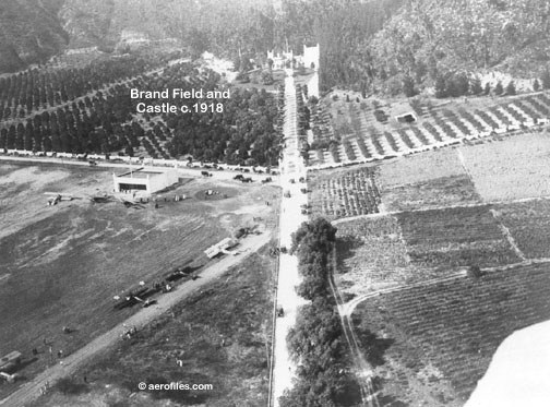
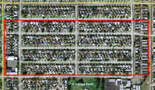
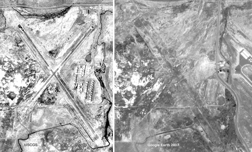
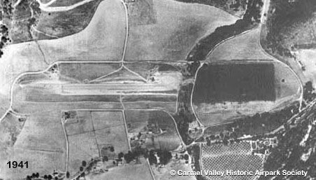
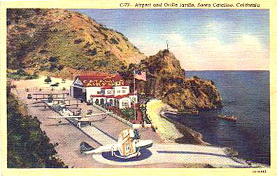
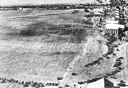
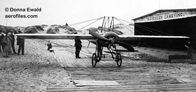
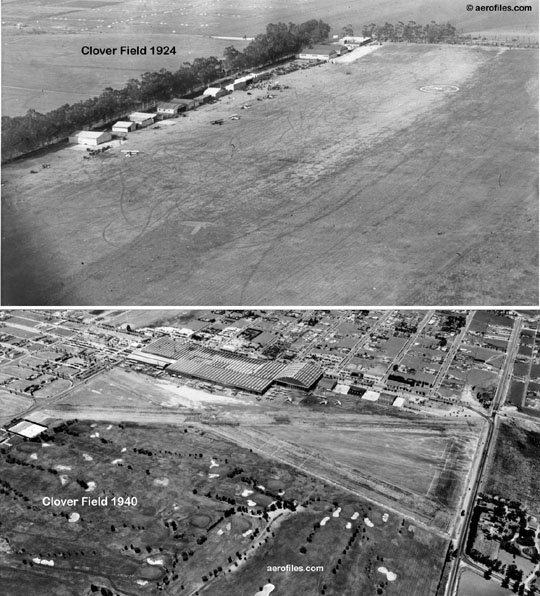
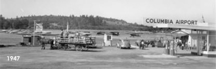
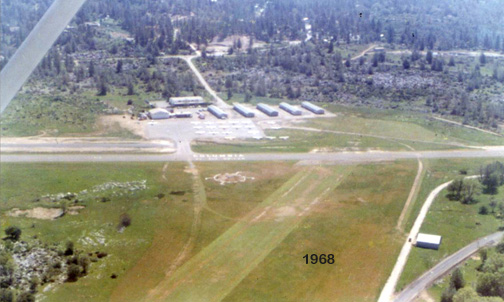


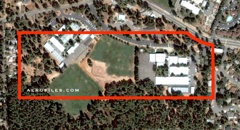
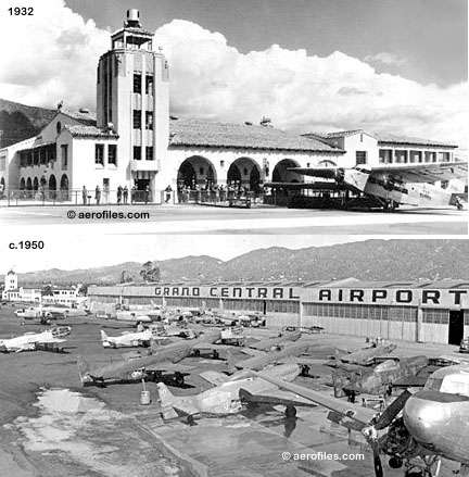
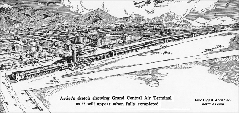
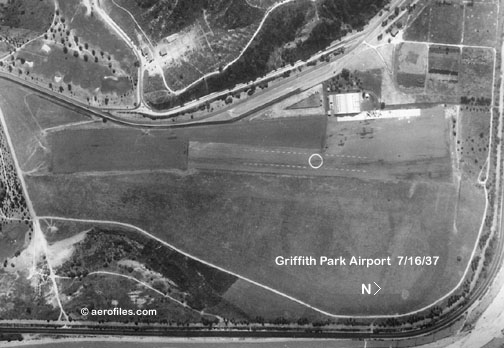
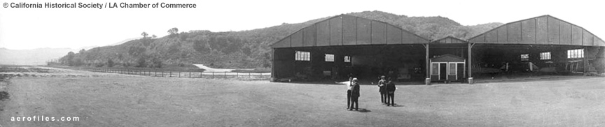
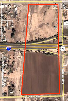
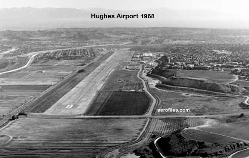
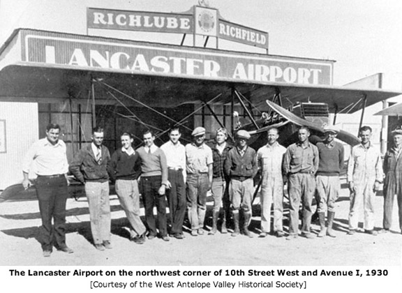

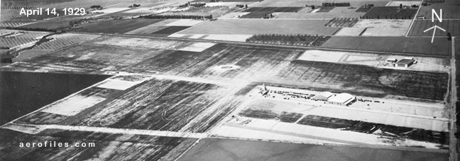
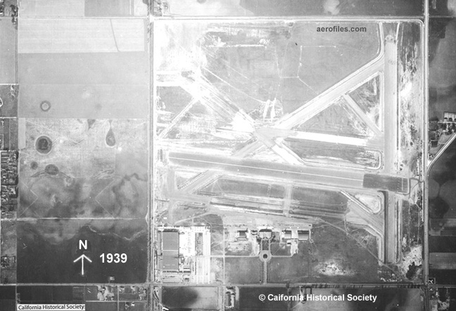
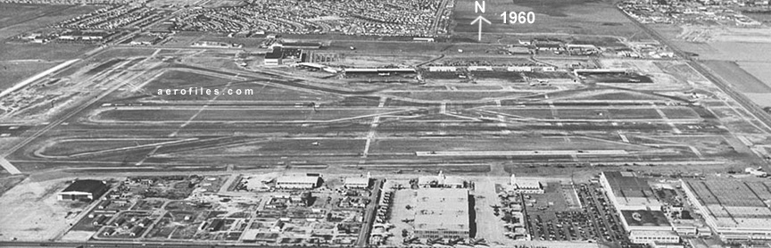

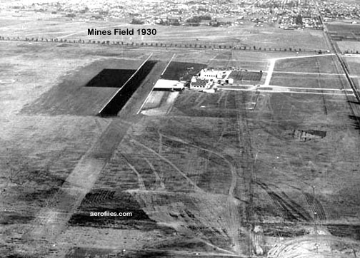


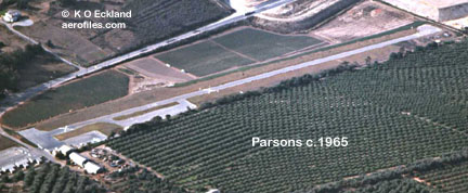
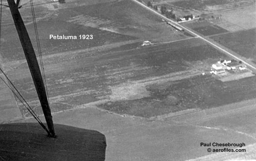
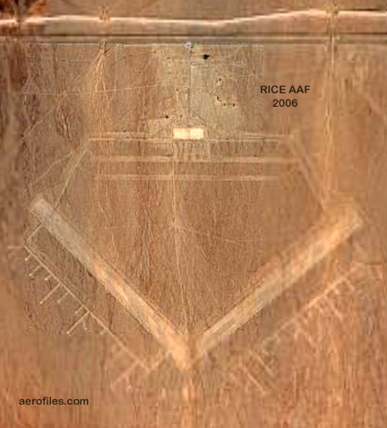
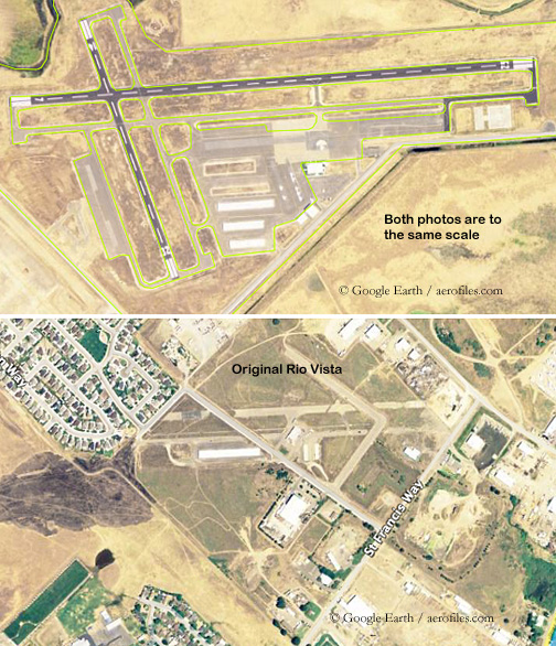
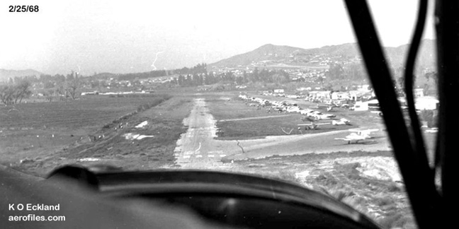
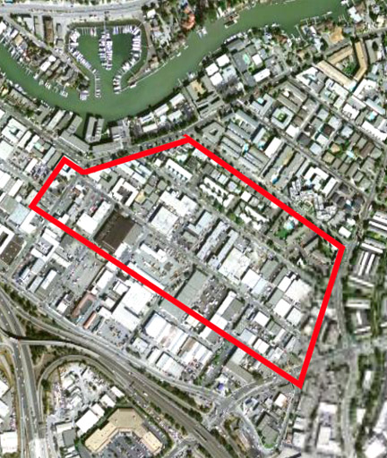
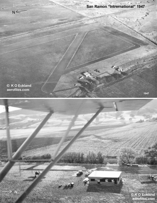


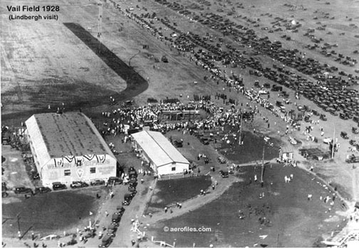
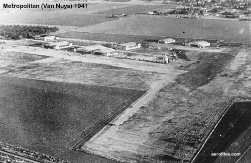
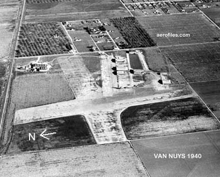
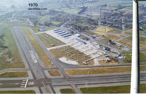

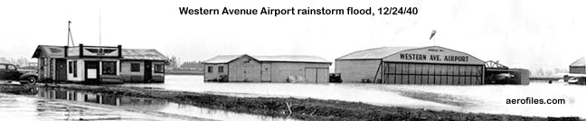
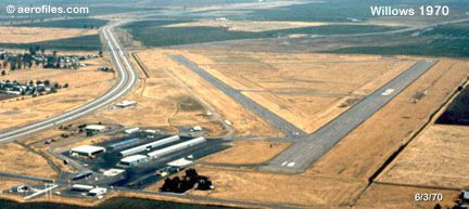
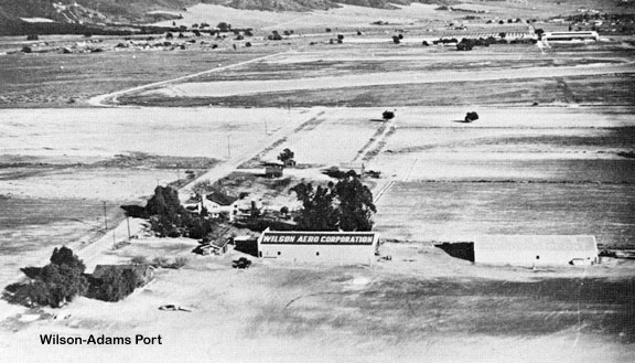